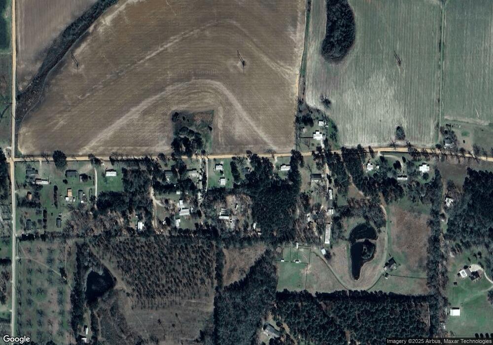
Estimated Value: $109,515 - $150,000
3
Beds
2
Baths
968
Sq Ft
$136/Sq Ft
Est. Value
About This Home
This home is located at 496 Harper Rd, Cairo, GA 39827 and is currently estimated at $131,629, approximately $135 per square foot. 496 Harper Rd is a home located in Grady County with nearby schools including Cairo High School.
Ownership History
Date
Name
Owned For
Owner Type
Purchase Details
Closed on
May 22, 2024
Sold by
Maxwell Daryl H
Bought by
Anderson Phillip Christian
Current Estimated Value
Home Financials for this Owner
Home Financials are based on the most recent Mortgage that was taken out on this home.
Original Mortgage
$128,484
Outstanding Balance
$126,780
Interest Rate
7.17%
Mortgage Type
New Conventional
Estimated Equity
$4,849
Purchase Details
Closed on
Apr 13, 2020
Sold by
Maxwell Neal D
Bought by
Maxwell Daryl H
Purchase Details
Closed on
Jan 6, 2004
Bought by
Maxwell Neal D
Purchase Details
Closed on
Dec 17, 2003
Sold by
Cox Charlie Mae W
Bought by
Maxwell Neal D
Purchase Details
Closed on
Dec 2, 2003
Sold by
Gainous Fondren L
Bought by
Maxwell Neal D
Purchase Details
Closed on
Aug 13, 1984
Bought by
Cox Charlie Mae W
Create a Home Valuation Report for This Property
The Home Valuation Report is an in-depth analysis detailing your home's value as well as a comparison with similar homes in the area
Purchase History
| Date | Buyer | Sale Price | Title Company |
|---|---|---|---|
| Anderson Phillip Christian | $127,200 | -- | |
| Maxwell Daryl H | $15,000 | -- | |
| Maxwell Neal D | -- | -- | |
| Maxwell Neal D | $30,000 | -- | |
| Maxwell Neal D | -- | -- | |
| Cox Charlie Mae W | -- | -- |
Source: Public Records
Mortgage History
| Date | Status | Borrower | Loan Amount |
|---|---|---|---|
| Open | Anderson Phillip Christian | $128,484 | |
| Closed | Anderson Phillip Christian | $128,484 |
Source: Public Records
Tax History Compared to Growth
Tax History
| Year | Tax Paid | Tax Assessment Tax Assessment Total Assessment is a certain percentage of the fair market value that is determined by local assessors to be the total taxable value of land and additions on the property. | Land | Improvement |
|---|---|---|---|---|
| 2024 | $1,167 | $30,885 | $3,111 | $27,774 |
| 2023 | $556 | $18,051 | $1,200 | $16,851 |
| 2022 | $556 | $18,051 | $1,200 | $16,851 |
| 2021 | $557 | $18,051 | $1,200 | $16,851 |
| 2020 | $559 | $18,051 | $1,200 | $16,851 |
| 2019 | $559 | $18,051 | $1,200 | $16,851 |
| 2018 | $525 | $20,438 | $1,200 | $19,238 |
| 2017 | $566 | $20,438 | $1,200 | $19,238 |
| 2016 | $486 | $17,448 | $1,200 | $16,248 |
| 2015 | $480 | $17,448 | $1,200 | $16,248 |
| 2014 | -- | $17,448 | $1,200 | $16,248 |
| 2013 | -- | $15,972 | $1,200 | $14,772 |
Source: Public Records
Map
Nearby Homes
- 414 Woodland Rd
- 0 State Route 188
- 00 State Route 188
- 0 NE Airport Rd Unit 145784
- 408 Bay Tree Rd NE
- 3136 State Route 188
- 2600 U S 84
- 78.6 Ac Strickland Rd
- 00 NW 9th Ave
- 3109 U S 84
- 3109 U S 84
- 105 Woodridge Ln
- 1210 Elkins Rd
- 21 24th St NE
- 158 Woodridge Ln
- 711 2nd Ave NE
- 2975 U S 84
- 1420 Parallel Dr NW
- 000 15th Ave Nw -- Tract 2
- 4135 Georgia 111
- 482 Harper Rd
- 514 Harper Rd
- 418 Lot 3 Harper Rd
- 468 Harper Rd
- 530 Harper Rd
- 469 Harper Rd
- 531 Harper Rd
- 456 Harper Rd
- 450 Harper Rd
- 450 Harper Rd Unit C,D&E
- 558 Harper Rd
- 418 Harper Rd
- 424 Harper Rd
- 574 Harper Rd
- 542 Harper Rd
- 542 Harper Rd Unit 1
- 408 Harper Rd
- 272 Robert Willis Rd
- 388 Harper Rd
- 358 Robert Willis Rd
