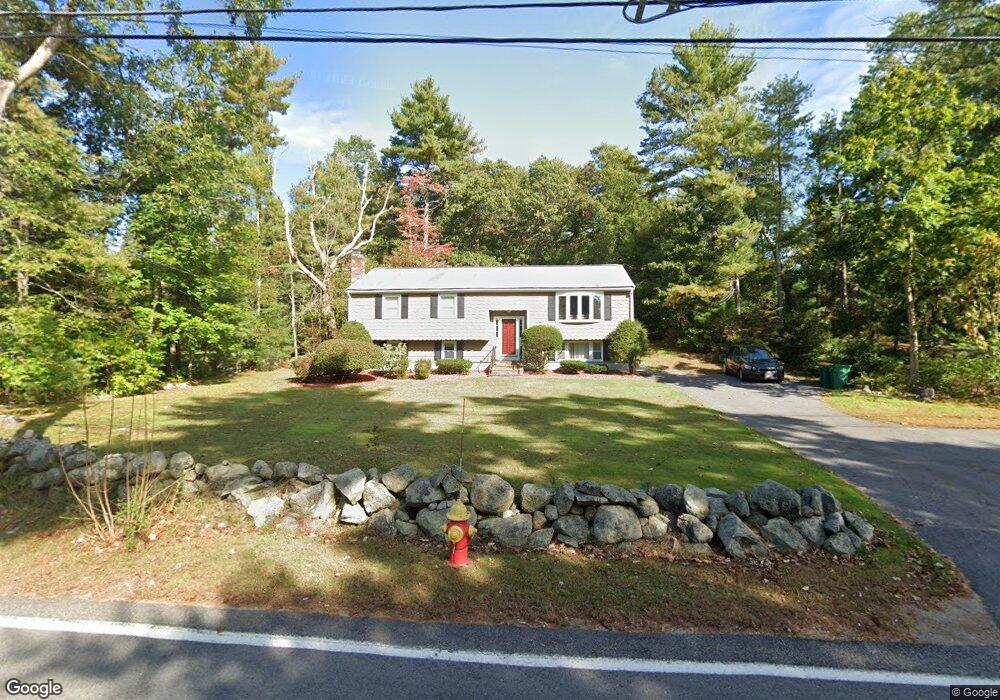
496 Maple St Mansfield, MA 02048
Estimated Value: $595,470 - $684,000
3
Beds
2
Baths
1,236
Sq Ft
$532/Sq Ft
Est. Value
About This Home
This home is located at 496 Maple St, Mansfield, MA 02048 and is currently estimated at $657,368, approximately $531 per square foot. 496 Maple St is a home located in Bristol County with nearby schools including Jordan/Jackson Elementary School, Everett W. Robinson Elementary School, and Harold L. Qualters Middle School.
Ownership History
Date
Name
Owned For
Owner Type
Purchase Details
Closed on
May 27, 2025
Sold by
Greene Martin B and Greene Patricia A
Bought by
Greene Rt and Greene
Current Estimated Value
Create a Home Valuation Report for This Property
The Home Valuation Report is an in-depth analysis detailing your home's value as well as a comparison with similar homes in the area
Home Values in the Area
Average Home Value in this Area
Purchase History
| Date | Buyer | Sale Price | Title Company |
|---|---|---|---|
| Greene Rt | -- | None Available |
Source: Public Records
Tax History
| Year | Tax Paid | Tax Assessment Tax Assessment Total Assessment is a certain percentage of the fair market value that is determined by local assessors to be the total taxable value of land and additions on the property. | Land | Improvement |
|---|---|---|---|---|
| 2025 | $6,888 | $523,000 | $244,800 | $278,200 |
| 2024 | $6,491 | $480,800 | $244,800 | $236,000 |
| 2023 | $6,349 | $450,600 | $244,800 | $205,800 |
| 2022 | $6,151 | $405,500 | $226,600 | $178,900 |
| 2021 | $2,930 | $379,800 | $198,300 | $181,500 |
| 2020 | $4,053 | $375,200 | $188,900 | $186,300 |
| 2019 | $2,678 | $343,600 | $157,300 | $186,300 |
| 2018 | $4,848 | $322,000 | $150,100 | $171,900 |
| 2017 | $3,498 | $320,900 | $145,800 | $175,100 |
| 2016 | $4,763 | $309,100 | $138,800 | $170,300 |
| 2015 | $4,422 | $285,300 | $138,800 | $146,500 |
Source: Public Records
Map
Nearby Homes
- 261 East St
- 26 Fredric Ln
- 4 Erick Rd Unit 90
- 631 East St Unit L101
- 9 Independence Dr Unit 9
- 619 N Main St
- 4 Concetta Cir
- 132 Cannon Forge Dr
- 25 Kingman Ave
- 46 Hope St
- 122 Samoset Ave
- 81 Chilson Ave
- 22 Pleasant St Unit B
- 266 N Main St Unit 3
- 97 East St
- 28 Court St
- 150 Rumford Ave Unit 110
- 44 Fairfield Park Unit 44
- 166 Chauncy St
- 15 Coach Rd
- 530 Maple St
- 421 Franklin St
- 429 Franklin St
- 542 Maple St
- 7 Green Acres Dr
- 491 Maple St
- 515 Maple St
- 437 Franklin St
- 11 Green Acres Dr
- 0 Green Acres Dr
- 546 Maple St
- 422 Franklin St Unit 1
- 422 Franklin St Unit 424
- 422-424 Franklin St
- 424 Franklin St Unit 424
- 424 Franklin St Unit 2
- 545 Maple St
- 405 Franklin St
- 428 Franklin St Unit 430
- 445 Franklin St
Your Personal Tour Guide
Ask me questions while you tour the home.