Estimated Value: $223,000 - $378,000
3
Beds
2
Baths
2,569
Sq Ft
$122/Sq Ft
Est. Value
About This Home
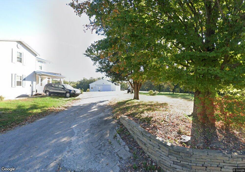
This home is located at 496 Suchman Rd, Ava, IL 62907 and is currently estimated at $312,872, approximately $121 per square foot. 496 Suchman Rd is a home located in Jackson County with nearby schools including Trico Elementary School.
Ownership History
Date
Name
Owned For
Owner Type
Purchase Details
Closed on
Nov 12, 2014
Sold by
Thielemann Norris J and Thielemann Jennie L
Bought by
Ramsayer Carl F and Ramsayer Kathleen L
Current Estimated Value
Home Financials for this Owner
Home Financials are based on the most recent Mortgage that was taken out on this home.
Original Mortgage
$115,000
Outstanding Balance
$84,717
Interest Rate
6%
Mortgage Type
New Conventional
Estimated Equity
$228,155
Purchase Details
Closed on
Mar 18, 2010
Sold by
Thielemann Norris J and Thielemann Jennie L
Bought by
Null Robert L
Create a Home Valuation Report for This Property
The Home Valuation Report is an in-depth analysis detailing your home's value as well as a comparison with similar homes in the area
Purchase History
| Date | Buyer | Sale Price | Title Company |
|---|---|---|---|
| Ramsayer Carl F | $165,000 | None Available | |
| Null Robert L | $40,500 | None Available |
Source: Public Records
Mortgage History
| Date | Status | Borrower | Loan Amount |
|---|---|---|---|
| Open | Ramsayer Carl F | $115,000 |
Source: Public Records
Tax History
| Year | Tax Paid | Tax Assessment Tax Assessment Total Assessment is a certain percentage of the fair market value that is determined by local assessors to be the total taxable value of land and additions on the property. | Land | Improvement |
|---|---|---|---|---|
| 2024 | $5,119 | $81,796 | $12,901 | $68,895 |
| 2023 | $4,398 | $72,764 | $11,477 | $61,287 |
| 2022 | $4,102 | $65,951 | $10,402 | $55,549 |
| 2021 | $4,032 | $63,396 | $9,999 | $53,397 |
| 2020 | $3,447 | $57,076 | $10,176 | $46,900 |
| 2019 | $3,323 | $56,083 | $9,999 | $46,084 |
| 2018 | $3,415 | $56,083 | $9,999 | $46,084 |
| 2017 | $3,090 | $56,083 | $9,999 | $46,084 |
| 2016 | $3,131 | $55,661 | $10,000 | $45,661 |
| 2015 | -- | $63,611 | $10,000 | $53,611 |
| 2014 | -- | $63,611 | $10,000 | $53,611 |
Source: Public Records
Map
Nearby Homes
- 1100 Sharp Rock Rd
- 0000 Forest Rd
- 101 E Knauer St
- 676 Swan Pond Rd
- 802 State Route 3
- 1219 Indian Ridge Rd
- 71 Ehlers Rd
- 205 Jefferson St
- 13 Pcr 351
- 115 Mount Joy Rd
- 1020 Krause Ave
- 929 State Route 4
- 402 W Pine St
- 807 Broadway St
- 307 Broadway St
- 0 Pcr 350 Unit 24567371
- 1117 Puxico Rd
- 2229 Town Creek Rd
- 564 Stave Mill Rd
- 233 Dunivan Rd
- 507 Suchman Rd
- 407 Suchman Rd
- 2122 Kessel Rd
- 601 Suchman Rd
- 351 Suchman Rd
- 693 Suchman Rd
- 708 Suchman Rd
- 1852 Kessel Rd
- 173 Suchman Rd
- 1847 Kessel Rd
- 1804 Kessel Rd
- 76 Suchman Rd
- 1795 Kessel Rd
- 0 Suchman Rd
- 0 Suchman Rd Unit RMAEB238717
- 0 Suchman Rd Unit RMAEB238869
- 0 Suchman Rd Unit MRDEB316156
- 0 Suchman Rd Unit MRDEB238869
- 0 Suchman Rd Unit MRDEB238717
- 0 Suchman Rd Unit MRDEB233066
Your Personal Tour Guide
Ask me questions while you tour the home.