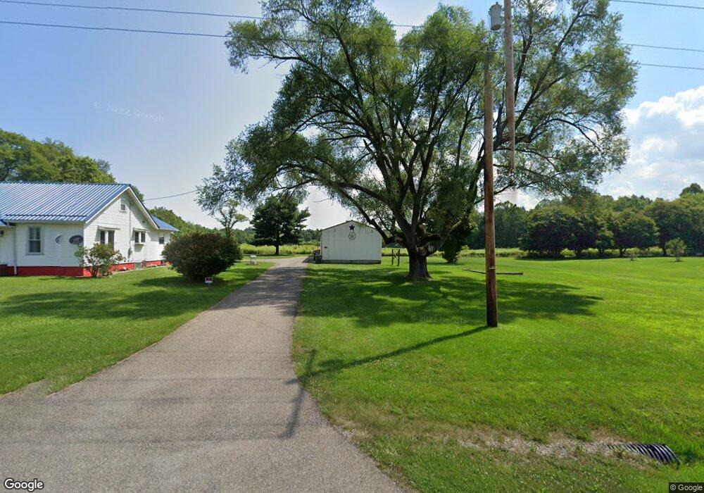
4964 State Route 13 NE New Lexington, OH 43764
Estimated Value: $157,000 - $240,000
2
Beds
1
Bath
1,140
Sq Ft
$188/Sq Ft
Est. Value
About This Home
This home is located at 4964 State Route 13 NE, New Lexington, OH 43764 and is currently estimated at $214,192, approximately $187 per square foot. 4964 State Route 13 NE is a home located in Perry County with nearby schools including New Lexington Elementary School, Junction City Elementary School, and New Lexington Middle School.
Ownership History
Date
Name
Owned For
Owner Type
Purchase Details
Closed on
Jan 27, 2025
Sold by
Roberts Caren S
Bought by
Guisinger Talia and Leckrone Carter
Current Estimated Value
Home Financials for this Owner
Home Financials are based on the most recent Mortgage that was taken out on this home.
Original Mortgage
$178,571
Outstanding Balance
$177,148
Interest Rate
6.72%
Mortgage Type
FHA
Estimated Equity
$37,044
Purchase Details
Closed on
Aug 30, 2016
Sold by
Mayfield Helen and Mayfield Buddy Joe
Bought by
Back Raymond D and Roberts Caren S
Home Financials for this Owner
Home Financials are based on the most recent Mortgage that was taken out on this home.
Original Mortgage
$103,856
Interest Rate
3.43%
Mortgage Type
New Conventional
Purchase Details
Closed on
Sep 12, 2014
Sold by
Mayfield Brian and Mayfield Kelly M
Bought by
Mayfield Helen and Mayfield Buddy Joe
Create a Home Valuation Report for This Property
The Home Valuation Report is an in-depth analysis detailing your home's value as well as a comparison with similar homes in the area
Home Values in the Area
Average Home Value in this Area
Purchase History
| Date | Buyer | Sale Price | Title Company |
|---|---|---|---|
| Guisinger Talia | $195,000 | Valmer Land Title | |
| Back Raymond D | $101,000 | Mid Ohio Title Agency Inc | |
| Mayfield Helen | -- | None Available |
Source: Public Records
Mortgage History
| Date | Status | Borrower | Loan Amount |
|---|---|---|---|
| Open | Guisinger Talia | $178,571 | |
| Previous Owner | Back Raymond D | $103,856 |
Source: Public Records
Tax History Compared to Growth
Tax History
| Year | Tax Paid | Tax Assessment Tax Assessment Total Assessment is a certain percentage of the fair market value that is determined by local assessors to be the total taxable value of land and additions on the property. | Land | Improvement |
|---|---|---|---|---|
| 2024 | $2,061 | $56,470 | $9,780 | $46,690 |
| 2023 | $2,061 | $56,470 | $9,780 | $46,690 |
| 2022 | $1,703 | $34,420 | $6,210 | $28,210 |
| 2021 | $1,530 | $37,390 | $6,210 | $31,180 |
| 2020 | $1,530 | $37,390 | $6,210 | $31,180 |
| 2019 | $1,343 | $32,910 | $5,910 | $27,000 |
| 2018 | $1,368 | $32,910 | $5,910 | $27,000 |
| 2017 | $1,103 | $32,910 | $5,910 | $27,000 |
| 2016 | $908 | $31,080 | $7,230 | $23,850 |
| 2015 | $909 | $31,250 | $7,400 | $23,850 |
| 2014 | $1,209 | $31,250 | $7,400 | $23,850 |
| 2013 | $792 | $31,250 | $7,400 | $23,850 |
| 2012 | -- | $31,250 | $7,400 | $23,850 |
Source: Public Records
Map
Nearby Homes
- 6045 Township Road 173 NE
- 5353 Buckeye Valley Rd NE
- 3298 State Route 37 E
- 210 Academy St
- 418 W Broadway St Unit Rear
- 221 W Broadway St
- 3773 State Route 345 NE
- 255 Kennedy Dr
- 139 E Jefferson St
- 851 Township Road 421 SE
- 318 N Pleasant St
- 4890 Township Road 122 NW
- 200 N Main St
- 551 W Brown St
- 524 Shawnee St
- 314 W Brown St
- 603 Shawnee St
- 315 W Brown St
- 105 S Maple Heights
- 211 S High St
- 5066 State Route 13 NE
- 4964 State Route #13 NE
- 4964 State Route #13 NE
- 5171 State Route 13 NE
- 5066 State Route 13 NE
- 5030 State Route 13 NE
- 3910 State Route 13 NE
- 3853 Township Road 149 NE
- 4010 State Route 13 NE
- 3927 State Route 13 NE
- 4056 State Route 13 NE
- 4108 State Route 13 NE
- 3740 State Route 13 NE
- 4021 State Route 13 NE
- 4058 State Route 13 NE
- 3667 State Route 13 NE
- 4076 State Route 13 NE
- 4094 State Route 13 NE
- 3650 State Route 13 NE
- 4100 State Route 13 NE