Estimated Value: $467,000 - $548,000
4
Beds
3
Baths
2,948
Sq Ft
$168/Sq Ft
Est. Value
About This Home
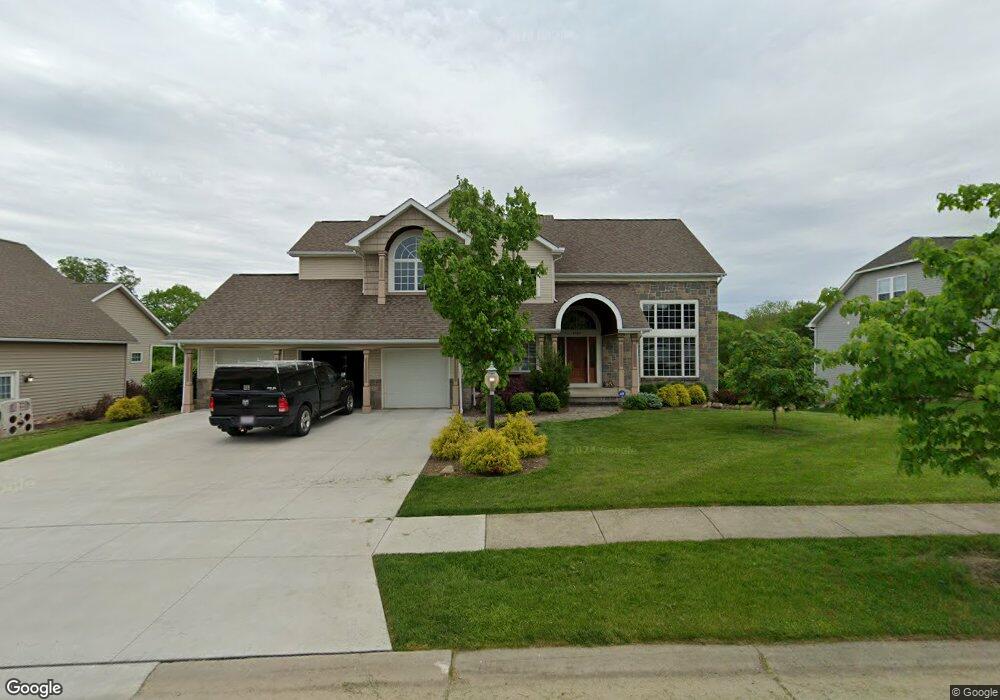
This home is located at 4966 Brower Tree Ln, Kent, OH 44240 and is currently estimated at $496,133, approximately $168 per square foot. 4966 Brower Tree Ln is a home located in Portage County with nearby schools including Brimfield Elementary School, Field Middle School, and Field High School.
Ownership History
Date
Name
Owned For
Owner Type
Purchase Details
Closed on
May 29, 2008
Sold by
Freedom Building Inc
Bought by
Rice Michael S and Rice Deanna J
Current Estimated Value
Home Financials for this Owner
Home Financials are based on the most recent Mortgage that was taken out on this home.
Original Mortgage
$197,000
Outstanding Balance
$125,246
Interest Rate
5.87%
Mortgage Type
Purchase Money Mortgage
Estimated Equity
$370,887
Purchase Details
Closed on
Dec 19, 2005
Sold by
Sugar Maple Hills Llc
Bought by
Freedom Building Inc
Create a Home Valuation Report for This Property
The Home Valuation Report is an in-depth analysis detailing your home's value as well as a comparison with similar homes in the area
Home Values in the Area
Average Home Value in this Area
Purchase History
| Date | Buyer | Sale Price | Title Company |
|---|---|---|---|
| Rice Michael S | $357,500 | None Available | |
| Freedom Building Inc | $56,500 | None Available |
Source: Public Records
Mortgage History
| Date | Status | Borrower | Loan Amount |
|---|---|---|---|
| Open | Rice Michael S | $197,000 |
Source: Public Records
Tax History Compared to Growth
Tax History
| Year | Tax Paid | Tax Assessment Tax Assessment Total Assessment is a certain percentage of the fair market value that is determined by local assessors to be the total taxable value of land and additions on the property. | Land | Improvement |
|---|---|---|---|---|
| 2024 | $7,260 | $153,930 | $22,750 | $131,180 |
| 2023 | $7,071 | $120,750 | $15,750 | $105,000 |
| 2022 | $7,091 | $120,750 | $15,750 | $105,000 |
| 2021 | $6,932 | $120,750 | $15,750 | $105,000 |
| 2020 | $7,097 | $111,200 | $15,750 | $95,450 |
| 2019 | $6,988 | $111,200 | $15,750 | $95,450 |
| 2018 | $5,644 | $100,520 | $15,750 | $84,770 |
| 2017 | $5,345 | $100,520 | $15,750 | $84,770 |
| 2016 | $5,337 | $100,520 | $15,750 | $84,770 |
| 2015 | $5,163 | $100,520 | $15,750 | $84,770 |
| 2014 | $4,981 | $100,520 | $15,750 | $84,770 |
| 2013 | $4,864 | $100,520 | $15,750 | $84,770 |
Source: Public Records
Map
Nearby Homes
- 4832 Raspberry Cir
- 2105 Sugar Maple Dr
- 2092 Sugar Maple Dr
- 1997 Sugar Maple Dr
- 2014 Sugar Maple Dr
- 2312 Cranberry Creek Rd
- 2464 Hazelnut Rd
- 5205 Cline Rd Unit A
- 5123 Troyer Dr
- 5032 Blackberry Ln
- 2694 Sandy Lake Rd
- 1024E Cedar Ridge Dr
- 1024A Cedar Ridge Dr
- 2216 - 2218 Roberts Journey
- 5044 Sherman Wood Dr
- 1523 Whitehall Blvd
- 3123 Clearview Rd
- 2262 Willyard Ave
- 5223 Aspen Meadow Dr
- 1426 Loop Rd Unit 1426
- 4956 Brower Tree Ln
- 4976 Brower Tree Ln
- 4955 Brower Tree Ln
- 4965 Brower Tree Ln
- 4947 Brower Tree Ln
- 4948 Brower Tree Ln
- 4984 Brower Tree Ln
- 4975 Brower Tree Ln
- 4939 Brower Tree Ln
- 48 Briarhill Dr
- 4983 Brower Tree Ln
- 2324 Meloy Rd
- 4928 Brower Tree Ln
- 2354 Meloy Rd
- 4925 Brower Tree Ln
- 4920 Brower Tree Ln
- 2303 Meloy Rd
- 49 Briarhill Dr
- S/L 31 Yellowwood Cir
- 4911 Brower Tree Ln