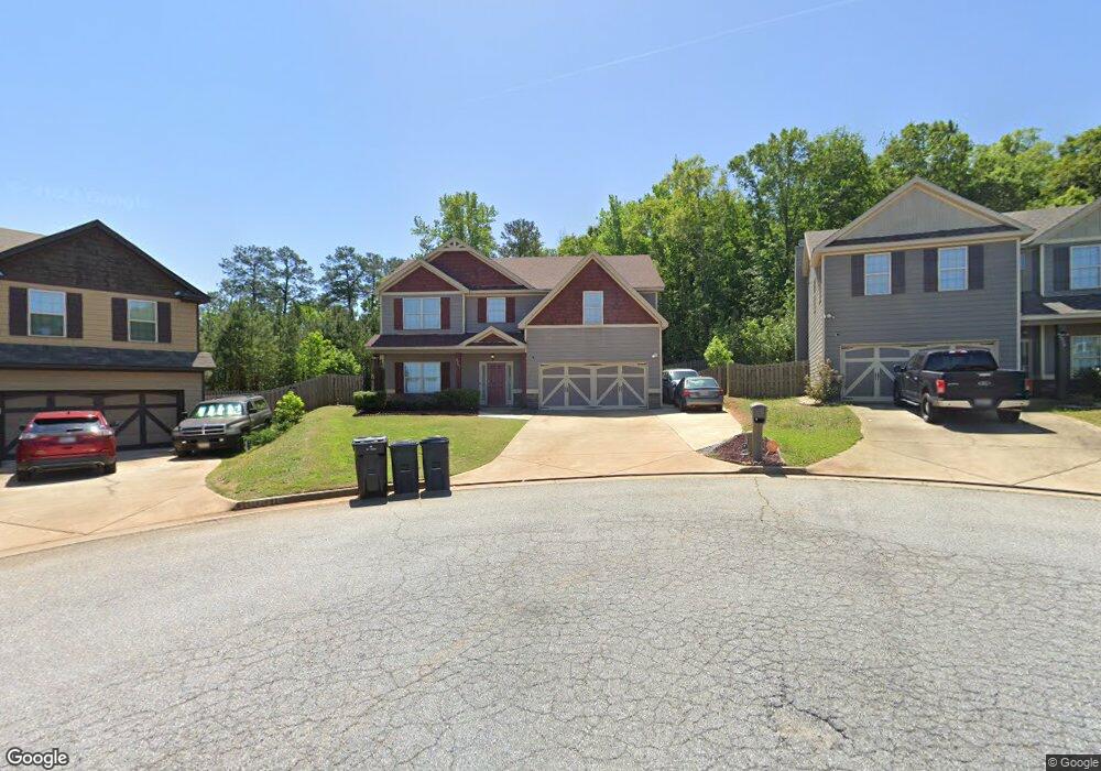
4967 Brightstar Ln Columbus, GA 31907
Eastern Columbus NeighborhoodEstimated Value: $284,000 - $365,000
3
Beds
3
Baths
2,735
Sq Ft
$115/Sq Ft
Est. Value
About This Home
This home is located at 4967 Brightstar Ln, Columbus, GA 31907 and is currently estimated at $313,869, approximately $114 per square foot. 4967 Brightstar Ln is a home with nearby schools including Dawson Elementary School, East Columbus Magnet Academy, and Kendrick High School.
Ownership History
Date
Name
Owned For
Owner Type
Purchase Details
Closed on
Oct 6, 2014
Sold by
Edgar Hughston Builder Inc
Bought by
Ford Donavan and Ford Mekiko
Current Estimated Value
Home Financials for this Owner
Home Financials are based on the most recent Mortgage that was taken out on this home.
Original Mortgage
$206,636
Outstanding Balance
$158,824
Interest Rate
4.17%
Mortgage Type
VA
Estimated Equity
$155,045
Create a Home Valuation Report for This Property
The Home Valuation Report is an in-depth analysis detailing your home's value as well as a comparison with similar homes in the area
Home Values in the Area
Average Home Value in this Area
Purchase History
| Date | Buyer | Sale Price | Title Company |
|---|---|---|---|
| Ford Donavan | $206,700 | -- |
Source: Public Records
Mortgage History
| Date | Status | Borrower | Loan Amount |
|---|---|---|---|
| Open | Ford Donavan | $206,636 |
Source: Public Records
Tax History Compared to Growth
Tax History
| Year | Tax Paid | Tax Assessment Tax Assessment Total Assessment is a certain percentage of the fair market value that is determined by local assessors to be the total taxable value of land and additions on the property. | Land | Improvement |
|---|---|---|---|---|
| 2025 | -- | $90,324 | $16,040 | $74,284 |
| 2024 | -- | $90,324 | $16,040 | $74,284 |
| 2023 | $0 | $90,324 | $16,040 | $74,284 |
| 2022 | $0 | $78,116 | $16,040 | $62,076 |
| 2021 | $0 | $78,168 | $16,040 | $62,128 |
| 2020 | $0 | $78,168 | $16,040 | $62,128 |
| 2019 | $3,203 | $78,168 | $16,040 | $62,128 |
| 2018 | $3,203 | $78,168 | $16,040 | $62,128 |
| 2017 | $3,213 | $78,168 | $16,040 | $62,128 |
| 2016 | $3,411 | $82,680 | $14,000 | $68,680 |
| 2015 | $3,415 | $82,680 | $14,000 | $68,680 |
| 2014 | $331 | $8,000 | $8,000 | $0 |
| 2013 | -- | $8,000 | $8,000 | $0 |
Source: Public Records
Map
Nearby Homes
- 4965 Brightstar Ln
- 4201 Valley Crest Dr
- 4917 Brightstar Ln
- 780 Honey Do Ct
- 59 Apollo Dr
- 4939 Aaron Dr
- 4930 Capricorn Ct
- 849 Bunker Hill Rd
- 5234 Saint Marys Rd
- 811 Pheasant Loop
- 906 Bunker Hill Rd
- 31 R C Allen Dr
- 4408 Walking Stick Way
- 300 Jefferson Dr
- 5021 Shirley Ann Dr
- 5003 Shirley Ann Dr
- 5219 Argonne Dr
- 4718 Velpoe Dr
- 5336 Gettysburg Way
- 1513 Alamo Dr
- 4970 Brightstar Ln
- 4963 Brightstar Ln
- 4964 Brightstar Ln
- 4960 Brightstar Ln
- 4959 Brightstar Ln
- 4955 Brightstar Ln
- 4952 Brightstar Ln
- 4953 Brightstar Ln
- 500 Shootingstar St
- 5009 Saint Marys Rd
- 504 Shootingstar St
- 501 Shootingstar St
- 4949 Brightstar Ln
- 4948 Brightstar Ln
- 508 Shootingstar St
- 503 Shootingstar St
- 400 Stardust Ct
- 4944 Brightstar Ln
- 510 Shootingstar St
- 511 Shootingstar St