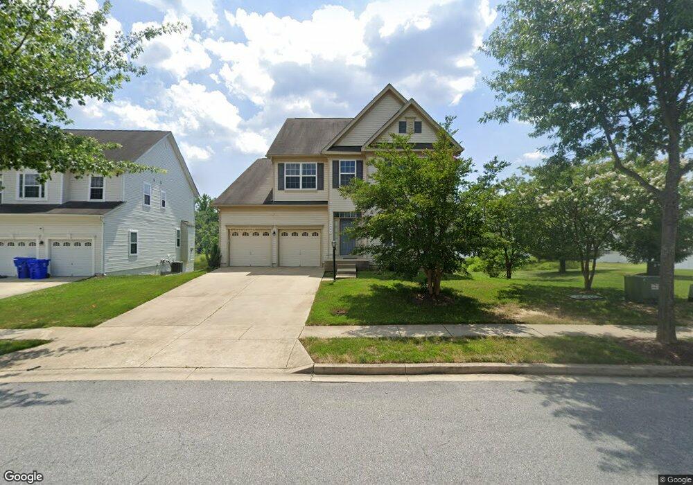
4969 Saint Matthews Dr Waldorf, MD 20602
Estimated Value: $549,119 - $618,000
4
Beds
3
Baths
2,804
Sq Ft
$208/Sq Ft
Est. Value
About This Home
This home is located at 4969 Saint Matthews Dr, Waldorf, MD 20602 and is currently estimated at $583,280, approximately $208 per square foot. 4969 Saint Matthews Dr is a home located in Charles County with nearby schools including Mary B. Neal Elementary School, Milton M. Somers Middle School, and St. Charles High School.
Ownership History
Date
Name
Owned For
Owner Type
Purchase Details
Closed on
Sep 20, 2010
Sold by
Us Home Corporation
Bought by
Berry Angelique R
Current Estimated Value
Home Financials for this Owner
Home Financials are based on the most recent Mortgage that was taken out on this home.
Original Mortgage
$305,376
Outstanding Balance
$202,263
Interest Rate
4.5%
Mortgage Type
FHA
Estimated Equity
$381,017
Create a Home Valuation Report for This Property
The Home Valuation Report is an in-depth analysis detailing your home's value as well as a comparison with similar homes in the area
Home Values in the Area
Average Home Value in this Area
Purchase History
| Date | Buyer | Sale Price | Title Company |
|---|---|---|---|
| Berry Angelique R | $309,490 | -- |
Source: Public Records
Mortgage History
| Date | Status | Borrower | Loan Amount |
|---|---|---|---|
| Open | Berry Angelique R | $305,376 |
Source: Public Records
Tax History Compared to Growth
Tax History
| Year | Tax Paid | Tax Assessment Tax Assessment Total Assessment is a certain percentage of the fair market value that is determined by local assessors to be the total taxable value of land and additions on the property. | Land | Improvement |
|---|---|---|---|---|
| 2025 | $14,029 | $478,700 | -- | -- |
| 2024 | $6,364 | $458,800 | $126,100 | $332,700 |
| 2023 | $6,124 | $428,567 | $0 | $0 |
| 2022 | $5,514 | $398,333 | $0 | $0 |
| 2021 | $6,297 | $368,100 | $108,100 | $260,000 |
| 2020 | $6,297 | $357,500 | $0 | $0 |
| 2019 | $6,143 | $346,900 | $0 | $0 |
| 2018 | $5,961 | $336,300 | $90,100 | $246,200 |
| 2017 | $5,872 | $330,233 | $0 | $0 |
| 2016 | -- | $324,167 | $0 | $0 |
| 2015 | $5,059 | $318,100 | $0 | $0 |
| 2014 | $5,059 | $314,533 | $0 | $0 |
Source: Public Records
Map
Nearby Homes
- 11771 Sunningdale Place
- 5050 Royal Birkdale Ave
- 11787 Sunningdale Place
- 11839 Tower Hamlets Place
- 5084 Ottawa Park Place
- 11659 Royal Lytham Ln
- 11791 Sunset Ridge Place
- 5189 Tipperary Ave
- 5249 Turkeyfoot Lake St
- 5245 Turkeyfoot Lake St
- 5096 Atlantis Ln
- 10701 Millport St
- 5149 Atlantis Ln
- 4909 Keswick Ct
- 5165 Atlantis Ln
- 11150 Saint Christopher Dr
- 4646 Scottsdale Place
- 4930 Shoal Creek Ln
- 11287 Saint Christopher Dr
- 4973 Derryfield Ct
- 4973 Saint Matthews Dr
- 4977 Saint Matthews Dr
- 4961 Saint Matthews Dr
- 11660 Palm Desert Place
- 11662 Palm Desert Place
- 11664 Palm Desert Place
- 4948 Morraine St
- 4952 Morraine St
- 11741 Marston Moor Ln
- 11735 Marston Moor Ln
- 11670 Palm Desert Place
- 4956 Morraine St
- 11672 Palm Desert Place
- 11731 Marston Moor Ln
- 11745 Marston Moor Ln
- 11676 Palm Desert Place
- 11678 Palm Desert Place
- 11693 Palm Desert Place
- 11727 Marston Moor Ln
- 11680 Palm Desert Place