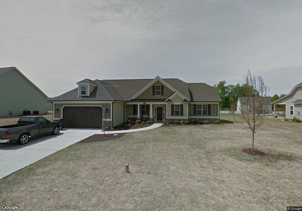
497 Adams Point Dr Garner, NC 27529
Cleveland NeighborhoodEstimated Value: $438,485 - $509,000
3
Beds
3
Baths
2,517
Sq Ft
$189/Sq Ft
Est. Value
About This Home
This home is located at 497 Adams Point Dr, Garner, NC 27529 and is currently estimated at $474,871, approximately $188 per square foot. 497 Adams Point Dr is a home located in Johnston County with nearby schools including West View Elementary School, Cleveland Middle School, and West Johnston High School.
Ownership History
Date
Name
Owned For
Owner Type
Purchase Details
Closed on
Mar 1, 2022
Sold by
Osborne David E and Osborne Michelle E
Bought by
Progress Raleigh Llc
Current Estimated Value
Purchase Details
Closed on
Sep 7, 2012
Sold by
Carroll Construction Homes Inc
Bought by
Osborne David E and Osborne Michelle E
Home Financials for this Owner
Home Financials are based on the most recent Mortgage that was taken out on this home.
Original Mortgage
$225,900
Interest Rate
3.63%
Mortgage Type
VA
Purchase Details
Closed on
Aug 22, 2012
Sold by
Kimsey Drive Llc
Bought by
Carroll Construction Homes Inc
Home Financials for this Owner
Home Financials are based on the most recent Mortgage that was taken out on this home.
Original Mortgage
$225,900
Interest Rate
3.63%
Mortgage Type
VA
Purchase Details
Closed on
Sep 8, 2011
Sold by
Son Lan Development Co Inc
Bought by
Atlas Nc I Spe Llc
Create a Home Valuation Report for This Property
The Home Valuation Report is an in-depth analysis detailing your home's value as well as a comparison with similar homes in the area
Home Values in the Area
Average Home Value in this Area
Purchase History
| Date | Buyer | Sale Price | Title Company |
|---|---|---|---|
| Progress Raleigh Llc | $430,000 | Costner Law Office Pllc | |
| Osborne David E | $226,000 | None Available | |
| Carroll Construction Homes Inc | -- | None Available | |
| Atlas Nc I Spe Llc | $6,220,000 | None Available |
Source: Public Records
Mortgage History
| Date | Status | Borrower | Loan Amount |
|---|---|---|---|
| Previous Owner | Osborne David E | $225,900 |
Source: Public Records
Tax History Compared to Growth
Tax History
| Year | Tax Paid | Tax Assessment Tax Assessment Total Assessment is a certain percentage of the fair market value that is determined by local assessors to be the total taxable value of land and additions on the property. | Land | Improvement |
|---|---|---|---|---|
| 2025 | $2,667 | $419,990 | $70,000 | $349,990 |
| 2024 | $2,256 | $278,570 | $48,000 | $230,570 |
| 2023 | $2,180 | $278,570 | $48,000 | $230,570 |
| 2022 | $2,291 | $278,570 | $48,000 | $230,570 |
| 2021 | $2,291 | $278,570 | $48,000 | $230,570 |
| 2020 | $2,319 | $278,570 | $48,000 | $230,570 |
| 2019 | $2,319 | $278,570 | $48,000 | $230,570 |
| 2018 | $2,138 | $250,810 | $44,000 | $206,810 |
| 2017 | $2,138 | $250,810 | $44,000 | $206,810 |
| 2016 | $2,138 | $250,810 | $44,000 | $206,810 |
| 2015 | $2,138 | $250,810 | $44,000 | $206,810 |
| 2014 | $2,138 | $250,810 | $44,000 | $206,810 |
Source: Public Records
Map
Nearby Homes
- 39 Beau Dr
- 325 Airedale Trail
- 413 Fieldtrial Cir
- 146 Shadowbark Dr
- 394 Airedale Trail
- 36 Labradoodle Ct
- 75 Fawn Hill Ct
- 58 Larkwood Ln
- 181 Fawn Hill Ct
- 115 Unique Place
- 1152 Black Angus Dr
- 42 Miry Branch Ct
- 1092 Adams Point Dr
- 1037 Olive Dr
- 165 Rynal Dr
- Roanoke Plan at Brant Station
- Fontana Plan at Brant Station
- Avenel II Plan at Brant Station
- 111 Artic Cir
- 51 Makers Way
- 475 Adams Point Dr
- 505 Adams Point Dr
- 517 Adams Point Dr
- 88 Sporting Club Dr
- 447 Adams Point Dr Unit CARLO
- 108 Sporting Club Dr
- 494 Adams Point Dr
- 482 Adams Point Dr
- 482 Adams Point Dr Unit LILLY
- 70 Sporting Club Dr
- 506 Adams Point Dr
- 466 Adams Point Dr Unit BELLE
- 529 Adams Point Dr
- 429 Adams Point Dr
- 516 Adams Point Dr
- 120 Sporting Club Dr
- 450 Adams Point Dr
- 428 Adams Point Dr
- 528 Adams Point Dr
- 541 Adams Point Dr