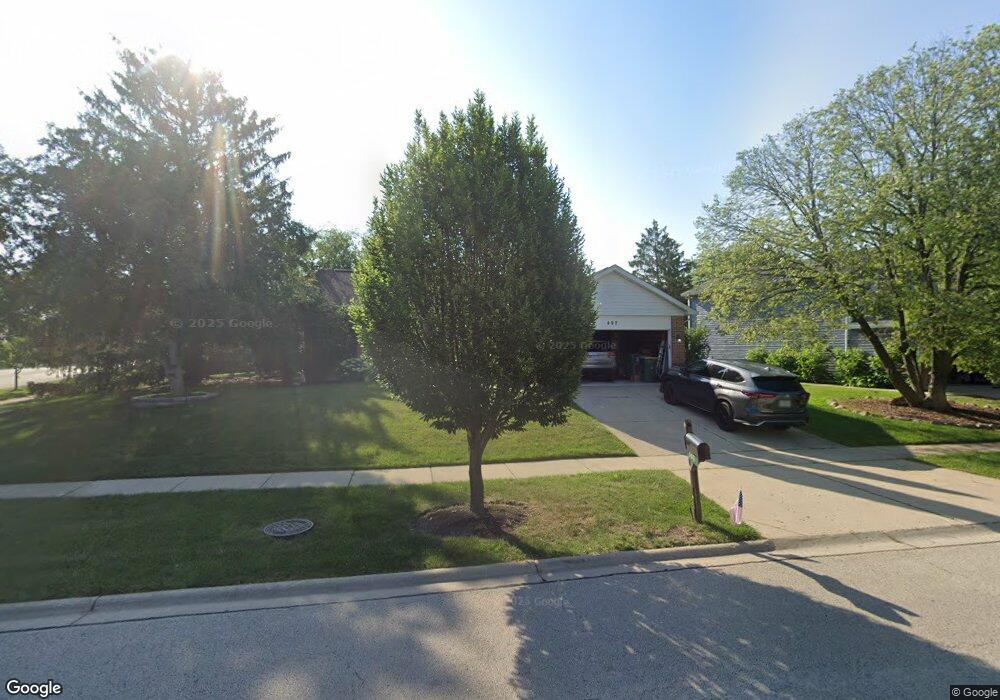
497 Cameron Way Buffalo Grove, IL 60089
South Buffalo Grove NeighborhoodEstimated Value: $466,000 - $518,000
3
Beds
2
Baths
1,537
Sq Ft
$319/Sq Ft
Est. Value
About This Home
This home is located at 497 Cameron Way, Buffalo Grove, IL 60089 and is currently estimated at $490,606, approximately $319 per square foot. 497 Cameron Way is a home located in Cook County with nearby schools including Henry W Longfellow Elementary School, Cooper Middle School, and Buffalo Grove High School.
Ownership History
Date
Name
Owned For
Owner Type
Purchase Details
Closed on
Aug 19, 2000
Sold by
Fabbrini Richard R
Bought by
Fabbrini Richard R and Gila Jeannine
Current Estimated Value
Purchase Details
Closed on
Jun 13, 1997
Sold by
Carasco Ferdinand
Bought by
Fabbrini Richard R
Home Financials for this Owner
Home Financials are based on the most recent Mortgage that was taken out on this home.
Original Mortgage
$150,000
Outstanding Balance
$20,124
Interest Rate
7.25%
Estimated Equity
$470,482
Create a Home Valuation Report for This Property
The Home Valuation Report is an in-depth analysis detailing your home's value as well as a comparison with similar homes in the area
Home Values in the Area
Average Home Value in this Area
Purchase History
| Date | Buyer | Sale Price | Title Company |
|---|---|---|---|
| Fabbrini Richard R | -- | -- | |
| Fabbrini Richard R | $209,500 | -- |
Source: Public Records
Mortgage History
| Date | Status | Borrower | Loan Amount |
|---|---|---|---|
| Open | Fabbrini Richard R | $150,000 |
Source: Public Records
Tax History Compared to Growth
Tax History
| Year | Tax Paid | Tax Assessment Tax Assessment Total Assessment is a certain percentage of the fair market value that is determined by local assessors to be the total taxable value of land and additions on the property. | Land | Improvement |
|---|---|---|---|---|
| 2024 | $9,612 | $36,000 | $12,026 | $23,974 |
| 2023 | $9,189 | $36,000 | $12,026 | $23,974 |
| 2022 | $9,189 | $36,000 | $12,026 | $23,974 |
| 2021 | $9,767 | $30,975 | $6,833 | $24,142 |
| 2020 | $9,583 | $30,975 | $6,833 | $24,142 |
| 2019 | $9,630 | $34,532 | $6,833 | $27,699 |
| 2018 | $10,606 | $34,232 | $6,013 | $28,219 |
| 2017 | $10,431 | $34,232 | $6,013 | $28,219 |
| 2016 | $10,539 | $36,052 | $6,013 | $30,039 |
| 2015 | $9,662 | $31,063 | $5,193 | $25,870 |
| 2014 | $9,520 | $31,063 | $5,193 | $25,870 |
| 2013 | $8,782 | $31,063 | $5,193 | $25,870 |
Source: Public Records
Map
Nearby Homes
- 715 W Whiting Ln
- 715 W Happfield Dr
- 812 W Whiting Ln
- 811 W Nichols Rd
- 751 W Happfield Dr Unit 30
- 705 Grove Dr Unit 101
- 921 Bernard Dr
- 720 Weidner Rd Unit 302
- 859 Beechwood Rd
- 571 Estate Dr
- 535 Estate Dr
- 813 Stradford Cir Unit 21B2
- 6 Villa Verde Dr Unit 103
- 820 Weidner Rd Unit 4013
- 820 Weidner Rd Unit 409
- 18 E Heritage Ct
- 1631 W Partridge Ct Unit 8
- 4210 N Mallard Dr Unit 4
- 3227 N Heritage Ln
- 1115 Miller Ln Unit 104
- 499 Cameron Way
- 1320 Rose Ct W
- 1318 Rose Ct W
- 1400 Countryside Dr
- 501 Cameron Way
- 1322 Rose Ct W
- 508 W Nichols Rd
- 504 W Nichols Rd
- 512 W Nichols Rd Unit 1
- 500 Cameron Way
- 1410 Countryside Dr
- 1316 Rose Ct W
- 503 Cameron Way
- 1324 Rose Ct W
- 3908 N Highland Ave
- 515 W Nichols Rd
- 502 Cameron Way
- 516 W Nichols Rd
- 1420 Countryside Dr
- 505 Cameron Way