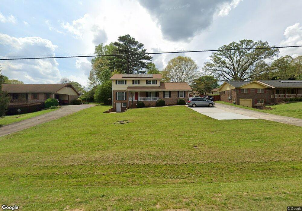
497 Cole Rd SW Lilburn, GA 30047
Estimated Value: $342,000 - $418,262
4
Beds
3
Baths
2,289
Sq Ft
$161/Sq Ft
Est. Value
About This Home
This home is located at 497 Cole Rd SW, Lilburn, GA 30047 and is currently estimated at $369,566, approximately $161 per square foot. 497 Cole Rd SW is a home located in Gwinnett County with nearby schools including Camp Creek Elementary School, Trickum Middle School, and Parkview High School.
Ownership History
Date
Name
Owned For
Owner Type
Purchase Details
Closed on
Dec 6, 2024
Sold by
Mohammed Shani
Bought by
Grajale Arboleda Euclides Dejesus and Grajales Benavides Valentina
Current Estimated Value
Home Financials for this Owner
Home Financials are based on the most recent Mortgage that was taken out on this home.
Original Mortgage
$338,751
Outstanding Balance
$335,600
Interest Rate
6.99%
Mortgage Type
FHA
Estimated Equity
$33,966
Purchase Details
Closed on
Jul 26, 2019
Sold by
Pair Abbie Mickelson
Bought by
Mohammed Shani and Mohammed Saflatu
Home Financials for this Owner
Home Financials are based on the most recent Mortgage that was taken out on this home.
Original Mortgage
$198,850
Interest Rate
3.73%
Mortgage Type
New Conventional
Purchase Details
Closed on
Dec 1, 1999
Sold by
Frisbee Frank W
Bought by
Mickelson Ward A and Mickelson Maxine F
Create a Home Valuation Report for This Property
The Home Valuation Report is an in-depth analysis detailing your home's value as well as a comparison with similar homes in the area
Home Values in the Area
Average Home Value in this Area
Purchase History
| Date | Buyer | Sale Price | Title Company |
|---|---|---|---|
| Grajale Arboleda Euclides Dejesus | $345,000 | -- | |
| Mohammed Shani | $205,000 | -- | |
| Mickelson Ward A | $134,500 | -- |
Source: Public Records
Mortgage History
| Date | Status | Borrower | Loan Amount |
|---|---|---|---|
| Open | Grajale Arboleda Euclides Dejesus | $338,751 | |
| Previous Owner | Mohammed Shani | $198,850 |
Source: Public Records
Tax History Compared to Growth
Tax History
| Year | Tax Paid | Tax Assessment Tax Assessment Total Assessment is a certain percentage of the fair market value that is determined by local assessors to be the total taxable value of land and additions on the property. | Land | Improvement |
|---|---|---|---|---|
| 2025 | $2,582 | $167,960 | $26,120 | $141,840 |
| 2024 | $4,834 | $156,600 | $26,120 | $130,480 |
| 2023 | $4,834 | $160,200 | $26,000 | $134,200 |
| 2022 | $4,321 | $134,160 | $26,000 | $108,160 |
| 2021 | $3,689 | $101,040 | $16,800 | $84,240 |
| 2020 | $3,084 | $82,000 | $16,800 | $65,200 |
| 2019 | $2,981 | $96,760 | $16,800 | $79,960 |
| 2018 | $2,556 | $77,080 | $12,800 | $64,280 |
| 2016 | $2,430 | $70,440 | $12,800 | $57,640 |
| 2015 | $2,464 | $70,880 | $11,200 | $59,680 |
| 2014 | $2,475 | $70,880 | $11,200 | $59,680 |
Source: Public Records
Map
Nearby Homes
- 562 Gregg Dr SW
- 4814 Delgado Dr SW
- 311 Arbor Point Ct SW
- 4704 Arrowhead Trail SW
- 4872 Arrowhead Trail West SW Unit 1
- 4567 Town Crier Rd SW
- 4582 Warrior Trail SW
- 4702 Sequoia Dr SW
- 248 Kettlewood Dr SW
- 5000 Bainbridge Ct SW
- 4983 Arcado Rd SW
- 551 Briggs Cir SW
- 5041 Bainbridge Ct SW Unit 3
- 5041 Cricket Ct SW
- 4989 Woodfall Dr SW
- 4406 Hale Dr SW
- 487 Cole Dr SW
- 507 Cole Rd SW
- 0 Cole Dr SW Unit 7416498
- 0 Cole Dr SW Unit 7391340
- 0 Cole Dr SW Unit 7353552
- 0 Cole Dr SW Unit 8740724
- 0 Cole Dr SW Unit 8443282
- 0 Cole Dr SW Unit 8399338
- 0 Cole Dr SW Unit 8356881
- 0 Cole Dr SW Unit 8102613
- 0 Cole Dr SW Unit 8074023
- 0 Cole Dr SW Unit 7602063
- 0 Cole Dr SW Unit 8155211
- 0 Cole Dr SW Unit 7561176
- 0 Cole Dr SW Unit 7156016
- 0 Cole Dr SW Unit 2966817
- 0 Cole Dr SW Unit 2621073
- 0 Cole Dr SW
- 477 Cole Dr SW
- 517 Cole Rd SW