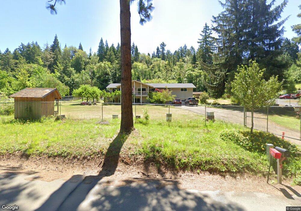
497 Lone Rock Rd Glide, OR 97443
Glide NeighborhoodEstimated Value: $626,870 - $765,000
3
Beds
4
Baths
3,712
Sq Ft
$182/Sq Ft
Est. Value
About This Home
This home is located at 497 Lone Rock Rd, Glide, OR 97443 and is currently estimated at $673,968, approximately $181 per square foot. 497 Lone Rock Rd is a home located in Douglas County with nearby schools including Glide Elementary School, Glide Middle School, and Glide High School.
Ownership History
Date
Name
Owned For
Owner Type
Purchase Details
Closed on
Aug 12, 2009
Sold by
Deford Charles S and Deford Jacqueline
Bought by
Hubbs Allen L and Hubbs Theresa A
Current Estimated Value
Home Financials for this Owner
Home Financials are based on the most recent Mortgage that was taken out on this home.
Original Mortgage
$292,000
Outstanding Balance
$189,701
Interest Rate
5.3%
Mortgage Type
Unknown
Estimated Equity
$484,267
Purchase Details
Closed on
Feb 25, 2009
Sold by
Bledsaw Donna Lee
Bought by
Bledsaw Donna Lee and Broxson Marven Ellis
Create a Home Valuation Report for This Property
The Home Valuation Report is an in-depth analysis detailing your home's value as well as a comparison with similar homes in the area
Home Values in the Area
Average Home Value in this Area
Purchase History
| Date | Buyer | Sale Price | Title Company |
|---|---|---|---|
| Hubbs Allen L | $365,000 | First American Title Ins Co | |
| Bledsaw Donna Lee | -- | None Available |
Source: Public Records
Mortgage History
| Date | Status | Borrower | Loan Amount |
|---|---|---|---|
| Open | Hubbs Allen L | $292,000 |
Source: Public Records
Tax History Compared to Growth
Tax History
| Year | Tax Paid | Tax Assessment Tax Assessment Total Assessment is a certain percentage of the fair market value that is determined by local assessors to be the total taxable value of land and additions on the property. | Land | Improvement |
|---|---|---|---|---|
| 2025 | $4,039 | $441,225 | -- | -- |
| 2024 | $3,900 | $428,374 | -- | -- |
| 2023 | $3,811 | $415,898 | $0 | $0 |
| 2022 | $3,612 | $403,785 | $0 | $0 |
| 2021 | $3,601 | $392,025 | $0 | $0 |
| 2020 | $3,470 | $380,607 | $0 | $0 |
| 2019 | $3,397 | $369,522 | $0 | $0 |
| 2018 | $3,239 | $348,413 | $0 | $0 |
| 2017 | $2,902 | $325,468 | $0 | $0 |
| 2016 | $3,015 | $338,266 | $0 | $0 |
| 2015 | $3,014 | $336,396 | $0 | $0 |
| 2014 | $2,939 | $326,599 | $0 | $0 |
| 2013 | -- | $305,540 | $0 | $0 |
Source: Public Records
Map
Nearby Homes
- 283 Upper Terrace Ln
- 130 Terrace Dr
- 173 Park St
- 298 Grandview St
- 485 Brown St
- 123 Mountain View
- 713 Little River Rd
- 3387 Wild River Dr
- 369 Upper Camp Loop Rd
- 1070 Mystic Mountain Ln
- 900 Old Cabin Dr
- 1884 Wild River Dr
- 121 Wild Goose Ln
- 606 Whistlers Ln
- 400 Newbridge Rd
- 14115 N Bank Rd
- 13767 N Bank Rd
- 1424 Cavitt Creek Rd
- 8738 Buckhorn Rd
- 2665 Whistlers Park Rd
- 469 Lone Rock Rd
- 551 Lone Rock Rd
- 445 Lone Rock Rd
- 601 Lone Rock Rd
- 607 Lone Rock Rd
- 607 Lone Rock Rd
- 607 Lone Rock Rd
- 0 Lone Rock Rd Unit 285324
- 0 Lone Rock Rd Unit 285322
- 0 Lone Rock Rd Unit 285317
- 0 Lone Rock Rd Unit 277748
- 0 Lone Rock Rd Unit 277744
- 0 Lone Rock Rd Unit 258986
- 0 Lone Rock Rd Unit 254728
- 0 Lone Rock Rd Unit 254726
- 0 Lone Rock Rd Unit 233193
- 0 Lone Rock Rd Unit 218626
- 0 Lone Rock Rd Unit 218624
- 0 Lone Rock Rd Unit 20521187
- 0 Lone Rock Rd Unit 1500 19697670