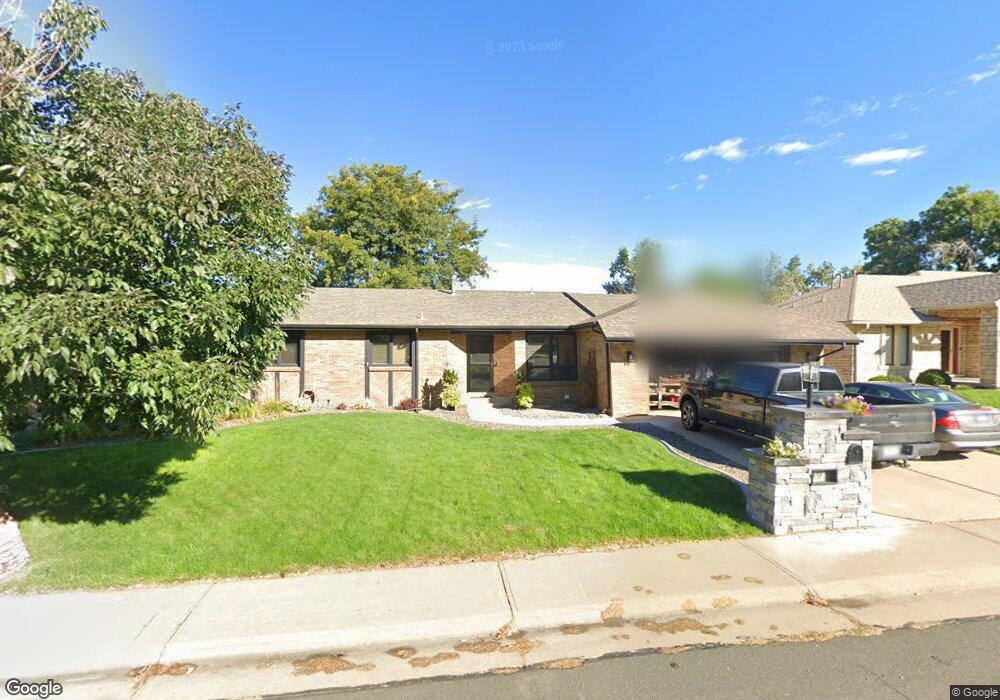
497 Poppy Dr Brighton, CO 80601
Estimated Value: $452,337 - $487,000
5
Beds
1
Bath
1,720
Sq Ft
$272/Sq Ft
Est. Value
About This Home
This home is located at 497 Poppy Dr, Brighton, CO 80601 and is currently estimated at $467,334, approximately $271 per square foot. 497 Poppy Dr is a home located in Adams County with nearby schools including Southeast Elementary School, Vikan Middle School, and Brighton High School.
Ownership History
Date
Name
Owned For
Owner Type
Purchase Details
Closed on
Dec 30, 2016
Sold by
Durkee Marilyn Ann
Bought by
Hillyard Monte B and Hillyard Dallene S
Current Estimated Value
Home Financials for this Owner
Home Financials are based on the most recent Mortgage that was taken out on this home.
Original Mortgage
$245,700
Interest Rate
2.8%
Mortgage Type
New Conventional
Purchase Details
Closed on
May 3, 2005
Sold by
Ball Michael G and Ball Doreen E
Bought by
Durkee Marilyn Ann
Home Financials for this Owner
Home Financials are based on the most recent Mortgage that was taken out on this home.
Original Mortgage
$197,150
Interest Rate
5.87%
Mortgage Type
Unknown
Purchase Details
Closed on
Jan 15, 1999
Sold by
Farner Dorothy F
Bought by
Ball Michael G and Ball Doreen E
Home Financials for this Owner
Home Financials are based on the most recent Mortgage that was taken out on this home.
Original Mortgage
$155,200
Interest Rate
6.68%
Mortgage Type
Balloon
Purchase Details
Closed on
Aug 28, 1998
Sold by
Shipp William K and Platz Jama L
Bought by
Farner Dorothy F
Purchase Details
Closed on
Oct 15, 1997
Sold by
Farner Dorothy F
Bought by
Shipp William K and Platz Jama L
Home Financials for this Owner
Home Financials are based on the most recent Mortgage that was taken out on this home.
Original Mortgage
$124,800
Interest Rate
11.6%
Purchase Details
Closed on
Dec 13, 1996
Sold by
Casady Patrick Edward and Casady Wendy Elizabeth
Bought by
Farner Dorothy F
Purchase Details
Closed on
Dec 11, 1996
Sold by
Ruth Casady Patsy
Bought by
Casady Patrick Edward and Casady Wendy Elizabeth
Purchase Details
Closed on
Oct 6, 1993
Sold by
Hanson Irvin F and Hanson Starr F
Bought by
Casady Patsy Ruth
Home Financials for this Owner
Home Financials are based on the most recent Mortgage that was taken out on this home.
Original Mortgage
$123,000
Interest Rate
6.93%
Purchase Details
Closed on
Dec 24, 1991
Create a Home Valuation Report for This Property
The Home Valuation Report is an in-depth analysis detailing your home's value as well as a comparison with similar homes in the area
Home Values in the Area
Average Home Value in this Area
Purchase History
| Date | Buyer | Sale Price | Title Company |
|---|---|---|---|
| Hillyard Monte B | $325,000 | None Available | |
| Durkee Marilyn Ann | $246,450 | Empire Title & Escrow | |
| Ball Michael G | $194,000 | -- | |
| Farner Dorothy F | $57,000 | -- | |
| Shipp William K | $192,000 | -- | |
| Farner Dorothy F | $172,000 | First American | |
| Casady Patrick Edward | -- | -- | |
| Casady Patsy Ruth | $146,000 | -- | |
| -- | $132,000 | -- |
Source: Public Records
Mortgage History
| Date | Status | Borrower | Loan Amount |
|---|---|---|---|
| Previous Owner | Hillyard Monte B | $245,700 | |
| Previous Owner | Durkee Marilyn Ann | $197,150 | |
| Previous Owner | Ball Michael G | $155,200 | |
| Previous Owner | Shipp William K | $124,800 | |
| Previous Owner | Casady Patsy Ruth | $123,000 | |
| Closed | Shipp William K | $57,600 |
Source: Public Records
Tax History Compared to Growth
Tax History
| Year | Tax Paid | Tax Assessment Tax Assessment Total Assessment is a certain percentage of the fair market value that is determined by local assessors to be the total taxable value of land and additions on the property. | Land | Improvement |
|---|---|---|---|---|
| 2024 | $3,179 | $28,250 | $6,560 | $21,690 |
| 2023 | $3,160 | $32,200 | $7,100 | $25,100 |
| 2022 | $2,636 | $25,250 | $6,670 | $18,580 |
| 2021 | $2,636 | $25,250 | $6,670 | $18,580 |
| 2020 | $2,537 | $25,390 | $6,860 | $18,530 |
| 2019 | $2,542 | $25,390 | $6,860 | $18,530 |
| 2018 | $2,185 | $21,760 | $6,480 | $15,280 |
| 2017 | $2,188 | $21,760 | $6,480 | $15,280 |
| 2016 | $2,219 | $21,950 | $3,900 | $18,050 |
| 2015 | $2,204 | $21,950 | $3,900 | $18,050 |
| 2014 | $1,863 | $18,780 | $2,950 | $15,830 |
Source: Public Records
Map
Nearby Homes
- 434 Voiles Dr
- 406 S 16th Ave
- 628 S 16th Ave
- 2084 Donna Ct
- 792 S 12th Ave
- 797 S 11th Ave
- 595 Badger Creek Dr
- 791 S 21st Ct
- 316 S 22nd Ave
- 551 Longhurst Place
- 933 Skeel St
- 290 S 22nd Ave
- 465 S 24th Ave
- 2277 Wingler Place
- 175 S 10th Ave
- 438 S 7th Ave
- 414 S 7th Ave
- 2364 Cherry St
- 285 S 8th Ave
- 865 S 8th Ave