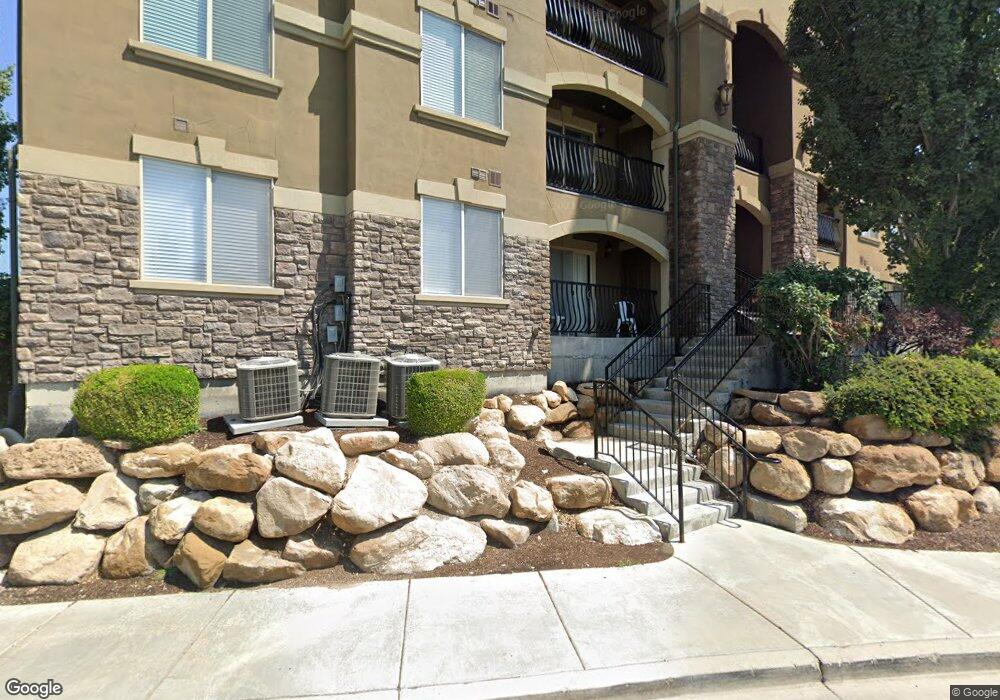
497 S 2220 W Pleasant Grove, UT 84062
Estimated Value: $315,000 - $330,000
3
Beds
2
Baths
1,239
Sq Ft
$260/Sq Ft
Est. Value
About This Home
This home is located at 497 S 2220 W, Pleasant Grove, UT 84062 and is currently estimated at $321,633, approximately $259 per square foot. 497 S 2220 W is a home located in Utah County with nearby schools including Barratt Elementary School, American Fork Junior High School, and American Fork High School.
Ownership History
Date
Name
Owned For
Owner Type
Purchase Details
Closed on
Jun 19, 2019
Sold by
Cheikhouni Llc
Bought by
497 Pg Llc
Current Estimated Value
Purchase Details
Closed on
Nov 19, 2012
Sold by
Alsolaiman Mohammad
Bought by
Cheikhouni Llc
Purchase Details
Closed on
Oct 12, 2012
Sold by
Federal Home Loan Mortgage Corporation
Bought by
Alsolaiman Mohammad
Purchase Details
Closed on
Feb 24, 2012
Sold by
Smith Stanley B
Bought by
Federal Home Loan Mortgage Corporation
Purchase Details
Closed on
Jul 25, 2008
Sold by
Smith Stanley B
Bought by
Smith Stanley B and Smith Mary Kaye
Home Financials for this Owner
Home Financials are based on the most recent Mortgage that was taken out on this home.
Original Mortgage
$134,392
Interest Rate
6.31%
Mortgage Type
Purchase Money Mortgage
Create a Home Valuation Report for This Property
The Home Valuation Report is an in-depth analysis detailing your home's value as well as a comparison with similar homes in the area
Home Values in the Area
Average Home Value in this Area
Purchase History
| Date | Buyer | Sale Price | Title Company |
|---|---|---|---|
| 497 Pg Llc | -- | None Available | |
| Cheikhouni Llc | -- | None Available | |
| Alsolaiman Mohammad | -- | Bonneville Superior Title Co | |
| Federal Home Loan Mortgage Corporation | $118,000 | None Available | |
| Smith Stanley B | -- | Mountain West Title Company | |
| Smith Stanley B | -- | Mountain West Title Company |
Source: Public Records
Mortgage History
| Date | Status | Borrower | Loan Amount |
|---|---|---|---|
| Previous Owner | Smith Stanley B | $134,392 |
Source: Public Records
Tax History Compared to Growth
Tax History
| Year | Tax Paid | Tax Assessment Tax Assessment Total Assessment is a certain percentage of the fair market value that is determined by local assessors to be the total taxable value of land and additions on the property. | Land | Improvement |
|---|---|---|---|---|
| 2025 | $1,433 | $321,700 | $35,700 | $286,000 |
| 2024 | $1,433 | $170,995 | $0 | $0 |
| 2023 | $1,383 | $168,960 | $0 | $0 |
| 2022 | $1,390 | $169,015 | $0 | $0 |
| 2021 | $799 | $226,000 | $27,100 | $198,900 |
| 2020 | $1,143 | $207,400 | $24,900 | $182,500 |
| 2019 | $1,005 | $188,500 | $22,000 | $166,500 |
| 2018 | $896 | $159,000 | $19,100 | $139,900 |
| 2017 | $850 | $80,300 | $0 | $0 |
| 2016 | $754 | $73,700 | $0 | $0 |
| 2015 | $799 | $73,700 | $0 | $0 |
| 2014 | $739 | $63,250 | $0 | $0 |
Source: Public Records
Map
Nearby Homes
- 581 S 2220 W Unit 301
- 518 S 2150 W Unit 202
- 574 S 2150 W Unit 104
- 684 S 2150 W Unit 203
- 661 S 2220 W Unit 202
- 626 S 2310 W
- 685 S 2220 W Unit 102
- 685 S 2220 W Unit 302
- 1795 W 120 S Unit 52
- The Henley B Plan at Tayside Farm - Single Family Home
- The Hastings Plan at Tayside Farm - Townhome
- The Henley A Plan at Tayside Farm - Single Family Home
- The Denton Plan at Tayside Farm - Townhome
- 128 S 1700 W Unit 12
- 1775 W 120 S Unit 54
- 1765 W 120 S Unit 55
- 29 S 2000 W
- 1597 W 80 S
- 43 S 1630 W
- 1559 W 50 N
- 497 S 2220 W Unit 303
- 497 S 2220 W
- 497 S 2220 W Unit 204
- 497 S 2220 W
- 497 S 2220 W
- 497 S 2220 W
- 497 S 2220 W
- 497 S 2220 W Unit 102
- 497 S 2220 W Unit 304
- 497 S 2220 W Unit 104
- 497 S 2220 W Unit 203
- 497 S 2220 W Unit 301
- 497 S 2220 W Unit 101
- 497 S 2220 W Unit 103
- 496 S 2150 W
- 496 S 2150 W
- 496 S 2150 W
- 496 S 2150 W Unit 204
- 496 S 2150 W
- 496 S 2150 W Unit 202