Estimated payment $3,858/month
Highlights
- Second Kitchen
- RV or Boat Parking
- Fruit Trees
- Eaglecrest Elementary School Rated A-
- 0.46 Acre Lot
- 2-minute walk to Lehi Centennial Park
About This Home
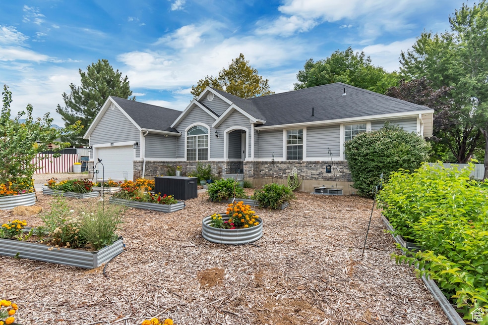
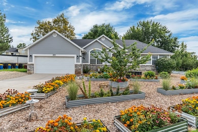
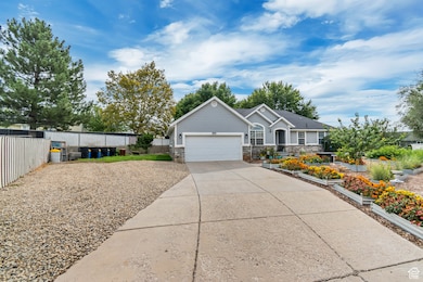
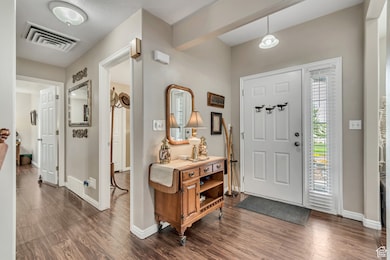
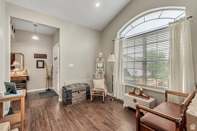
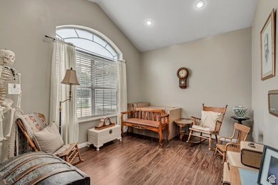
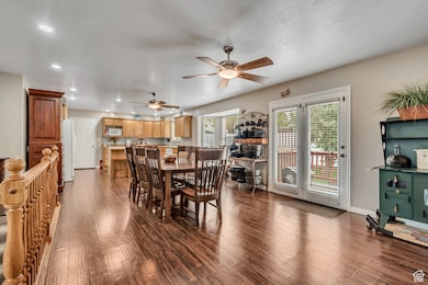
Urban/City Homestead Oasis & Retreat For Sale by Owner 497 West 2200 North, Lehi, UT 84043 5 Beds | 3 Baths | 0.46 Acre | $690,000] Escape the hustle without leaving the city! This rare urban/city homestead offers the perfect balance of modern convenience and sustainable living. Nestled in a quiet neighborhood just minutes from Lehi and American Fork City Centers, this property is a private sanctuary for gardeners, hobby farmers, and anyone craving space to breathe. Property Highlights: Charming 5-bedroom, 3-bath Ranch/Rambler style home 1471 sq. ft. main level with master bed and bath with walk-in closet and 2nd bedroom and main bath. 1420 sq. ft. 100% finished basement with 3 bedrooms, 1 bath, and full kitchen, large family room with custom made solid oak built in bookcases and curio well as a large food pantry room. Add outside entrance to make into a rental. Two car garage with room for storage. Space for greenhouse which is perfect for seedlings extended growing season or relaxation. Extended gravel parking for additional vehicles, trailers and/or RV. Central Air and Wate Softener. Roof 5 years new. Homestead Features: 0.46-acre lot with mature fruit trees (cherry, plum, apple, asian pear, peach & Apricot), approx. 200 feet of various types of grape vines along two fence lines, 29 raised garden beds for garden/crop planting, another 23 raised beds for herbs and decorative flowers, as well as a chicken coop with large, fenced run. Lawn has Auto Sprinkler System and Garden Beds are equipped with auto drip systems to make for low maintenance upkeep. Zoned RA-1 Residential/Agriculture 2 sheds for tools, gardening and lawn care equipment or storage. Composting stations. Large lawn for family gatherings or to enjoy and relax outdoors. Location Perks: Close to local cafes, markets, schools, park, bike trails and transit. Quick access to urban amenities while enjoying a self-sufficient lifestyle. Strong community with local farmers markets nearby. Fiber internet access. This is city living with soul-a unique opportunity to live sustainably without sacrificing access or comfort. Schedule a viewing today to experience this unique blend of urban and rural living.
Home Details
Home Type
- Single Family
Est. Annual Taxes
- $2,566
Year Built
- Built in 1993
Lot Details
- 0.46 Acre Lot
- Cul-De-Sac
- Partially Fenced Property
- Landscaped
- Fruit Trees
- Mature Trees
- Vegetable Garden
- Property is zoned Single-Family
Parking
- 2 Car Attached Garage
- RV or Boat Parking
Home Design
- Rambler Architecture
- Brick Exterior Construction
- Stucco
Interior Spaces
- 2,894 Sq Ft Home
- 2-Story Property
- Double Pane Windows
- Blinds
- Entrance Foyer
- Den
- Carpet
- Mountain Views
- Basement Fills Entire Space Under The House
- Second Kitchen
- Electric Dryer Hookup
Bedrooms and Bathrooms
- 5 Bedrooms | 2 Main Level Bedrooms
- Walk-In Closet
- In-Law or Guest Suite
- Hydromassage or Jetted Bathtub
- Bathtub With Separate Shower Stall
Schools
- Eaglecrest Elementary School
- Lehi Middle School
- Lehi High School
Additional Features
- Sprinkler System
- Open Patio
- Forced Air Heating and Cooling System
Community Details
- No Home Owners Association
- Country Manor Estate Subdivision
Listing and Financial Details
- Exclusions: Storage Shed(s)
- Assessor Parcel Number 36-414-0007
Map
Home Values in the Area
Average Home Value in this Area
Tax History
| Year | Tax Paid | Tax Assessment Tax Assessment Total Assessment is a certain percentage of the fair market value that is determined by local assessors to be the total taxable value of land and additions on the property. | Land | Improvement |
|---|---|---|---|---|
| 2025 | $2,566 | $331,705 | $232,900 | $370,200 |
| 2024 | $2,566 | $300,300 | $0 | $0 |
| 2023 | $2,408 | $305,965 | $0 | $0 |
| 2022 | $2,512 | $309,485 | $0 | $0 |
| 2021 | $2,242 | $417,600 | $134,800 | $282,800 |
| 2020 | $2,114 | $389,100 | $124,800 | $264,300 |
| 2019 | $1,933 | $370,000 | $124,800 | $245,200 |
| 2018 | $1,850 | $334,700 | $113,800 | $220,900 |
| 2017 | $1,663 | $159,995 | $0 | $0 |
| 2016 | $1,634 | $145,805 | $0 | $0 |
| 2015 | $1,676 | $141,955 | $0 | $0 |
| 2014 | $1,637 | $137,885 | $0 | $0 |
Property History
| Date | Event | Price | List to Sale | Price per Sq Ft |
|---|---|---|---|---|
| 09/08/2025 09/08/25 | For Sale | $690,000 | -- | $238 / Sq Ft |
Purchase History
| Date | Type | Sale Price | Title Company |
|---|---|---|---|
| Quit Claim Deed | -- | Anderson Law Center Pc | |
| Warranty Deed | -- | Affiliated First Title Comp | |
| Interfamily Deed Transfer | -- | None Available |
Mortgage History
| Date | Status | Loan Amount | Loan Type |
|---|---|---|---|
| Previous Owner | $189,600 | Purchase Money Mortgage |
Source: UtahRealEstate.com
MLS Number: 2110217
APN: 36-414-0007
Disclaimer: Certain information contained herein is derived from information provided by parties other than Homes.com. All information provided is deemed reliable, but is not guaranteed to be accurate and should be independently verified.
![]() IDX information is provided exclusively for consumers’ personal, non-commercial use, that it may not be used for any purpose other than to identify prospective properties consumers may be interested in purchasing, and that the data is deemed reliable but is not guaranteed accurate by the MLS. Licensor is only providing the MLS Content and not other sources of data provided in the Product.
IDX information is provided exclusively for consumers’ personal, non-commercial use, that it may not be used for any purpose other than to identify prospective properties consumers may be interested in purchasing, and that the data is deemed reliable but is not guaranteed accurate by the MLS. Licensor is only providing the MLS Content and not other sources of data provided in the Product.
Based on information from the Wasatch Front Regional Multiple Listing Service, Inc.. All data, including all measurements and calculations of area, is obtained from various sources and has not been, and will not be, verified by broker or the MLS. All information should be independently reviewed and verified for accuracy. Properties may or may not be listed by the office/agent presenting the information.
- 497 W 2280 N
- 2287 N 750 W
- 1755 N 250 W
- 1817 W Bad Rock Cir
- 1011 W Mountain Way Unit 316
- 2687 N 900 W
- 192 E 2200 N
- 4333 N Baiken Ridge Dr Unit 1020
- 902 W 1500 N
- 2539 N 300 E
- 1610 N 1125 W
- 1272 W 1800 N
- 1249 W 1800 N
- 3117 N 325 W
- 2946 N 1080 W
- 1094 W 1425 N
- 1301 N 900 W Unit 12
- 389 W 3200 N
- 337 W 3200 N
- 1155 W 2980 N
- 339 W 2450 N
- 2377 N 1200 W
- 1788 N Festive Way
- 2884 N 675 E
- 2777 W Sandalwood Dr
- 1995 N 3930 W
- 3601 N Mountain View Rd
- 1971 W 1400 N
- 3851 N Traverse Mountain Blvd
- 4200 N Seasons View Dr
- 2718 N Elm Dr
- 1400 W Morning Vista Rd
- 1054 W Main St
- 4151 N Traverse Mountain Blvd
- 4104 N Fremont Dr
- 591 S Emerald Ln Unit Basement ADU
- 4206 W 1960 N Unit Private 3
- 200 S 1350 E
- 6225 W 10050 N
- 3108 W Desert Lily Dr
