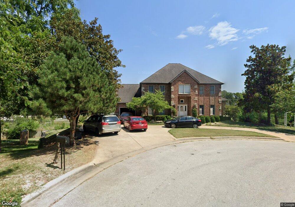
4970 S Leroy Ave Springfield, MO 65810
Southwest Springfield NeighborhoodEstimated Value: $501,000 - $750,000
6
Beds
6
Baths
5,780
Sq Ft
$112/Sq Ft
Est. Value
About This Home
This home is located at 4970 S Leroy Ave, Springfield, MO 65810 and is currently estimated at $646,988, approximately $111 per square foot. 4970 S Leroy Ave is a home located in Greene County with nearby schools including Gray Elementary School, Wilson's Creek Intermediate School, and Cherokee Middle School.
Ownership History
Date
Name
Owned For
Owner Type
Purchase Details
Closed on
Dec 24, 2014
Sold by
Bonis James G
Bought by
Scantlin Samuel Arron and Scantlin Donna Lee
Current Estimated Value
Home Financials for this Owner
Home Financials are based on the most recent Mortgage that was taken out on this home.
Original Mortgage
$286,560
Outstanding Balance
$220,551
Interest Rate
4.05%
Mortgage Type
New Conventional
Estimated Equity
$426,437
Create a Home Valuation Report for This Property
The Home Valuation Report is an in-depth analysis detailing your home's value as well as a comparison with similar homes in the area
Home Values in the Area
Average Home Value in this Area
Purchase History
| Date | Buyer | Sale Price | Title Company |
|---|---|---|---|
| Scantlin Samuel Arron | -- | None Available |
Source: Public Records
Mortgage History
| Date | Status | Borrower | Loan Amount |
|---|---|---|---|
| Open | Scantlin Samuel Arron | $286,560 |
Source: Public Records
Tax History
| Year | Tax Paid | Tax Assessment Tax Assessment Total Assessment is a certain percentage of the fair market value that is determined by local assessors to be the total taxable value of land and additions on the property. | Land | Improvement |
|---|---|---|---|---|
| 2025 | $4,644 | $94,680 | $12,120 | $82,560 |
| 2024 | $4,644 | $83,850 | $11,630 | $72,220 |
| 2023 | $4,619 | $83,850 | $11,630 | $72,220 |
| 2022 | $4,196 | $78,070 | $11,630 | $66,440 |
| 2021 | $4,195 | $78,070 | $11,630 | $66,440 |
| 2020 | $4,098 | $72,320 | $11,630 | $60,690 |
| 2019 | $3,952 | $71,800 | $11,630 | $60,170 |
| 2018 | $4,096 | $74,250 | $11,630 | $62,620 |
| 2017 | $4,056 | $69,180 | $11,630 | $57,550 |
| 2016 | $3,780 | $69,180 | $11,630 | $57,550 |
| 2015 | $3,750 | $69,180 | $11,630 | $57,550 |
| 2014 | $3,608 | $66,030 | $11,630 | $54,400 |
Source: Public Records
Map
Nearby Homes
- 5389 S Clifton Ave
- 1747 W Nottingham St
- 2680 W Williamsburg St
- 5021 S Farm Rd 137
- 2240 W Alta St
- 2047 W Blakey St
- 3032 W Allen Dr
- 1978 W Williamsburg St
- 5375 S Twelve Oaks Rd
- 1920 W Murray Dr
- 2914 W Marty St
- 2926 W Marty St
- 4911 S Sycamore Ave
- 3017 W Teton Dr
- 3039 W Teton Dr
- 2983 W Teton Dr
- 2929 W Marty St
- 2946 W Teton Dr
- 2941 W Marty St
- 2925 W Teton Dr
- 4983 S Leroy Ave
- 4954 S Leroy Ave
- 4971 S Leroy Ave
- 2468 W Chatsworth Ct
- 4955 S Leroy Ave
- 2391 W Farm Road 178
- 4942 S Leroy Ave
- 4945 S Leroy Ave
- 2467 W Chatsworth Ct
- 2474 W Chatsworth Ct
- 4966 S Jewell Ave
- 4980 S Jewell Ave
- 4924 S Leroy Ave
- 4931 S Leroy Ave
- 5044 S Chatsworth Ave
- 0 W Farm Road 178 Unit 10902260
- 0 W Farm Road 178 Unit 10919554
- 0 W Farm Road 178 Unit 11004800
- 4950 S Jewell Ave
- 5048 S Chatsworth Ave
Your Personal Tour Guide
Ask me questions while you tour the home.