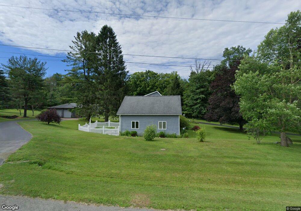
4971 S Hill Rd Mc Kean, PA 16426
Estimated Value: $267,000 - $431,000
3
Beds
2
Baths
2,903
Sq Ft
$120/Sq Ft
Est. Value
About This Home
This home is located at 4971 S Hill Rd, Mc Kean, PA 16426 and is currently estimated at $349,669, approximately $120 per square foot. 4971 S Hill Rd is a home located in Erie County with nearby schools including McKean Elementary School, James W. Parker Middle School, and General McLane High School.
Ownership History
Date
Name
Owned For
Owner Type
Purchase Details
Closed on
Apr 27, 2024
Sold by
Ducharme Family 2022 Irrevocable Trust and Ducharme David J
Bought by
Commonwealth Of Pennsylvania
Current Estimated Value
Purchase Details
Closed on
Dec 22, 2022
Sold by
Ducharme David J and Ducharme Diane M
Bought by
Ducharme Family 2022 Irrevocable Trust
Purchase Details
Closed on
May 14, 1997
Sold by
Larson Drew T and Larson Mary A
Bought by
Ducharme David J
Create a Home Valuation Report for This Property
The Home Valuation Report is an in-depth analysis detailing your home's value as well as a comparison with similar homes in the area
Home Values in the Area
Average Home Value in this Area
Purchase History
| Date | Buyer | Sale Price | Title Company |
|---|---|---|---|
| Commonwealth Of Pennsylvania | -- | None Listed On Document | |
| Ducharme Family 2022 Irrevocable Trust | -- | -- | |
| Ducharme David J | $155,000 | -- |
Source: Public Records
Tax History Compared to Growth
Tax History
| Year | Tax Paid | Tax Assessment Tax Assessment Total Assessment is a certain percentage of the fair market value that is determined by local assessors to be the total taxable value of land and additions on the property. | Land | Improvement |
|---|---|---|---|---|
| 2025 | $4,955 | $217,600 | $42,500 | $175,100 |
| 2024 | $4,798 | $217,600 | $42,500 | $175,100 |
| 2023 | $4,515 | $217,600 | $42,500 | $175,100 |
| 2022 | $4,385 | $217,600 | $42,500 | $175,100 |
| 2021 | $4,328 | $217,600 | $42,500 | $175,100 |
| 2020 | $4,274 | $217,600 | $42,500 | $175,100 |
| 2019 | $4,245 | $217,600 | $42,500 | $175,100 |
| 2018 | $4,154 | $217,600 | $42,500 | $175,100 |
| 2017 | $4,154 | $217,600 | $42,500 | $175,100 |
| 2016 | $4,989 | $217,600 | $42,500 | $175,100 |
| 2015 | $4,935 | $217,600 | $42,500 | $175,100 |
| 2014 | $2,352 | $217,600 | $42,500 | $175,100 |
Source: Public Records
Map
Nearby Homes
- 9735 Old Route 99
- 4817 Greenlee Rd
- 702 Skyline Dr
- 10050 Old Route 99
- 5115 West Rd
- 11897 Silverthorn (Tr 86 Rt T438) Rd
- 0 Edinboro Rd Unit 183772
- 0 Edinboro Rd Unit 182375
- 0 Edinboro Rd Unit 173270
- 127 Timberlake Dr
- 0 S Hill Rd
- 4241 Dunn Valley Rd
- 8580 Rick Rd
- 9731 Silverthorn Rd
- 29 Sharon Dr
- 4919 Old State Rd
- 7761 Grubb Rd
- 6870 Sterrettania Rd
- 5233 California Rd
- 0 Flower Rd
- 4951 S Hill Rd
- 4931 S Hill Rd
- 4928 S Hill Rd
- 4928 S Hill
- 9600 Old Route 99
- 9644 Old Route 99
- 9579 Old Route 99
- 9670 Old Route 99
- 9651 Old Route 99
- 9544 Edinboro Rd
- 9520 Old Route 99
- 9690 Old Route 99
- 9683 Old Route 99
- 9696 Edinboro Rd
- 9711 Old Route 99
- 9509 Old Route 99
- 9483 Old Route 99
- 9721 Old Route 99
- 9506 Old Route 99
- 9500 Old Route 99