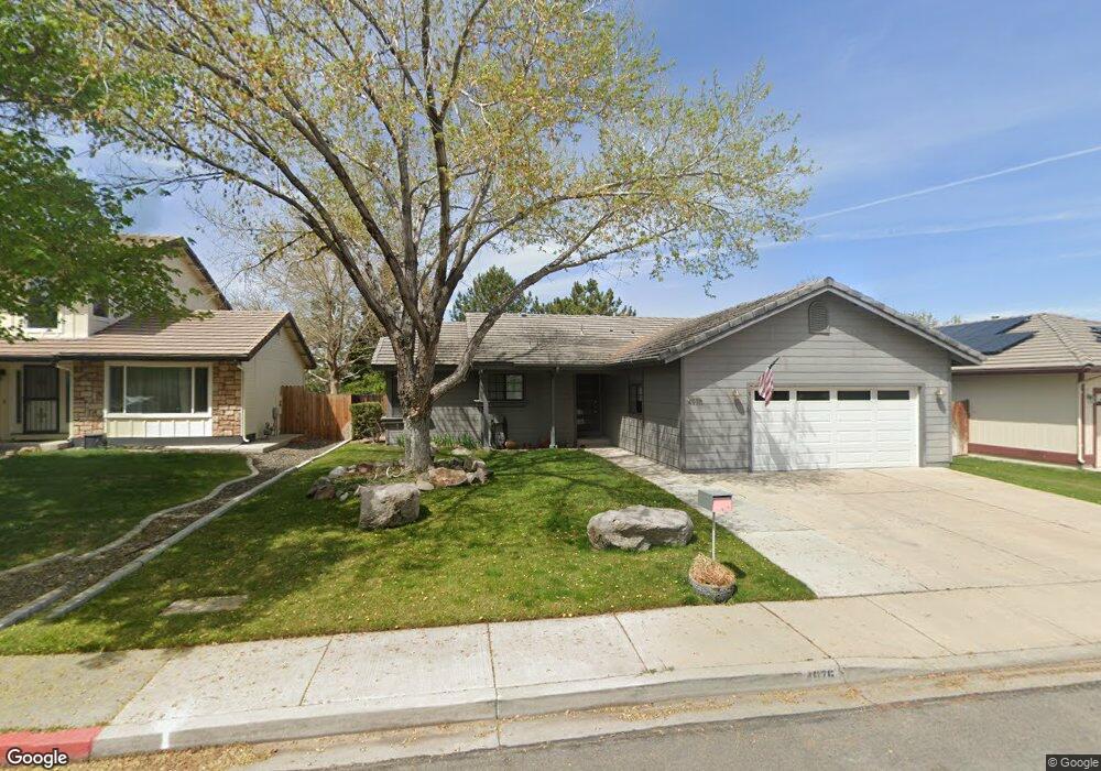
4975 Palo Alto Cir Unit 1 Sparks, NV 89436
Los Altos Parkway NeighborhoodEstimated Value: $508,000 - $538,000
3
Beds
2
Baths
1,495
Sq Ft
$351/Sq Ft
Est. Value
About This Home
This home is located at 4975 Palo Alto Cir Unit 1, Sparks, NV 89436 and is currently estimated at $524,386, approximately $350 per square foot. 4975 Palo Alto Cir Unit 1 is a home located in Washoe County with nearby schools including Bud Beasley Elementary School, Edward C Reed High School, and Excel Christian School.
Ownership History
Date
Name
Owned For
Owner Type
Purchase Details
Closed on
Apr 15, 2011
Sold by
Garrett Rhodora C
Bought by
Miller Michael A
Current Estimated Value
Home Financials for this Owner
Home Financials are based on the most recent Mortgage that was taken out on this home.
Original Mortgage
$143,273
Interest Rate
4.87%
Mortgage Type
FHA
Purchase Details
Closed on
Nov 4, 2003
Sold by
Garrett Scott M
Bought by
Garrett Rhodora C
Home Financials for this Owner
Home Financials are based on the most recent Mortgage that was taken out on this home.
Original Mortgage
$215,000
Interest Rate
5.94%
Mortgage Type
Unknown
Purchase Details
Closed on
Jan 10, 1994
Sold by
Horning Russell T and Horning Diane L
Bought by
Barker Horning Investments
Create a Home Valuation Report for This Property
The Home Valuation Report is an in-depth analysis detailing your home's value as well as a comparison with similar homes in the area
Home Values in the Area
Average Home Value in this Area
Purchase History
| Date | Buyer | Sale Price | Title Company |
|---|---|---|---|
| Miller Michael A | $147,000 | First Centennial Reno | |
| Garrett Rhodora C | -- | Stewart Title Of Northern Nv | |
| Garrett Rhodora C | $587,666 | Stewart Title Of Northern Nv | |
| Barker Horning Investments | $139,500 | -- |
Source: Public Records
Mortgage History
| Date | Status | Borrower | Loan Amount |
|---|---|---|---|
| Previous Owner | Miller Michael A | $143,273 | |
| Previous Owner | Garrett Rhodora C | $215,000 |
Source: Public Records
Tax History Compared to Growth
Tax History
| Year | Tax Paid | Tax Assessment Tax Assessment Total Assessment is a certain percentage of the fair market value that is determined by local assessors to be the total taxable value of land and additions on the property. | Land | Improvement |
|---|---|---|---|---|
| 2025 | $2,407 | $95,773 | $42,560 | $53,213 |
| 2024 | $2,339 | $94,179 | $40,075 | $54,104 |
| 2023 | $2,339 | $90,274 | $38,710 | $51,564 |
| 2022 | $2,165 | $75,930 | $32,830 | $43,100 |
| 2021 | $2,101 | $66,921 | $23,835 | $43,086 |
| 2020 | $2,039 | $67,300 | $23,800 | $43,500 |
| 2019 | $1,979 | $66,334 | $24,360 | $41,974 |
| 2018 | $1,923 | $59,115 | $17,780 | $41,335 |
| 2017 | $1,866 | $58,079 | $16,450 | $41,629 |
| 2016 | $1,788 | $55,307 | $14,525 | $40,782 |
| 2015 | $1,785 | $53,804 | $12,880 | $40,924 |
| 2014 | $1,734 | $50,697 | $10,885 | $39,812 |
| 2013 | -- | $45,126 | $8,925 | $36,201 |
Source: Public Records
Map
Nearby Homes
- 1560 Freeman Way
- 5276 Santa Rosa Ave
- 1388 Lambrays Ln
- 5105 Santa Anita Dr
- 1550 Istrice Rd
- 1685 Southview Dr
- 1716 Canyon Terrace Dr
- 1304 Lambrusca Dr
- 1215 Ebling Dr
- 4788 Ravello Dr
- 4675 Firtree Ln
- 3693 Vista Blvd
- 4748 Pradera St
- 4393 Acobat Ct
- 4950 San Diego Ct
- 5049 Keams Ct
- 4515 Whitney Cir
- 1484 Serendipity Ct
- 1850 Almonte Ct
- 5436 Vista Terrace Ln Unit 2B
- 4965 Palo Alto Cir Unit 1
- 4985 Palo Alto Cir
- 4995 Palo Alto Cir
- 4955 Palo Alto Cir
- 1569 Iratcabal Dr
- 1573 Iratcabal Dr
- 1565 Iratcabal Dr
- 5005 Palo Alto Cir
- 1577 Iratcabal Dr
- 4976 Palo Alto Cir
- 4966 Palo Alto Cir
- 4986 Palo Alto Cir Unit 1
- 1561 Iratcabal Dr
- 4996 Palo Alto Cir
- 4945 Palo Alto Cir
- 1581 Iratcabal Dr
- 4946 Palo Alto Cir
- 5015 Palo Alto Cir
- 1557 Iratcabal Dr
- 5006 Palo Alto Cir Unit 1