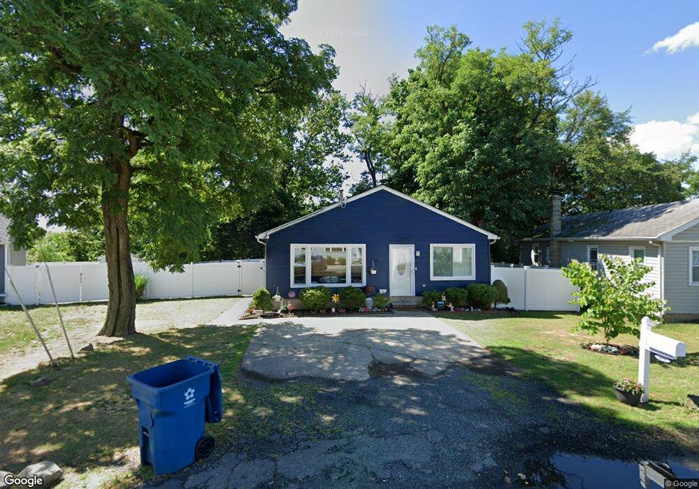
498 Harding Rd Laurence Harbor, NJ 08879
Estimated Value: $375,192 - $447,000
--
Bed
--
Bath
1,140
Sq Ft
$374/Sq Ft
Est. Value
About This Home
This home is located at 498 Harding Rd, Laurence Harbor, NJ 08879 and is currently estimated at $425,798, approximately $373 per square foot. 498 Harding Rd is a home located in Middlesex County with nearby schools including Old Bridge High School, Icob Academy, and St. Joseph Elementary School.
Ownership History
Date
Name
Owned For
Owner Type
Purchase Details
Closed on
Jun 25, 2020
Sold by
Kessler Dennis and Kessler Norlyn
Bought by
Erazo Tabatha
Current Estimated Value
Home Financials for this Owner
Home Financials are based on the most recent Mortgage that was taken out on this home.
Original Mortgage
$247,350
Outstanding Balance
$219,741
Interest Rate
3.2%
Mortgage Type
New Conventional
Estimated Equity
$206,057
Purchase Details
Closed on
Jul 18, 1980
Bought by
Kessler Dennis and Tripp Irving
Create a Home Valuation Report for This Property
The Home Valuation Report is an in-depth analysis detailing your home's value as well as a comparison with similar homes in the area
Home Values in the Area
Average Home Value in this Area
Purchase History
| Date | Buyer | Sale Price | Title Company |
|---|---|---|---|
| Erazo Tabatha | $255,000 | Old Republic Title | |
| Kessler Dennis | $4,500 | -- |
Source: Public Records
Mortgage History
| Date | Status | Borrower | Loan Amount |
|---|---|---|---|
| Open | Erazo Tabatha | $247,350 |
Source: Public Records
Tax History Compared to Growth
Tax History
| Year | Tax Paid | Tax Assessment Tax Assessment Total Assessment is a certain percentage of the fair market value that is determined by local assessors to be the total taxable value of land and additions on the property. | Land | Improvement |
|---|---|---|---|---|
| 2025 | $5,168 | $90,200 | $42,200 | $48,000 |
| 2024 | $4,956 | $90,200 | $42,200 | $48,000 |
| 2023 | $4,956 | $90,200 | $42,200 | $48,000 |
| 2022 | $4,822 | $90,200 | $42,200 | $48,000 |
| 2021 | $3,535 | $90,200 | $42,200 | $48,000 |
| 2020 | $4,676 | $90,200 | $42,200 | $48,000 |
| 2019 | $4,601 | $90,200 | $42,200 | $48,000 |
| 2018 | $4,550 | $90,200 | $42,200 | $48,000 |
| 2017 | $4,408 | $90,200 | $42,200 | $48,000 |
| 2016 | $4,321 | $90,200 | $42,200 | $48,000 |
| 2015 | $4,245 | $90,200 | $42,200 | $48,000 |
| 2014 | $4,193 | $90,200 | $42,200 | $48,000 |
Source: Public Records
Map
Nearby Homes
- 235 Garfield Ave
- 250 Brookside Ave
- 146 Orchard Ave
- 301 Shoreland Cir
- 181 Norwood Ave
- 169 Norwood Ave
- 438 Brookside Ave
- 238 Shoreland Cir
- 239 Alpine Way
- 615 Greenwood Ave
- 243 Alpine Way
- 21 Lantana Way
- 107 Boulevard W
- 737 Prospect Ave
- 106 Boulevard W
- 809 Summerfield Ave
- 940 Grove Ave
- 110 Summerfield Ave
- 10 Woodlawn Cir
- 429 Lea Ave
- 500 Harding Rd
- 502 Harding Rd
- 257 Harding Rd
- 256 Harding Rd
- 494 Harding Rd
- 254 Garfield Ave
- 493 Harding Rd
- 199 Cleveland Ave
- 200 Cleveland Ave
- 197 Cleveland Ave
- 252 Garfield Ave
- 252 Garfield Ave Unit 250
- 202 Cleveland Ave
- 504 Harding Rd
- 490 Harding Rd
- 250 Garfield Ave
- 499 Harding Rd
- 495 Harding Rd
- 204 Cleveland Ave
- 205 Cleveland Ave