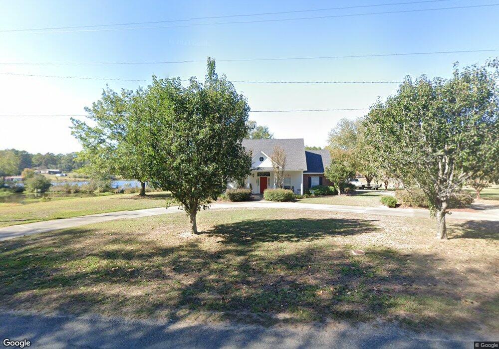
498 Jim Arrant Rd West Monroe, LA 71292
Estimated Value: $280,000 - $348,523
3
Beds
3
Baths
3,328
Sq Ft
$98/Sq Ft
Est. Value
About This Home
This home is located at 498 Jim Arrant Rd, West Monroe, LA 71292 and is currently estimated at $325,881, approximately $97 per square foot. 498 Jim Arrant Rd is a home located in Ouachita Parish with nearby schools including Woodlawn Elementary School, Woodlawn Middle School, and West Ouachita High School.
Ownership History
Date
Name
Owned For
Owner Type
Purchase Details
Closed on
Jun 20, 2012
Sold by
Thompson John Dale and Thompson Ruth Jones
Bought by
Billings Redmond Michael Shannon and Billings Redmond Rosemary Glidwell
Current Estimated Value
Purchase Details
Closed on
Sep 23, 2011
Sold by
Gibson Long Elizabeth Annette
Bought by
Thompson John Dale and Thompson Nelda Ruth
Home Financials for this Owner
Home Financials are based on the most recent Mortgage that was taken out on this home.
Original Mortgage
$251,000
Interest Rate
4.28%
Mortgage Type
VA
Create a Home Valuation Report for This Property
The Home Valuation Report is an in-depth analysis detailing your home's value as well as a comparison with similar homes in the area
Home Values in the Area
Average Home Value in this Area
Purchase History
| Date | Buyer | Sale Price | Title Company |
|---|---|---|---|
| Billings Redmond Michael Shannon | $250,000 | Fidelity Nationaltitle | |
| Thompson John Dale | $251,000 | None Available |
Source: Public Records
Mortgage History
| Date | Status | Borrower | Loan Amount |
|---|---|---|---|
| Previous Owner | Thompson John Dale | $251,000 |
Source: Public Records
Tax History Compared to Growth
Tax History
| Year | Tax Paid | Tax Assessment Tax Assessment Total Assessment is a certain percentage of the fair market value that is determined by local assessors to be the total taxable value of land and additions on the property. | Land | Improvement |
|---|---|---|---|---|
| 2024 | $1,618 | $25,100 | $4,016 | $21,084 |
| 2023 | $1,618 | $25,100 | $4,016 | $21,084 |
| 2022 | $2,227 | $25,100 | $4,016 | $21,084 |
| 2021 | $2,255 | $25,100 | $4,016 | $21,084 |
| 2020 | $2,255 | $25,100 | $4,016 | $21,084 |
| 2019 | $2,248 | $25,100 | $4,016 | $21,084 |
| 2018 | $1,576 | $25,100 | $4,016 | $21,084 |
| 2017 | $2,248 | $25,100 | $4,016 | $21,084 |
| 2016 | $2,247 | $25,100 | $4,016 | $21,084 |
| 2015 | $1,572 | $25,100 | $4,016 | $21,084 |
| 2014 | $1,572 | $25,100 | $4,016 | $21,084 |
| 2013 | $1,567 | $25,100 | $4,016 | $21,084 |
Source: Public Records
Map
Nearby Homes
- 329 Jim Arrant Rd
- 6347 Jonesboro Rd
- 243 Rebecca Dr
- 494 Lapine Rd
- 152 Jim Arrant Rd
- 160 Wainwright Ln Unit 1
- 219 Dogwood Cir
- 0 Chatham Ln
- 125 Chatham Ln
- 850 Lapine Rd
- 995 Larry Henry Rd
- 0 Ed Rutledge Rd Unit 215652
- 000 Jimmy Graham Loop
- 000 William Harris Rd Unit 1.365 Acres
- 0 Roberson Rd Unit 206166
- 0 Howard Brown Rd Unit 215550
- 300 Larry Henry Rd
- 203 Dick Tracy Dr
- 598 Howard Brown Rd
- 1066 Howard Brown Rd
- 494 Jim Arrant Rd
- 489 Jim Arrant Rd
- 480 Jim Arrant Rd
- 532 Jim Arrant Rd
- 482 Jim Arrant Rd
- 459 Jim Arrant Rd
- 458 Jim Arrant Rd
- 486 Jim Arrant Rd
- 451 Jim Arrant Rd
- 484 Jim Arrant Rd
- 436 Jim Arrant Rd
- 448 Jim Arrant Rd
- 437 Jim Arrant Rd
- 193 Isaac Burnett Rd
- 421 Jim Arrant Rd
- 1794 Highway 3033
- 411 Jim Arrant Rd
- 165 Isaac Burnett Rd
- 413 Jim Arrant Rd
- 620 Jim Arrant Rd