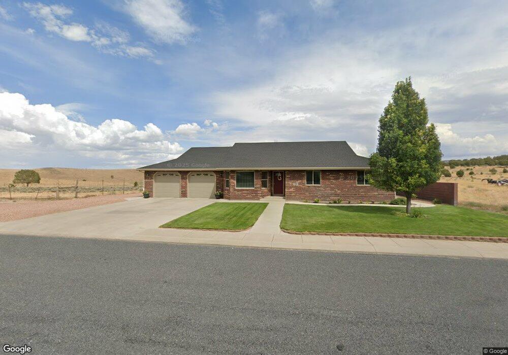
498 N 225 W Enterprise, UT 84725
Estimated Value: $604,000 - $794,000
6
Beds
4
Baths
2,047
Sq Ft
$335/Sq Ft
Est. Value
About This Home
This home is located at 498 N 225 W, Enterprise, UT 84725 and is currently estimated at $684,792, approximately $334 per square foot. 498 N 225 W is a home with nearby schools including Enterprise School and Enterprise High School.
Ownership History
Date
Name
Owned For
Owner Type
Purchase Details
Closed on
Jan 23, 2023
Sold by
Gardner Michael B
Bought by
Michael And Kari Gardner Trust
Current Estimated Value
Purchase Details
Closed on
May 15, 2008
Sold by
Desert Valley Development Inc
Bought by
Gardner Michael B and Gardner Kari S
Create a Home Valuation Report for This Property
The Home Valuation Report is an in-depth analysis detailing your home's value as well as a comparison with similar homes in the area
Purchase History
| Date | Buyer | Sale Price | Title Company |
|---|---|---|---|
| Michael And Kari Gardner Trust | -- | -- | |
| Gardner Michael B | -- | Southern Utah Title Co |
Source: Public Records
Tax History
| Year | Tax Paid | Tax Assessment Tax Assessment Total Assessment is a certain percentage of the fair market value that is determined by local assessors to be the total taxable value of land and additions on the property. | Land | Improvement |
|---|---|---|---|---|
| 2025 | $2,432 | $335,335 | $45,375 | $289,960 |
| 2023 | $2,315 | $327,745 | $45,375 | $282,370 |
| 2022 | $2,585 | $348,205 | $45,375 | $302,830 |
| 2021 | $2,230 | $440,700 | $49,500 | $391,200 |
| 2020 | $1,882 | $350,000 | $42,000 | $308,000 |
| 2019 | $1,888 | $340,700 | $36,000 | $304,700 |
| 2018 | $1,752 | $163,735 | $0 | $0 |
| 2017 | $1,606 | $144,155 | $0 | $0 |
| 2016 | $1,683 | $139,920 | $0 | $0 |
| 2015 | $1,722 | $138,105 | $0 | $0 |
| 2014 | $1,695 | $136,015 | $0 | $0 |
Source: Public Records
Map
Nearby Homes
- 232 W 475 N
- 453 N 300 W
- 328 W 475 N
- 319 N 200 W
- 177 W 350 N
- 130 W 100 South St
- 120 W 100 St S
- 81 S Center St
- 373 E 100 N
- 357 E Main St
- 400 E 100 N
- 242 S 200 St E
- 42 E 300 S
- 0 184 77 Acres Unit 25-265059
- 0 184 77 Acres Unit 113074
- 49 S 475 E Unit 6
- Financing Miningclaim Ownership
- Financing Miningclaim Ownership
- 260 E 300 S
- 0 1 01 Acre Parcel #E-Cwr-2-16 Unit 115712
Your Personal Tour Guide
Ask me questions while you tour the home.