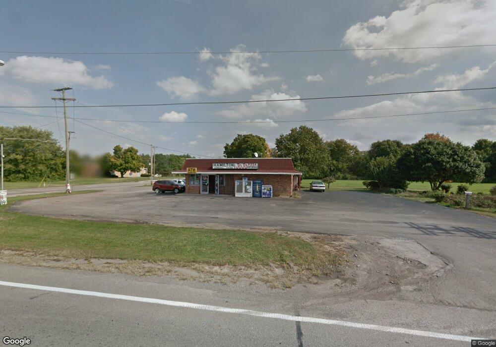
4980 Lockbourne Rd Lockbourne, OH 43137
Obetz-Lockbourne NeighborhoodEstimated Value: $463,412
Studio
--
Bath
1,520
Sq Ft
$305/Sq Ft
Est. Value
About This Home
This home is located at 4980 Lockbourne Rd, Lockbourne, OH 43137 and is currently estimated at $463,412, approximately $304 per square foot. 4980 Lockbourne Rd is a home located in Franklin County with nearby schools including Hamilton Elementary School, Hamilton Intermediate School, and Hamilton Middle School.
Ownership History
Date
Name
Owned For
Owner Type
Purchase Details
Closed on
Jul 29, 2021
Sold by
Evans J Michael and J Steven Evans Revocable Trust
Bought by
R & R Petroleum Llc
Current Estimated Value
Purchase Details
Closed on
May 20, 2018
Sold by
Evans Steven
Bought by
J Steven Evans Revocable Trust
Purchase Details
Closed on
Jun 26, 2017
Sold by
Evans J Steven and Evans Beve3rly G
Bought by
Evans J Steven
Purchase Details
Closed on
Aug 27, 2001
Sold by
Evans J Steven and Evans Beverly G
Bought by
Franklin County Commissioners
Create a Home Valuation Report for This Property
The Home Valuation Report is an in-depth analysis detailing your home's value as well as a comparison with similar homes in the area
Home Values in the Area
Average Home Value in this Area
Purchase History
| Date | Buyer | Sale Price | Title Company |
|---|---|---|---|
| R & R Petroleum Llc | $375,000 | Chicago Title West | |
| J Steven Evans Revocable Trust | -- | None Available | |
| Evans J Steven | -- | None Available | |
| Franklin County Commissioners | -- | -- |
Source: Public Records
Tax History
| Year | Tax Paid | Tax Assessment Tax Assessment Total Assessment is a certain percentage of the fair market value that is determined by local assessors to be the total taxable value of land and additions on the property. | Land | Improvement |
|---|---|---|---|---|
| 2025 | $3,633 | $42,180 | $16,000 | $26,180 |
| 2024 | $3,633 | $42,180 | $16,000 | $26,180 |
| 2023 | $2,646 | $42,175 | $15,995 | $26,180 |
| 2022 | $2,498 | $38,540 | $14,070 | $24,470 |
| 2021 | $2,554 | $38,540 | $14,070 | $24,470 |
| 2020 | $2,592 | $38,540 | $14,070 | $24,470 |
| 2019 | $2,557 | $35,010 | $12,780 | $22,230 |
| 2018 | $2,369 | $35,010 | $12,780 | $22,230 |
| 2017 | $2,425 | $35,010 | $12,780 | $22,230 |
| 2016 | $2,289 | $31,190 | $12,780 | $18,410 |
| 2015 | $2,235 | $31,190 | $12,780 | $18,410 |
| 2014 | $2,230 | $31,190 | $12,780 | $18,410 |
| 2013 | $1,097 | $31,185 | $12,775 | $18,410 |
Source: Public Records
Map
Nearby Homes
- 4926 Meadowbrook Dr
- 1291 Webb Dr Unit Lot 90
- 1307 Webb Dr Unit Lot 92
- 1315 Webb Dr Unit Lot 93
- 5076 Ranger Dr Unit Lot 100
- 908 Tecumseh Ave
- 863 Cherrydale Ave
- 1132 Ayrshire Dr
- 5220 Edgeview Rd
- 4410 Holstein Dr
- 4436 Wesley Trail
- 1962 Reese Ave
- 4412 Catamaran Dr
- 4455 Catamaran Dr
- 1987 Reese Ave
- 2027 Reese Ave
- 4344 Brett Ln
- 1187 Rendezvous Ln
- 1632 Marlboro Ave
- 4356 Monterey Ct
- 4918 Ranger Dr
- 2257 Rathmell Rd
- 4870 Lockbourne Rd
- 1260 Seward Dr
- 1451 Rathmell Rd
- 1495 Rathmell Rd
- 1340 Wilburn Blvd
- 1260 Seward Dr
- 1500 Rathmell Rd
- 4934 Ranger Dr
- 4934 Ranger Dr Unit Lot 4
- 4942 Ranger Dr
- 4942 Ranger Dr Unit Lot 5
- 1291 Andean Dr
- 4980 Ranger Dr
- 4928 Faron St Unit Lot 17
- 4921 Andean Dr Unit Lot 23
- 4920 Andean Dr Unit Lot 30
- 4937 Faron St Unit Lot 11
- 4950 Ranger Dr Unit Lot 6
Your Personal Tour Guide
Ask me questions while you tour the home.