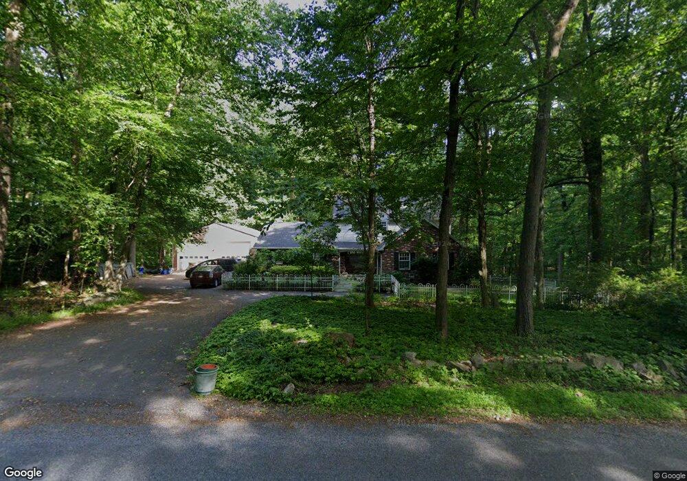
4980 S Mountain Dr Emmaus, PA 18049
Upper Milford Township NeighborhoodEstimated Value: $496,761 - $620,000
4
Beds
3
Baths
2,486
Sq Ft
$230/Sq Ft
Est. Value
About This Home
This home is located at 4980 S Mountain Dr, Emmaus, PA 18049 and is currently estimated at $571,440, approximately $229 per square foot. 4980 S Mountain Dr is a home located in Lehigh County with nearby schools including Lincoln Elementary School, Lower Macungie Middle School, and Emmaus High School.
Ownership History
Date
Name
Owned For
Owner Type
Purchase Details
Closed on
Dec 30, 1998
Sold by
Erskine Kenneth J and Erskine Sheila A
Bought by
Horn Thomas J and Horn Jennifer
Current Estimated Value
Purchase Details
Closed on
Nov 7, 1994
Sold by
Christensen Kim P and Christensen Susan L
Bought by
Erskine Kenneth J and Erskine Sheila A
Purchase Details
Closed on
Nov 7, 1990
Sold by
Baker Iii Henry D and Baker Kathy J
Bought by
Christensen Kim P and Christensen Susan L
Purchase Details
Closed on
Jul 24, 1985
Sold by
Bartholomew Frederick E and Bartholomew Sandra A
Bought by
Baker Henry D and Baker Kathy J
Purchase Details
Closed on
Nov 16, 1977
Bought by
Bartholomew Frederick E and Bartholomew Sandra A
Create a Home Valuation Report for This Property
The Home Valuation Report is an in-depth analysis detailing your home's value as well as a comparison with similar homes in the area
Home Values in the Area
Average Home Value in this Area
Purchase History
| Date | Buyer | Sale Price | Title Company |
|---|---|---|---|
| Horn Thomas J | $212,500 | -- | |
| Erskine Kenneth J | $185,000 | -- | |
| Christensen Kim P | $178,000 | -- | |
| Baker Henry D | $137,000 | -- | |
| Bartholomew Frederick E | $13,900 | -- |
Source: Public Records
Tax History Compared to Growth
Tax History
| Year | Tax Paid | Tax Assessment Tax Assessment Total Assessment is a certain percentage of the fair market value that is determined by local assessors to be the total taxable value of land and additions on the property. | Land | Improvement |
|---|---|---|---|---|
| 2025 | $6,977 | $273,300 | $69,700 | $203,600 |
| 2024 | $6,669 | $273,300 | $69,700 | $203,600 |
| 2023 | $6,534 | $273,300 | $69,700 | $203,600 |
| 2022 | $6,377 | $273,300 | $203,600 | $69,700 |
| 2021 | $6,240 | $273,300 | $69,700 | $203,600 |
| 2020 | $6,180 | $273,300 | $69,700 | $203,600 |
| 2019 | $6,141 | $273,300 | $69,700 | $203,600 |
| 2018 | $5,984 | $273,300 | $69,700 | $203,600 |
| 2017 | $5,878 | $273,300 | $69,700 | $203,600 |
| 2016 | -- | $273,300 | $69,700 | $203,600 |
| 2015 | -- | $273,300 | $69,700 | $203,600 |
| 2014 | -- | $273,300 | $69,700 | $203,600 |
Source: Public Records
Map
Nearby Homes
- 97 Chestnut Hill Rd
- 521 Wood St
- 339 Delong Ave Unit 343
- 2571 Brunner Rd
- 618 Broad St
- 659 Broad St
- 569 Chestnut St Unit 571
- 657 Walnut St
- 5031 Hunter Ln
- 543 Long St
- 4285 Taviston Ct E
- 4290 Taviston Ct E
- 4109 Eveningstar Rd
- 3430 Gentlewind Way Unit IC 109
- 4160 Newport Dr
- 4314 Taviston Ct E
- 4338 Taviston Ct E Unit Homesite 26
- 120 N 2nd St
- 5065 Maple Ridge Way
- 118 N 2nd St
- 5032 S Mountain Dr
- 5232 S Mountain Dr
- 4981 S Mountain Dr
- 5080 S Mountain Dr
- 5043 S Mountain Dr
- 5075 S Mountain Dr
- 4951 S Mountain Dr
- 5111 S Mountain Dr
- 5025 S Mountain Dr
- 4886 S Mountain Dr
- 4894 S Mountain Dr
- 4811 S Mountain Dr
- 4862 S Mountain Dr
- 5173 S Mountain Dr
- 5186 S Mountain Dr
- 5162 S Mountain Dr
- 4826 S Mountain Dr
- 4892 S Mountain Dr
- 5221 S Mountain Dr
- 5208 S Mountain Dr