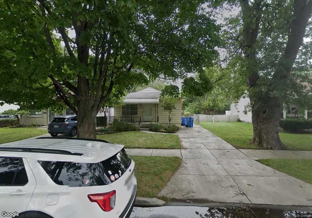
4981 Hipp St Dearborn Heights, MI 48125
Estimated Value: $143,000 - $172,000
3
Beds
1
Bath
940
Sq Ft
$163/Sq Ft
Est. Value
About This Home
This home is located at 4981 Hipp St, Dearborn Heights, MI 48125 and is currently estimated at $153,097, approximately $162 per square foot. 4981 Hipp St is a home located in Wayne County with nearby schools including Polk Elementary School, Bedford School, and Pardee School.
Ownership History
Date
Name
Owned For
Owner Type
Purchase Details
Closed on
May 22, 2009
Sold by
Mcleod Paula A and Mclead Paula A
Bought by
Mcleod Paula A
Current Estimated Value
Purchase Details
Closed on
Aug 22, 2008
Sold by
Us Bank Na
Bought by
Mclead Paula A
Purchase Details
Closed on
Oct 3, 2007
Sold by
Schroder Robert
Bought by
Us Bank Na and Structured Asset Securities Corp Mortgag
Purchase Details
Closed on
Jul 19, 2005
Sold by
Pigott Laura
Bought by
Schroder Robert
Purchase Details
Closed on
Jul 29, 1996
Sold by
Bora Kenneth and Bora Laura
Bought by
Kloss Melvin A and Kloss Gertrude
Create a Home Valuation Report for This Property
The Home Valuation Report is an in-depth analysis detailing your home's value as well as a comparison with similar homes in the area
Home Values in the Area
Average Home Value in this Area
Purchase History
| Date | Buyer | Sale Price | Title Company |
|---|---|---|---|
| Mcleod Paula A | -- | None Available | |
| Mclead Paula A | $25,501 | Attorneys Title Agency Llc | |
| Us Bank Na | $116,880 | None Available | |
| Schroder Robert | $115,000 | Commonwealth Land Title | |
| Kloss Melvin A | $79,000 | -- |
Source: Public Records
Tax History Compared to Growth
Tax History
| Year | Tax Paid | Tax Assessment Tax Assessment Total Assessment is a certain percentage of the fair market value that is determined by local assessors to be the total taxable value of land and additions on the property. | Land | Improvement |
|---|---|---|---|---|
| 2025 | $1,185 | $64,100 | $0 | $0 |
| 2024 | $1,185 | $57,700 | $0 | $0 |
| 2023 | $1,119 | $50,900 | $0 | $0 |
| 2022 | $1,557 | $43,700 | $0 | $0 |
| 2021 | $1,556 | $37,500 | $0 | $0 |
| 2019 | $1,510 | $32,600 | $0 | $0 |
| 2018 | $1,015 | $28,000 | $0 | $0 |
| 2017 | $915 | $27,100 | $0 | $0 |
| 2016 | $1,438 | $26,900 | $0 | $0 |
| 2015 | $2,570 | $25,700 | $0 | $0 |
| 2013 | $2,620 | $27,400 | $0 | $0 |
| 2010 | -- | $34,500 | $0 | $0 |
Source: Public Records
Map
Nearby Homes
- 20425 Powers Ave
- 5381 Merrick St
- 5455 Mayfair St
- 5648 Hipp St
- 4679 Mayfair St
- 5621 Merrick St
- 5660 Hipp St
- 5642 Weddel St
- 4641 Weddell St
- 5709 Weddell St
- 4705 Jackson St
- 4924 Ziegler St
- 4455 Hipp St
- 4476 Weddel St
- 4913 Campbell St
- 4644 Gertrude St
- 20001 Annapolis St
- 5873 Merrick St
- 4630 Pelham St
- 21302 Powers Ave
- 4973 Hipp St
- 4995 Hipp St
- 4965 Hipp St
- 4957 Hipp St
- 4972 Huron St
- 4949 Hipp St
- 4994 Huron St
- 20540 Powers Ave
- 4964 Huron St
- 20550 Powers Ave Unit Bldg-Unit
- 20550 Powers Ave
- 20532 Powers Ave
- 20524 Powers Ave Unit Bldg-Unit
- 20524 Powers Ave
- 4956 Huron St
- 4994 Hipp St
- 4972 Hipp St
- 4941 Hipp St
- 4964 Hipp St
- 4948 Huron St