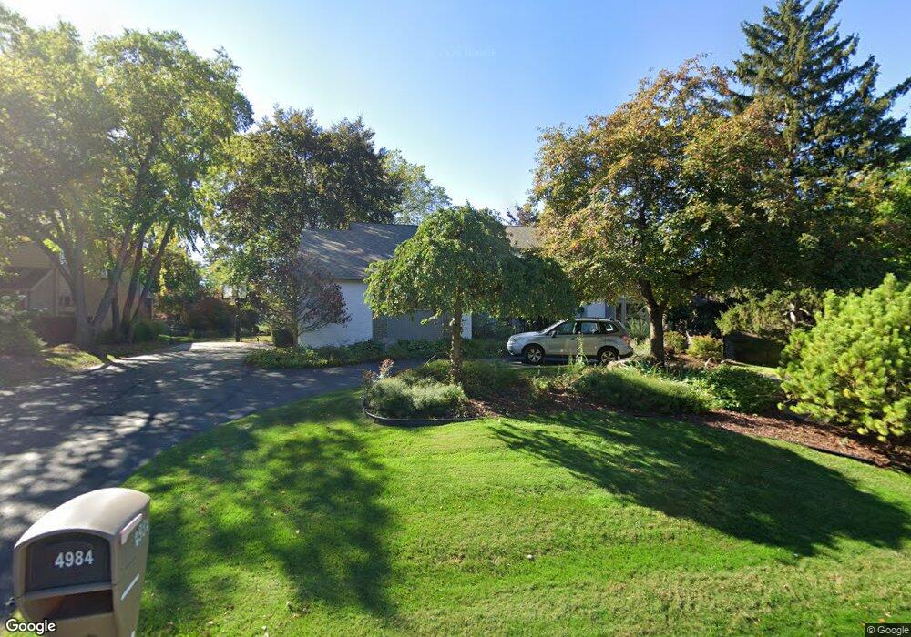
4984 Champlain Cir West Bloomfield, MI 48323
Estimated Value: $659,000 - $828,000
4
Beds
3
Baths
3,716
Sq Ft
$206/Sq Ft
Est. Value
About This Home
This home is located at 4984 Champlain Cir, West Bloomfield, MI 48323 and is currently estimated at $764,062, approximately $205 per square foot. 4984 Champlain Cir is a home located in Oakland County with nearby schools including West Hills Middle School, Bloomfield Hills High School, and Brookfield Academy - West Bloomfield Campus.
Ownership History
Date
Name
Owned For
Owner Type
Purchase Details
Closed on
Oct 2, 2020
Sold by
Singer Michael David
Bought by
Singer Michael David and Singer Bonnie Laker
Current Estimated Value
Home Financials for this Owner
Home Financials are based on the most recent Mortgage that was taken out on this home.
Original Mortgage
$400,000
Outstanding Balance
$355,130
Interest Rate
2.8%
Mortgage Type
New Conventional
Estimated Equity
$408,932
Purchase Details
Closed on
May 1, 2002
Sold by
Singer Franci J
Bought by
Singer Michael D
Purchase Details
Closed on
Jun 30, 1997
Sold by
Katz Uri
Bought by
Singer Michael
Home Financials for this Owner
Home Financials are based on the most recent Mortgage that was taken out on this home.
Original Mortgage
$420,000
Interest Rate
7.94%
Create a Home Valuation Report for This Property
The Home Valuation Report is an in-depth analysis detailing your home's value as well as a comparison with similar homes in the area
Home Values in the Area
Average Home Value in this Area
Purchase History
| Date | Buyer | Sale Price | Title Company |
|---|---|---|---|
| Singer Michael David | -- | None Available | |
| Singer Michael David | -- | None Listed On Document | |
| Singer Michael D | -- | -- | |
| Singer Michael | -- | -- |
Source: Public Records
Mortgage History
| Date | Status | Borrower | Loan Amount |
|---|---|---|---|
| Open | Singer Michael David | $400,000 | |
| Closed | Singer Michael David | $400,000 | |
| Previous Owner | Singer Michael | $420,000 |
Source: Public Records
Tax History Compared to Growth
Tax History
| Year | Tax Paid | Tax Assessment Tax Assessment Total Assessment is a certain percentage of the fair market value that is determined by local assessors to be the total taxable value of land and additions on the property. | Land | Improvement |
|---|---|---|---|---|
| 2024 | $4,790 | $302,330 | $0 | $0 |
| 2022 | $4,635 | $282,240 | $30,000 | $252,240 |
| 2021 | $8,547 | $265,550 | $0 | $0 |
| 2020 | $4,239 | $267,170 | $30,000 | $237,170 |
| 2018 | $8,034 | $240,670 | $26,000 | $214,670 |
| 2015 | -- | $219,890 | $0 | $0 |
| 2014 | -- | $204,320 | $0 | $0 |
| 2011 | -- | $195,040 | $0 | $0 |
Source: Public Records
Map
Nearby Homes
- 4670 Cove Rd
- 4710 Cove Rd
- 3075 Bloomfield Park Dr
- 4641 Cove Rd
- 4941 Fairway Ridge Cir
- 3142 Bloomfield Shore Dr
- 4724 Tara Ct
- 3367 Lone Pine Rd
- 5321 Fairway Ln Unit 7
- 5415 Fairway Ln
- 4768 Wendrick Dr
- 4568 Rolling Ridge Rd
- 2433 Wickfield Rd
- 2460 Turner St
- 3440 Lone Pine Rd
- 3104 Spring St
- 4274 Wendell Rd
- 5622 Powder Horn Dr
- 0 Wendell Rd Unit 20250033815
- 4427 Westover Dr
- 4996 Champlain Cir
- 4972 Champlain Cir
- 5008 Champlain Cir
- 5025 Oakbrooke Dr
- 5020 Oakbrooke Dr
- 4983 Champlain Cir
- 5015 Oakbrooke Dr
- 4960 Champlain Cir
- 5021 Champlain Cir
- 5005 Oakbrooke Dr
- 4951 Champlain Cir
- 5030 Oakbrooke Dr Unit Bldg-Unit
- 5030 Oakbrooke Dr
- 5030 Oakbrooke Dr Unit 22
- 5020 Champlain Cir
- 4995 Oakbrooke Dr
- 5045 Oakbrooke Dr
- 4948 Champlain Cir
- 5045 Champlain Cir
- 5034 Champlain Cir