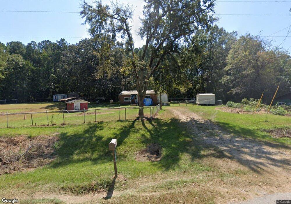
4986 Hollingsworth Ferry Rd Franklin, GA 30217
Estimated Value: $94,188 - $418,000
2
Beds
1
Bath
1,108
Sq Ft
$246/Sq Ft
Est. Value
About This Home
This home is located at 4986 Hollingsworth Ferry Rd, Franklin, GA 30217 and is currently estimated at $272,797, approximately $246 per square foot. 4986 Hollingsworth Ferry Rd is a home located in Heard County with nearby schools including Heard County High School.
Ownership History
Date
Name
Owned For
Owner Type
Purchase Details
Closed on
Jan 27, 1997
Sold by
Kirk Steven A
Bought by
Kirk Steven A
Current Estimated Value
Purchase Details
Closed on
Jan 8, 1997
Sold by
Carrollton Federal B
Bought by
Kirk Steven A
Purchase Details
Closed on
Nov 14, 1996
Sold by
Brown Hugh M
Bought by
Carrollton Federal B
Purchase Details
Closed on
Jun 23, 1995
Sold by
Hurston Elmon D
Bought by
Brown Hugh M
Purchase Details
Closed on
Nov 1, 1985
Sold by
Yarbrough Lewis Etal
Bought by
Hurston Elmon D
Create a Home Valuation Report for This Property
The Home Valuation Report is an in-depth analysis detailing your home's value as well as a comparison with similar homes in the area
Home Values in the Area
Average Home Value in this Area
Purchase History
| Date | Buyer | Sale Price | Title Company |
|---|---|---|---|
| Kirk Steven A | -- | -- | |
| Kirk Steven A | $17,700 | -- | |
| Carrollton Federal B | -- | -- | |
| Brown Hugh M | $15,000 | -- | |
| Hurston Elmon D | $13,000 | -- |
Source: Public Records
Tax History Compared to Growth
Tax History
| Year | Tax Paid | Tax Assessment Tax Assessment Total Assessment is a certain percentage of the fair market value that is determined by local assessors to be the total taxable value of land and additions on the property. | Land | Improvement |
|---|---|---|---|---|
| 2024 | $424 | $23,048 | $2,646 | $20,402 |
| 2023 | $339 | $18,228 | $2,205 | $16,023 |
| 2022 | $305 | $16,616 | $1,469 | $15,147 |
| 2021 | $237 | $12,808 | $1,469 | $11,339 |
| 2020 | $244 | $13,006 | $1,469 | $11,537 |
| 2019 | $244 | $13,006 | $1,469 | $11,537 |
| 2018 | $294 | $13,006 | $1,469 | $11,537 |
| 2017 | $212 | $11,371 | $1,205 | $10,166 |
| 2016 | $212 | $11,371 | $1,205 | $10,166 |
| 2015 | -- | $11,177 | $2,272 | $8,905 |
| 2014 | -- | $11,181 | $2,272 | $8,909 |
| 2013 | -- | $14,302 | $2,272 | $12,030 |
Source: Public Records
Map
Nearby Homes
- 0 S Bridge Rd Unit 10615531
- 4230 Joe Stephens Rd
- 0 Newman Rd Unit 10559645
- 323 Newman Rd
- 1255 S Bridge Rd
- 262 Jackson Shoals Rd
- 2100 Star Point Rd
- 2201 Star Point Rd
- 1238 Goshen Church Rd
- 2018 Star Point Rd
- 260 Ancient Oak Ln
- 1074 Glenloch Rd
- 1921 Star Point Rd
- 0 Joe Cook Rd Unit 4 10550489
- 0 Joe Cook Rd Unit 3 10550484
- 192 Hawk Rd
- 1001 Glenloch Rd
- 0 Knight Dr
- 484 Lepard Rd
- 4944 Hollingsworth Ferry Rd
- 5040 Hollingsworth Ferry Rd
- 50 Webb Rd
- 201 Webb Rd
- 5120 Hollingsworth Ferry Rd
- 0 Webb Rd
- 231 Webb Rd
- 4848 Hollingsworth Ferry Rd
- 240 Webb Rd
- 4810 Hollingsworth Ferry Rd
- 4704 Hollingsworth Ferry Rd
- 288 Webb Rd
- 7240 Five Notch Rd
- 4430 Hollingsworth Ferry Rd
- 6990 Five Notch Rd
- 2935 Ferry Rd
- 0 Ferry Rd Unit 8322593
- 0 Ferry Rd Unit 8322553
- 0 Ferry Rd Unit 7075322
- 0 Ferry Rd Unit 3241206