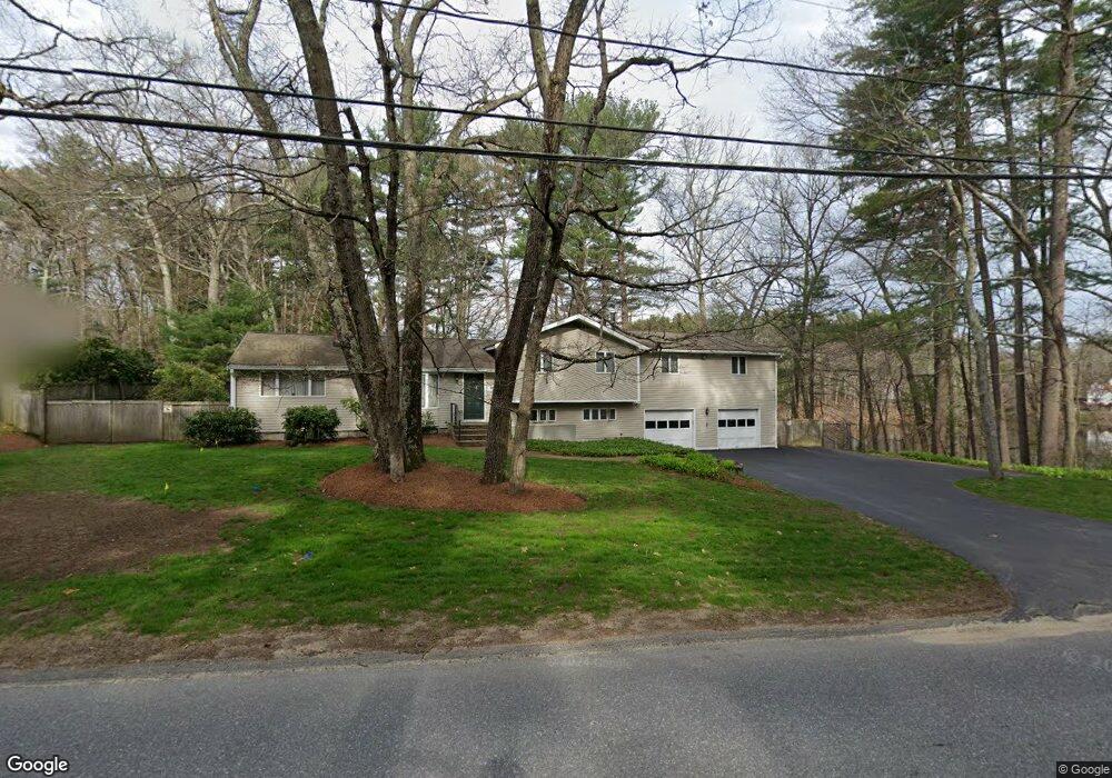
499 Dutton Rd Sudbury, MA 01776
Estimated Value: $971,000 - $1,053,000
4
Beds
3
Baths
2,798
Sq Ft
$358/Sq Ft
Est. Value
About This Home
This home is located at 499 Dutton Rd, Sudbury, MA 01776 and is currently estimated at $1,001,757, approximately $358 per square foot. 499 Dutton Rd is a home located in Middlesex County with nearby schools including Peter Noyes Elementary School, Ephraim Curtis Middle School, and Lincoln-Sudbury Regional High School.
Ownership History
Date
Name
Owned For
Owner Type
Purchase Details
Closed on
Nov 14, 2011
Sold by
Wong Albert Yc and Wong How-Ching Fc
Bought by
Acharya Ajit P and Chhibber Kavita
Current Estimated Value
Home Financials for this Owner
Home Financials are based on the most recent Mortgage that was taken out on this home.
Original Mortgage
$392,000
Outstanding Balance
$267,177
Interest Rate
4.01%
Mortgage Type
Purchase Money Mortgage
Estimated Equity
$734,580
Create a Home Valuation Report for This Property
The Home Valuation Report is an in-depth analysis detailing your home's value as well as a comparison with similar homes in the area
Home Values in the Area
Average Home Value in this Area
Purchase History
| Date | Buyer | Sale Price | Title Company |
|---|---|---|---|
| Acharya Ajit P | $490,000 | -- | |
| Acharya Ajit P | $490,000 | -- |
Source: Public Records
Mortgage History
| Date | Status | Borrower | Loan Amount |
|---|---|---|---|
| Open | Acharya Ajit P | $392,000 | |
| Closed | Acharya Ajit P | $392,000 | |
| Previous Owner | Acharya Ajit P | $161,000 | |
| Previous Owner | Acharya Ajit P | $92,000 |
Source: Public Records
Tax History
| Year | Tax Paid | Tax Assessment Tax Assessment Total Assessment is a certain percentage of the fair market value that is determined by local assessors to be the total taxable value of land and additions on the property. | Land | Improvement |
|---|---|---|---|---|
| 2025 | $12,274 | $838,400 | $403,600 | $434,800 |
| 2024 | $11,856 | $811,500 | $391,800 | $419,700 |
| 2023 | $11,681 | $740,700 | $356,100 | $384,600 |
| 2022 | $11,077 | $613,700 | $326,800 | $286,900 |
| 2021 | $10,601 | $563,000 | $326,800 | $236,200 |
| 2020 | $10,387 | $563,000 | $326,800 | $236,200 |
| 2019 | $10,083 | $563,000 | $326,800 | $236,200 |
| 2018 | $9,460 | $527,600 | $330,600 | $197,000 |
| 2017 | $8,913 | $502,400 | $319,200 | $183,200 |
| 2016 | $8,685 | $487,900 | $307,000 | $180,900 |
Source: Public Records
Map
Nearby Homes
- 557 Dutton Rd Unit 2
- 53 Pine St
- 15 Harness Ln
- 30 Harness Ln
- 30 Kendall Rd
- 11 Great Lake Dr
- 11 October Rd
- 62 Churchill St
- 45 Webster Cir
- 30 Rolling Ln
- 15 Huckleberry Ln
- 22 Barracks Rd Unit 22
- 55 Widow Rites Ln
- 45 Widow Rites Ln
- 0 Robbins Rd
- 111 Willis Rd
- 123 Dutton Rd
- 0 Boston Post Rd
- 725 Boston Post Rd Unit 12
- 11 Farmstead Ln Unit 11
- 493 Dutton Rd
- 506 Dutton Rd
- 489 Dutton Rd
- 215 Pratts Mill Rd
- 212 Pratts Mill Rd Lot 1
- 212 Pratts Mill Rd
- 210 Pratts Mill Rd
- 486 Dutton Rd
- 481 Dutton Rd
- 211 Pratts Mill Rd
- 480 Dutton Rd
- 207 Pratts Mill Rd
- 516 Dutton Rd
- 47 Raynor Rd
- 8 Barton Dr
- 12 Magnolia Rd
- 20 Barton Dr
- 474 Dutton Rd
- 202 Pratts Mill Rd
- 29 Oakhill Rd
Your Personal Tour Guide
Ask me questions while you tour the home.