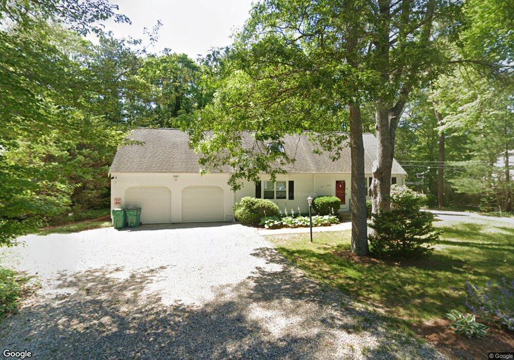
499 Skunknet Rd Centerville, MA 2632
Centerville NeighborhoodEstimated Value: $678,000 - $703,000
4
Beds
4
Baths
2,062
Sq Ft
$333/Sq Ft
Est. Value
About This Home
This home is located at 499 Skunknet Rd, Centerville, MA 2632 and is currently estimated at $687,521, approximately $333 per square foot. 499 Skunknet Rd is a home located in Barnstable County with nearby schools including West Villages Elementary School, Barnstable United Elementary School, and Barnstable Intermediate School.
Ownership History
Date
Name
Owned For
Owner Type
Purchase Details
Closed on
Dec 28, 2020
Sold by
Cape Abilities Inc
Bought by
Genosa Merilyn C and Genosa Edgar
Current Estimated Value
Home Financials for this Owner
Home Financials are based on the most recent Mortgage that was taken out on this home.
Original Mortgage
$390,000
Outstanding Balance
$348,015
Interest Rate
2.7%
Mortgage Type
New Conventional
Estimated Equity
$339,506
Purchase Details
Closed on
May 1, 2002
Sold by
Dwyer Daniel A and Dwyer Debra A
Bought by
Nauset Inc
Home Financials for this Owner
Home Financials are based on the most recent Mortgage that was taken out on this home.
Original Mortgage
$223,920
Interest Rate
7.13%
Mortgage Type
Commercial
Purchase Details
Closed on
Apr 25, 1997
Sold by
Walker Donna Doane Est
Bought by
Dwyer Daniel A
Home Financials for this Owner
Home Financials are based on the most recent Mortgage that was taken out on this home.
Original Mortgage
$70,000
Interest Rate
7.77%
Mortgage Type
Commercial
Create a Home Valuation Report for This Property
The Home Valuation Report is an in-depth analysis detailing your home's value as well as a comparison with similar homes in the area
Home Values in the Area
Average Home Value in this Area
Purchase History
| Date | Buyer | Sale Price | Title Company |
|---|---|---|---|
| Genosa Merilyn C | $435,000 | None Available | |
| Nauset Inc | $279,900 | -- | |
| Dwyer Daniel A | $88,000 | -- |
Source: Public Records
Mortgage History
| Date | Status | Borrower | Loan Amount |
|---|---|---|---|
| Open | Genosa Merilyn C | $390,000 | |
| Previous Owner | Dwyer Daniel A | $223,920 | |
| Previous Owner | Dwyer Daniel A | $140,000 | |
| Previous Owner | Dwyer Daniel A | $92,000 | |
| Previous Owner | Dwyer Daniel A | $70,000 |
Source: Public Records
Tax History Compared to Growth
Tax History
| Year | Tax Paid | Tax Assessment Tax Assessment Total Assessment is a certain percentage of the fair market value that is determined by local assessors to be the total taxable value of land and additions on the property. | Land | Improvement |
|---|---|---|---|---|
| 2025 | $5,055 | $624,900 | $157,200 | $467,700 |
| 2024 | $4,641 | $594,300 | $157,200 | $437,100 |
| 2023 | $4,461 | $534,900 | $142,900 | $392,000 |
| 2022 | $4,187 | $434,300 | $105,800 | $328,500 |
| 2021 | $0 | $388,900 | $105,800 | $283,100 |
| 2020 | $0 | $382,100 | $111,400 | $270,700 |
| 2019 | $0 | $354,600 | $111,400 | $243,200 |
| 2018 | $0 | $320,300 | $111,400 | $208,900 |
| 2017 | -- | $309,600 | $111,400 | $198,200 |
| 2016 | -- | $307,600 | $112,500 | $195,100 |
| 2015 | -- | $306,500 | $110,300 | $196,200 |
Source: Public Records
Map
Nearby Homes
- 16 Bridgets Path
- 21 Shannon Way
- 81 Monomoy Cir
- 315 Prince Hinckley Rd
- 296 Buckskin Path
- 53 Meadow Farm Rd
- 52 Meadow Farm Rd
- 149 Old Stage Rd
- 7 Ebenezer
- 44 Avalon Cir
- 90 Guildford Rd
- 82 Yacht Club Rd
- 900 Old Stage Rd
- 139 Falling Leaf Ln
- 87 Foxglove Rd
- 198 Great Marsh Rd
- 81 Falling Leaf Ln
- 1028 Old Falmouth Rd
- 1044 Old Falmouth Rd
- 40 Sachem Dr
- 499 Skunknet Rd
- 249 Ames Way
- 492 Skunknet Rd
- 25 Bridget's Path
- 261 Ames Way
- 502 Skunknet Rd
- 480 Skunknet Rd
- 201 Taramac Rd
- 7 Bridgets Path
- 271 Ames Way
- 24 Bridgets Path
- 472 Skunknet Rd
- 45 Bridget's Path
- 25 Bridgets Path
- 516 Skunknet Rd
- 191 Taramac Rd
- 178 Taramac Rd
- 498 Skunknet Rd
- 254 Ames Way
- 179 Taramac Rd