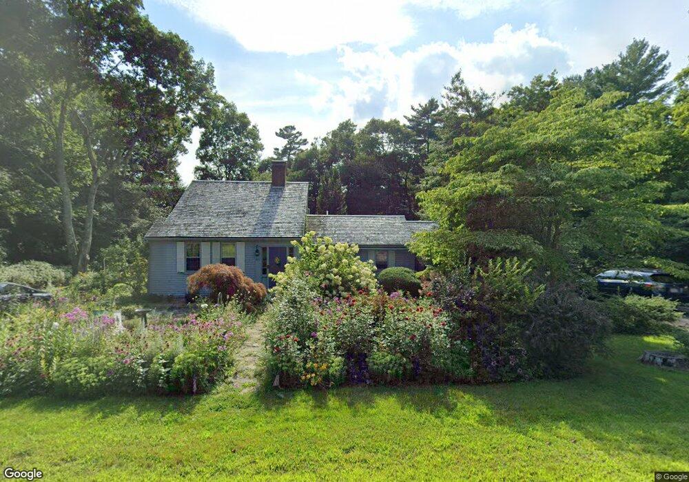
499 State St Hanson, MA 02341
Estimated Value: $580,765 - $682,000
3
Beds
2
Baths
1,762
Sq Ft
$354/Sq Ft
Est. Value
About This Home
This home is located at 499 State St, Hanson, MA 02341 and is currently estimated at $624,441, approximately $354 per square foot. 499 State St is a home located in Plymouth County with nearby schools including Cadence Academy Preschool - Hanover and Cardinal Cushing Centers.
Ownership History
Date
Name
Owned For
Owner Type
Purchase Details
Closed on
Sep 18, 2008
Sold by
Webster John C and Webster Susan K
Bought by
Webster Susan K
Current Estimated Value
Home Financials for this Owner
Home Financials are based on the most recent Mortgage that was taken out on this home.
Original Mortgage
$510,000
Outstanding Balance
$333,954
Interest Rate
6.54%
Mortgage Type
Purchase Money Mortgage
Estimated Equity
$290,487
Create a Home Valuation Report for This Property
The Home Valuation Report is an in-depth analysis detailing your home's value as well as a comparison with similar homes in the area
Home Values in the Area
Average Home Value in this Area
Purchase History
| Date | Buyer | Sale Price | Title Company |
|---|---|---|---|
| Webster Susan K | -- | -- |
Source: Public Records
Mortgage History
| Date | Status | Borrower | Loan Amount |
|---|---|---|---|
| Open | Webster Susan K | $510,000 | |
| Previous Owner | Webster Susan K | $50,000 |
Source: Public Records
Tax History
| Year | Tax Paid | Tax Assessment Tax Assessment Total Assessment is a certain percentage of the fair market value that is determined by local assessors to be the total taxable value of land and additions on the property. | Land | Improvement |
|---|---|---|---|---|
| 2025 | $6,136 | $458,600 | $192,200 | $266,400 |
| 2024 | $5,958 | $445,300 | $186,600 | $258,700 |
| 2023 | $6,129 | $432,200 | $186,600 | $245,600 |
| 2022 | $5,933 | $393,200 | $169,800 | $223,400 |
| 2021 | $5,311 | $351,700 | $163,300 | $188,400 |
| 2020 | $5,189 | $339,800 | $157,700 | $182,100 |
| 2019 | $4,976 | $320,400 | $154,700 | $165,700 |
| 2018 | $4,328 | $273,400 | $148,700 | $124,700 |
| 2017 | $4,201 | $262,900 | $141,700 | $121,200 |
| 2016 | $4,301 | $259,900 | $141,600 | $118,300 |
| 2015 | $4,101 | $257,600 | $141,600 | $116,000 |
Source: Public Records
Map
Nearby Homes
- 339 State St
- 430 Brook Bend Rd
- 114 Graham Hill Dr
- 108 Waterford Dr
- 51 Farmside Dr
- 139 Fairwood Dr
- 7 Farmside Dr
- 285 W Elm St
- 35 Sproul Rd
- 51 Cervelli Farm Dr
- 37 Dr
- 23 Cervelli Farm Dr
- 38 Cervelli Farm Dr
- 9 Cervelli Farm Dr
- 60 Summer Path Way
- 250 Center St
- 95 Tecumseh Dr
- 26 Stonebridge Dr
- 36 Grove St
- 127 Crescent Place
- 517 State St
- 1087 E Washington St
- 498 State St
- 525 State St
- 508 State St
- 1077 E Washington St
- 531 State St
- 520 State St
- 474 State St
- 539 State St
- 1063 E Washington St
- 1114 E Washington St
- 1098 E Washington St
- 1099 E Washington St
- 1084 E Washington St
- 1053 E Washington St
- 548 State St
- 548 State St Unit 2
- 458 State St
- 1064 E Washington St
Your Personal Tour Guide
Ask me questions while you tour the home.