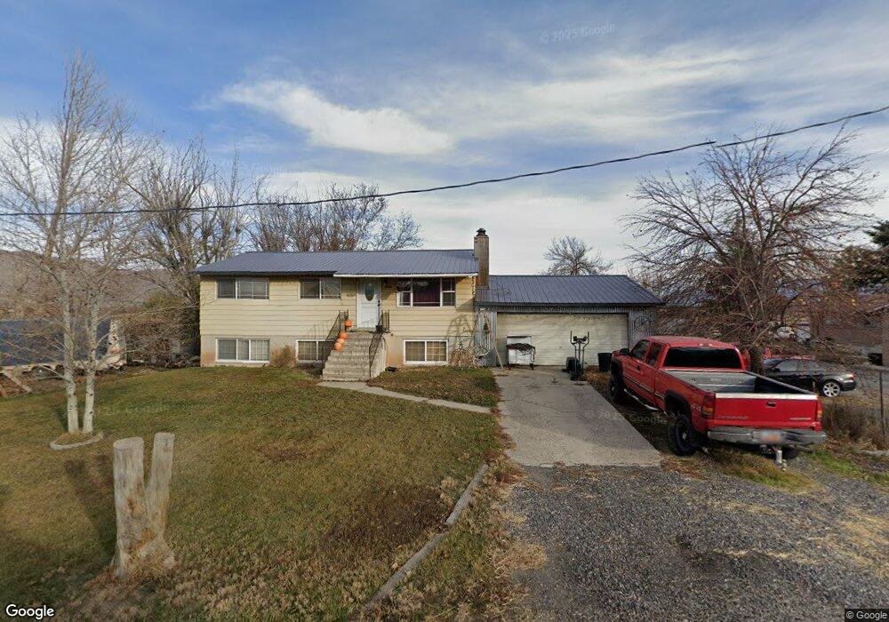
4992 W 11950 S Payson, UT 84651
Estimated Value: $619,138 - $954,000
3
Beds
2
Baths
1,872
Sq Ft
$403/Sq Ft
Est. Value
About This Home
This home is located at 4992 W 11950 S, Payson, UT 84651 and is currently estimated at $754,713, approximately $403 per square foot. 4992 W 11950 S is a home located in Utah County with nearby schools including Taylor Elementary School, Mt. Nebo Junior High School, and Salem Junior High School.
Ownership History
Date
Name
Owned For
Owner Type
Purchase Details
Closed on
Nov 24, 2020
Sold by
Crawford Donna
Bought by
Crawford Donna
Current Estimated Value
Purchase Details
Closed on
May 14, 2013
Sold by
Spencer Judeph C
Bought by
Crawford Donna
Home Financials for this Owner
Home Financials are based on the most recent Mortgage that was taken out on this home.
Original Mortgage
$19,416
Outstanding Balance
$13,696
Interest Rate
3.38%
Mortgage Type
Purchase Money Mortgage
Estimated Equity
$741,017
Purchase Details
Closed on
Feb 14, 2007
Sold by
Spencer Judeth C
Bought by
Spencer Judeth C
Home Financials for this Owner
Home Financials are based on the most recent Mortgage that was taken out on this home.
Original Mortgage
$95,000
Interest Rate
6.19%
Mortgage Type
New Conventional
Create a Home Valuation Report for This Property
The Home Valuation Report is an in-depth analysis detailing your home's value as well as a comparison with similar homes in the area
Home Values in the Area
Average Home Value in this Area
Purchase History
| Date | Buyer | Sale Price | Title Company |
|---|---|---|---|
| Crawford Donna | -- | Truly Title Inc | |
| Crawford Donna | -- | Bartlett Title Insurance Age | |
| Spencer Judeth C | -- | Eagle Pointe Title Insuranc |
Source: Public Records
Mortgage History
| Date | Status | Borrower | Loan Amount |
|---|---|---|---|
| Open | Crawford Donna | $19,416 | |
| Previous Owner | Spencer Judeth C | $95,000 |
Source: Public Records
Tax History Compared to Growth
Tax History
| Year | Tax Paid | Tax Assessment Tax Assessment Total Assessment is a certain percentage of the fair market value that is determined by local assessors to be the total taxable value of land and additions on the property. | Land | Improvement |
|---|---|---|---|---|
| 2025 | $2,598 | $278,520 | $184,900 | $321,500 |
| 2024 | $2,598 | $259,655 | $0 | $0 |
| 2023 | $2,581 | $258,225 | $0 | $0 |
| 2022 | $2,484 | $244,035 | $0 | $0 |
| 2021 | $2,233 | $342,600 | $150,200 | $192,400 |
| 2020 | $2,132 | $317,600 | $125,200 | $192,400 |
| 2019 | $1,875 | $285,000 | $110,100 | $174,900 |
| 2018 | $1,766 | $256,800 | $90,100 | $166,700 |
| 2017 | $1,514 | $117,700 | $0 | $0 |
| 2016 | $1,213 | $91,410 | $0 | $0 |
| 2015 | $1,140 | $85,195 | $0 | $0 |
| 2014 | $1,139 | $85,195 | $0 | $0 |
Source: Public Records
Map
Nearby Homes
- 2007 W 1150 S Unit 1041
- 1993 W 1150 S Unit 1038
- 1971 W 1150 S Unit 1034
- 1967 W 1150 S Unit 1033
- 9022 S 4400 W
- 1208 S 1740 W
- 1972 W 1150 S Unit 1027
- 1968 W 1150 S Unit 1028
- 1716 W 1210 S
- 11433 S 5600 W
- 11433 S 5600 West St
- 1704 W 1160 S
- 11363 S 5600 West St
- 2200 W 1130 St S
- 4125 W 12000 S
- 1763 S 1100 W Unit 14
- 1733 S 1100 W Unit 12
- 5635 W 11300 S
- 1605 S 1100 W
- 1597 S 1100 W
- 4972 W 11950 S
- 4987 W 11950 S
- 4973 W 11950 S
- 5020 W 11950 S
- 4850 W 11950 S
- 12000 S 5200 W
- 4774 W 11950 S
- 4728 W 11950 S
- 4728 W 11900 S
- 5289 W 12000 S
- 4682 W 11950 S
- 11804 S 4600 W
- 4728 W 12240 S
- 11801 S 5350 W
- 12225 S 5200 W
- 11500 S 5350 St W Unit 4
- 12261 S 5200 W
- 4888 W 11560 S
- 5365 W 12000 S
- 2194 W 1470 S