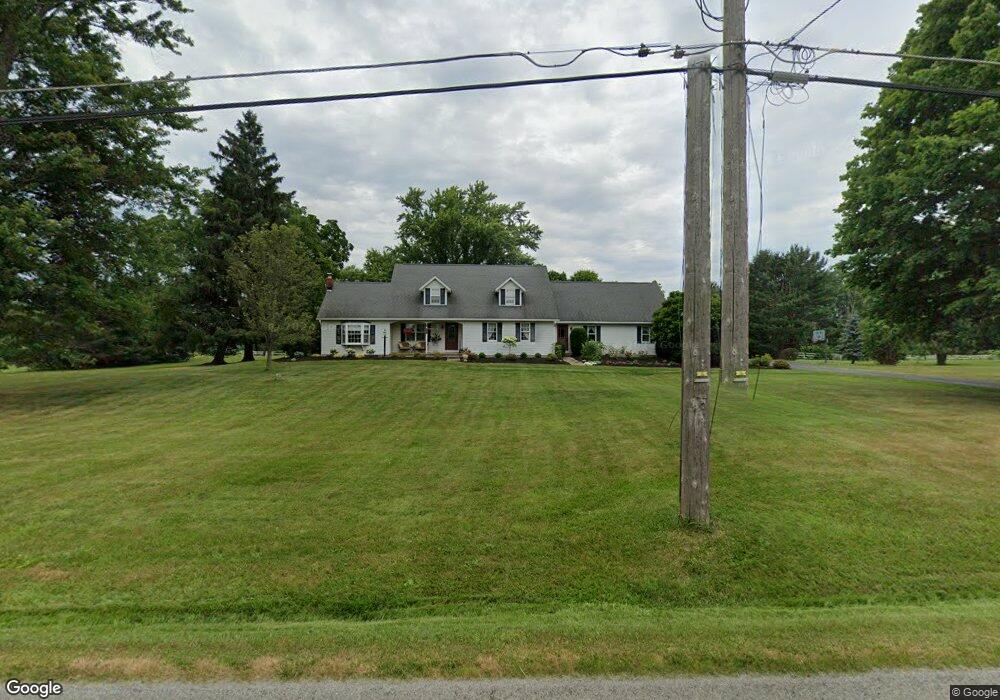
4993 Taylor Rd Atwater, OH 44201
Estimated Value: $372,000 - $440,000
3
Beds
3
Baths
3,051
Sq Ft
$134/Sq Ft
Est. Value
About This Home
This home is located at 4993 Taylor Rd, Atwater, OH 44201 and is currently estimated at $409,859, approximately $134 per square foot. 4993 Taylor Rd is a home located in Portage County with nearby schools including Waterloo Elementary School, Waterloo Middle School, and Waterloo High School.
Ownership History
Date
Name
Owned For
Owner Type
Purchase Details
Closed on
Mar 19, 2004
Sold by
White Richard L and White Susan E
Bought by
Merck Robert A and Merck Pamela S
Current Estimated Value
Home Financials for this Owner
Home Financials are based on the most recent Mortgage that was taken out on this home.
Original Mortgage
$190,000
Interest Rate
5.74%
Mortgage Type
Purchase Money Mortgage
Purchase Details
Closed on
Jun 2, 1987
Bought by
White Richard L and White Susan
Create a Home Valuation Report for This Property
The Home Valuation Report is an in-depth analysis detailing your home's value as well as a comparison with similar homes in the area
Home Values in the Area
Average Home Value in this Area
Purchase History
| Date | Buyer | Sale Price | Title Company |
|---|---|---|---|
| Merck Robert A | $257,000 | Midland Title Security Inc | |
| White Richard L | $85,000 | -- |
Source: Public Records
Mortgage History
| Date | Status | Borrower | Loan Amount |
|---|---|---|---|
| Previous Owner | Merck Robert A | $190,000 |
Source: Public Records
Tax History Compared to Growth
Tax History
| Year | Tax Paid | Tax Assessment Tax Assessment Total Assessment is a certain percentage of the fair market value that is determined by local assessors to be the total taxable value of land and additions on the property. | Land | Improvement |
|---|---|---|---|---|
| 2024 | $4,448 | $125,410 | $13,510 | $111,900 |
| 2023 | $3,678 | $90,550 | $10,400 | $80,150 |
| 2022 | $3,789 | $90,550 | $10,400 | $80,150 |
| 2021 | $3,798 | $90,550 | $10,400 | $80,150 |
| 2020 | $3,075 | $77,180 | $10,400 | $66,780 |
| 2019 | $3,097 | $77,180 | $10,400 | $66,780 |
| 2018 | $3,098 | $70,530 | $7,810 | $62,720 |
| 2017 | $2,803 | $70,530 | $7,810 | $62,720 |
| 2016 | $2,796 | $70,530 | $7,810 | $62,720 |
| 2015 | $2,828 | $70,530 | $7,810 | $62,720 |
| 2014 | $2,754 | $67,000 | $7,810 | $59,190 |
| 2013 | $2,668 | $67,000 | $7,810 | $59,190 |
Source: Public Records
Map
Nearby Homes
- 2113 New Milford Rd
- 2322 New Milford Rd
- 4958 Bassett Rd
- 1683 New Milford Rd
- 1628 New Milford Rd
- 0 Industry Rd
- 2265 Industry Rd
- 2547 Industry Rd
- 4324 Abbey Ln
- 5457 Waterloo Rd
- 5296 Eberly Rd
- 0 Waterloo Rd
- 1696 State Route 44
- Lot 1 New Milford (5 33 Ac)
- 2882 State Route 44
- 1291 State Route 44
- 3021 Hartville Rd
- 2236 Hartville Rd
- 3705 Alexander Rd
- 1015 Stroup Rd
- 5025 Taylor Rd
- 4994 Taylor Rd
- 5008 Taylor Rd
- 4971 Taylor Rd
- 5036 Taylor Rd
- 4954 Taylor Rd
- 4968 Taylor Rd
- 5048 Taylor Rd
- 5059 Taylor Rd
- 4940 Taylor Rd
- 4937 Taylor Rd
- 5064 Taylor Rd
- 2106 New Milford Rd
- 4926 Taylor Rd
- 2140 New Milford Rd
- 5080 Taylor Rd
- 4915 Taylor Rd
- 2036 New Milford Rd
- 5088 Taylor Rd
- 2002 New Milford Rd