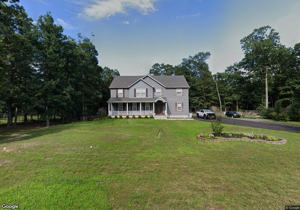
4997 Covered Bridge Rd Millville, NJ 08332
Estimated Value: $614,000 - $818,000
--
Bed
--
Bath
3,882
Sq Ft
$176/Sq Ft
Est. Value
About This Home
This home is located at 4997 Covered Bridge Rd, Millville, NJ 08332 and is currently estimated at $682,022, approximately $175 per square foot. 4997 Covered Bridge Rd is a home with nearby schools including Dr. William Mennies School, Landis Middle School, and Vineland Senior High School.
Ownership History
Date
Name
Owned For
Owner Type
Purchase Details
Closed on
Jul 25, 2022
Sold by
Joel Jewell
Bought by
Ryan Ashley and Steele Michael
Current Estimated Value
Home Financials for this Owner
Home Financials are based on the most recent Mortgage that was taken out on this home.
Original Mortgage
$458,850
Outstanding Balance
$438,761
Interest Rate
5.7%
Mortgage Type
New Conventional
Estimated Equity
$243,261
Purchase Details
Closed on
Feb 15, 2013
Sold by
Distasio Rafael A and Distasio Carmen J
Bought by
Jewell John
Purchase Details
Closed on
Jul 31, 2003
Sold by
Conner Richard
Bought by
Distasio Rafael A
Create a Home Valuation Report for This Property
The Home Valuation Report is an in-depth analysis detailing your home's value as well as a comparison with similar homes in the area
Home Values in the Area
Average Home Value in this Area
Purchase History
| Date | Buyer | Sale Price | Title Company |
|---|---|---|---|
| Ryan Ashley | $483,000 | Foundation Title | |
| Ryan Ashley | $483,000 | Foundation Title | |
| Jewell John | $52,000 | Foundation Title Llc | |
| Distasio Rafael A | $35,000 | -- |
Source: Public Records
Mortgage History
| Date | Status | Borrower | Loan Amount |
|---|---|---|---|
| Open | Ryan Ashley | $458,850 | |
| Closed | Ryan Ashley | $458,850 |
Source: Public Records
Tax History Compared to Growth
Tax History
| Year | Tax Paid | Tax Assessment Tax Assessment Total Assessment is a certain percentage of the fair market value that is determined by local assessors to be the total taxable value of land and additions on the property. | Land | Improvement |
|---|---|---|---|---|
| 2025 | $11,778 | $369,900 | $57,100 | $312,800 |
| 2024 | $11,778 | $369,900 | $57,100 | $312,800 |
| 2023 | $11,700 | $369,900 | $57,100 | $312,800 |
| 2022 | $9,631 | $313,800 | $57,100 | $256,700 |
| 2021 | $9,455 | $313,800 | $57,100 | $256,700 |
| 2020 | $9,185 | $313,800 | $57,100 | $256,700 |
| 2019 | $9,059 | $313,800 | $57,100 | $256,700 |
| 2018 | $1,605 | $57,100 | $57,100 | $0 |
| 2017 | $1,525 | $57,100 | $57,100 | $0 |
| 2016 | $1,471 | $57,100 | $57,100 | $0 |
| 2015 | $1,417 | $57,100 | $57,100 | $0 |
| 2014 | $1,340 | $57,100 | $57,100 | $0 |
Source: Public Records
Map
Nearby Homes
- 2110 Mays Landing Rd Unit 199
- 2110 Mays Landing Rd Unit 14
- 2110 Mays Landing Rd Unit 73
- 2110 Mays Landing Rd Unit 77
- 2110 Mays Landing Rd Unit 169
- 2110 Mays Landing Rd
- 2110 Mays Landing Rd Unit 317
- 2110 Mays Landing Rd Unit 267
- 2110 Mays Landing Rd Unit 308
- 4770 Stoney Bridge Rd
- 1921 Mountain Dr
- 2655 Mays Landing Rd
- 2801 Leaming Mill Rd
- 4225 Mays Landing Rd
- 9 Greenlawn Ct
- 447 Manor Ave
- 1916 Bessie Way
- 429 Manor Ave
- 4518 E Sherman Ave
- 1812 Newcombtown Rd
- 2110 Covered Bridge Rd
- 4971 Covered Bridge Rd
- 2110 #219 Mays Landing
- 2112 Mays Landing Rd
- 5010 Covered Bridge Rd
- 4960 Coverbridge Rd
- 4960 Covered Bridge Rd
- 2065 Mays Landing Rd
- 2065 E Landis Ave
- 4955 Covered Bridge Rd
- 2021 Mays Landing Rd
- 2110 Mays Landing Road #302
- 4930 Covered Bridge Rd
- 4935 Covered Bridge Rd
- 1940 Mays Landing Rd
- 32 Oak Rd
- 32 Oak Terrace
- 4911 Covered Bridge Rd
- 4910 Covered Bridge Rd
- 1973 Mays Landing Rd