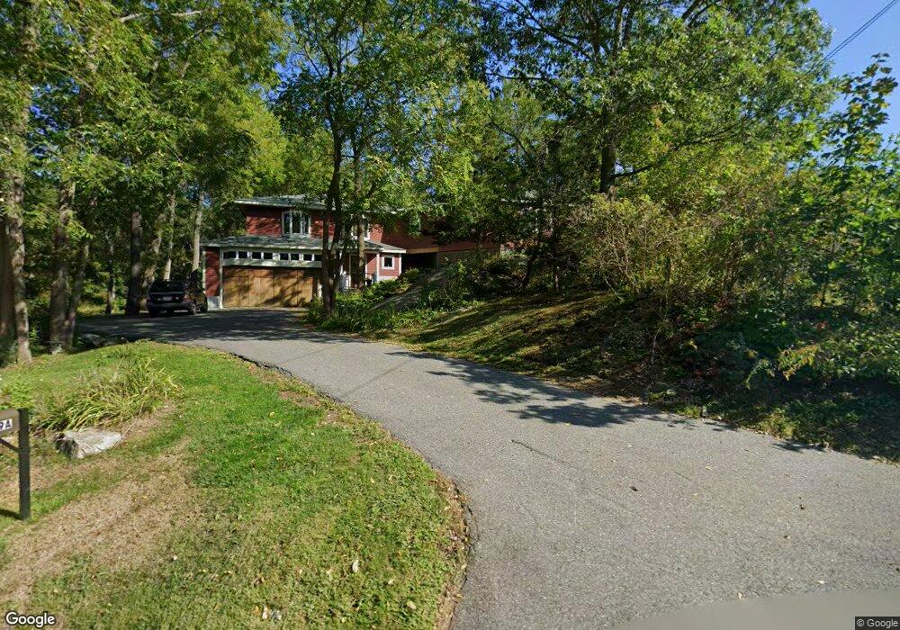
49A Sumner St Gloucester, MA 01930
West Gloucester NeighborhoodEstimated Value: $917,000 - $1,103,000
3
Beds
3
Baths
2,300
Sq Ft
$441/Sq Ft
Est. Value
About This Home
This home is located at 49A Sumner St, Gloucester, MA 01930 and is currently estimated at $1,014,007, approximately $440 per square foot. 49A Sumner St is a home located in Essex County with nearby schools including West Parish, Ralph B O'maley Middle School, and Gloucester High School.
Ownership History
Date
Name
Owned For
Owner Type
Purchase Details
Closed on
Dec 29, 2014
Sold by
Richardson Douglas W and Cook Lianne T
Bought by
Cook Richardson Ft
Current Estimated Value
Purchase Details
Closed on
Oct 23, 2009
Sold by
Gustafson Keith A and Gustafson Joey M
Bought by
Richardson Douglas W
Purchase Details
Closed on
Apr 24, 2009
Sold by
Gustafson Tr Keith A and Gustafson Joey M
Bought by
Gustafson Keith A
Purchase Details
Closed on
Mar 12, 2009
Sold by
Gustafson Joey M and Gustafson Keith A
Bought by
Gustafson Tr Keith A
Create a Home Valuation Report for This Property
The Home Valuation Report is an in-depth analysis detailing your home's value as well as a comparison with similar homes in the area
Home Values in the Area
Average Home Value in this Area
Purchase History
| Date | Buyer | Sale Price | Title Company |
|---|---|---|---|
| Cook Richardson Ft | -- | -- | |
| Cook Richardson Ft | -- | -- | |
| Richardson Douglas W | $525,000 | -- | |
| Richardson Douglas W | $525,000 | -- | |
| Gustafson Keith A | -- | -- | |
| Gustafson Keith A | -- | -- | |
| Gustafson Tr Keith A | -- | -- | |
| Gustafson Tr Keith A | -- | -- |
Source: Public Records
Mortgage History
| Date | Status | Borrower | Loan Amount |
|---|---|---|---|
| Previous Owner | Gustafson Tr Keith A | $397,900 | |
| Previous Owner | Gustafson Tr Keith A | $195,000 |
Source: Public Records
Tax History
| Year | Tax Paid | Tax Assessment Tax Assessment Total Assessment is a certain percentage of the fair market value that is determined by local assessors to be the total taxable value of land and additions on the property. | Land | Improvement |
|---|---|---|---|---|
| 2025 | $9,210 | $947,500 | $222,300 | $725,200 |
| 2024 | $8,566 | $880,400 | $211,700 | $668,700 |
| 2023 | $7,927 | $748,500 | $188,900 | $559,600 |
| 2022 | $7,647 | $651,900 | $164,300 | $487,600 |
| 2021 | $7,377 | $593,000 | $149,500 | $443,500 |
| 2020 | $7,492 | $607,600 | $149,500 | $458,100 |
| 2019 | $7,851 | $618,700 | $149,500 | $469,200 |
| 2018 | $7,287 | $563,600 | $149,500 | $414,100 |
| 2017 | $7,261 | $550,500 | $142,300 | $408,200 |
| 2016 | $7,109 | $522,300 | $148,400 | $373,900 |
| 2015 | $6,790 | $497,400 | $148,400 | $349,000 |
Source: Public Records
Map
Nearby Homes
- 7 Leaman Dr
- 587 Essex Ave
- 15 Lufkin Point Rd
- 368 Essex Ave
- 162 Main St
- 145 Main St Unit 1
- 145 Main St Unit 4
- 90 Southern Ave Unit 90
- 5 Samoset Rd Unit B
- 167 Atlantic St
- 178 Atlantic St
- 5 Lepage Ln
- 24 Cobblestone Ln Unit 603
- 226 Atlantic St
- 145 Essex Ave Unit 402
- 34 & 34R Pickering St
- 13 Honeysuckle Rd
- 85 Martin St
- 2 Breezy Point Rd
- 3 Hardy Ln
Your Personal Tour Guide
Ask me questions while you tour the home.