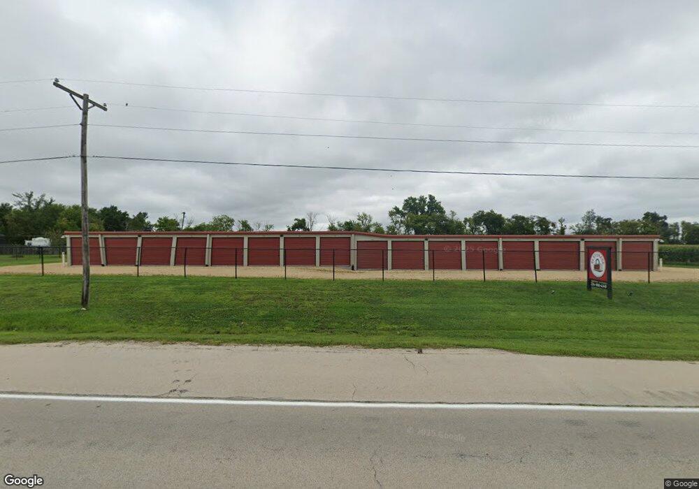
49W950 Il Route 64 Maple Park, IL 60151
15
Beds
9
Baths
5,470
Sq Ft
1.92
Acres
About This Home
This home is located at 49W950 Il Route 64, Maple Park, IL 60151. 49W950 Il Route 64 is a home located in Kane County with nearby schools including Kaneland John Stewart Elementary School, Harter Middle School, and Kaneland Senior High School.
Ownership History
Date
Name
Owned For
Owner Type
Purchase Details
Closed on
Jul 11, 2018
Sold by
Miller Joseph and Miller Megan
Bought by
64 Storage Llc
Purchase Details
Closed on
Dec 22, 2017
Sold by
Devon Bank
Bought by
Miller Joseph and Folkerts Megan
Home Financials for this Owner
Home Financials are based on the most recent Mortgage that was taken out on this home.
Original Mortgage
$110,000
Interest Rate
4.04%
Mortgage Type
Credit Line Revolving
Purchase Details
Closed on
Sep 1, 1998
Sold by
Scotella Michael and Scotella Lucille
Bought by
Devon Bank and Trust #6482
Home Financials for this Owner
Home Financials are based on the most recent Mortgage that was taken out on this home.
Original Mortgage
$246,000
Interest Rate
7.06%
Mortgage Type
Commercial
Create a Home Valuation Report for This Property
The Home Valuation Report is an in-depth analysis detailing your home's value as well as a comparison with similar homes in the area
Home Values in the Area
Average Home Value in this Area
Purchase History
| Date | Buyer | Sale Price | Title Company |
|---|---|---|---|
| 64 Storage Llc | -- | Attorney | |
| Miller Joseph | $78,000 | Fidelity National Title | |
| Devon Bank | $300,000 | 1St American Title |
Source: Public Records
Mortgage History
| Date | Status | Borrower | Loan Amount |
|---|---|---|---|
| Previous Owner | Miller Joseph | $110,000 | |
| Previous Owner | Devon Bank | $246,000 | |
| Closed | Devon Bank | $163,000 |
Source: Public Records
Tax History Compared to Growth
Tax History
| Year | Tax Paid | Tax Assessment Tax Assessment Total Assessment is a certain percentage of the fair market value that is determined by local assessors to be the total taxable value of land and additions on the property. | Land | Improvement |
|---|---|---|---|---|
| 2024 | $19,569 | $243,296 | $51,886 | $191,410 |
| 2023 | $4,164 | $48,181 | $48,181 | -- |
| 2022 | $2,789 | $31,308 | $31,308 | $0 |
| 2021 | $2,688 | $29,712 | $29,712 | $0 |
| 2020 | $2,585 | $28,660 | $28,660 | $0 |
| 2019 | $2,536 | $27,507 | $27,507 | $0 |
| 2018 | $2,452 | $25,889 | $25,889 | $0 |
| 2017 | $4,238 | $43,696 | $43,696 | $0 |
| 2016 | $4,025 | $41,010 | $41,010 | $0 |
| 2015 | -- | $38,773 | $38,773 | $0 |
| 2014 | -- | $37,644 | $37,644 | $0 |
| 2013 | -- | $37,644 | $37,644 | $0 |
Source: Public Records
Map
Nearby Homes
- 49W972 Peterson Rd
- 5N487 County Line Rd
- 00 Welter Rd
- 21058 Oak Ln
- 115 State St
- 8N153 Grand Arbor Ln
- 205 Center St
- 620 Elm St
- 804 Elm St
- 827 W Hampshire Dr
- 409 S Kincaid St
- 412 S Kincaid St
- 411 S Kincaid St
- 415 S Kincaid St
- 239 S Kincaid St
- 523 S Joliet St
- 529 S Kincaid St
- 325 W Burlington Dr
- 528 S Joliet St
- 753 W Ashton Dr
- 50W275 Il Route 64
- 50W275 Illinois 64
- 50W275 Illinois 64
- 6N686 Mcgough Rd
- 6N800 Mcgough Rd
- 7N239 Mcgough Rd
- 50W345 State Route 64
- 50W345 Illinois 64
- 50W345 Illinois 64
- 50W309 Old State Rd
- 6N610 Mcgough Rd
- 50W353 Old State Rd
- 6n588 Mcgough Rd
- 7N337 Mcgough Rd
- 6N405 Mcgough Rd
- 49W573 State Route 64
- 50w Read Rd
- 50W497 Rte 64
- 50W419 Old State Rd
- 50W443 Old State Rd Unit 2