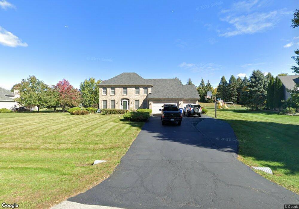
4N127 Wyngate Rd Unit 1 Saint Charles, IL 60175
Estimated Value: $531,533 - $634,000
--
Bed
1
Bath
2,368
Sq Ft
$247/Sq Ft
Est. Value
About This Home
This home is located at 4N127 Wyngate Rd Unit 1, Saint Charles, IL 60175 and is currently estimated at $584,383, approximately $246 per square foot. 4N127 Wyngate Rd Unit 1 is a home located in Kane County with nearby schools including Bell-Graham Elementary School, Thompson Middle School, and St Charles East High School.
Ownership History
Date
Name
Owned For
Owner Type
Purchase Details
Closed on
May 2, 1995
Sold by
Clarke James E and Clarke Patricia K
Bought by
York Michael C and York Joy L
Current Estimated Value
Home Financials for this Owner
Home Financials are based on the most recent Mortgage that was taken out on this home.
Original Mortgage
$209,000
Interest Rate
8%
Create a Home Valuation Report for This Property
The Home Valuation Report is an in-depth analysis detailing your home's value as well as a comparison with similar homes in the area
Home Values in the Area
Average Home Value in this Area
Purchase History
| Date | Buyer | Sale Price | Title Company |
|---|---|---|---|
| York Michael C | $261,500 | First American Title Ins Co |
Source: Public Records
Mortgage History
| Date | Status | Borrower | Loan Amount |
|---|---|---|---|
| Closed | York Michael C | $209,000 |
Source: Public Records
Tax History Compared to Growth
Tax History
| Year | Tax Paid | Tax Assessment Tax Assessment Total Assessment is a certain percentage of the fair market value that is determined by local assessors to be the total taxable value of land and additions on the property. | Land | Improvement |
|---|---|---|---|---|
| 2024 | $8,891 | $142,518 | $24,968 | $117,550 |
| 2023 | $8,676 | $127,419 | $22,323 | $105,096 |
| 2022 | $8,258 | $116,099 | $20,340 | $95,759 |
| 2021 | $7,754 | $109,620 | $19,205 | $90,415 |
| 2020 | $7,740 | $108,043 | $18,929 | $89,114 |
| 2019 | $7,641 | $106,457 | $18,651 | $87,806 |
| 2018 | $7,630 | $106,457 | $18,651 | $87,806 |
| 2017 | $7,561 | $104,894 | $18,377 | $86,517 |
| 2016 | $8,036 | $102,246 | $17,913 | $84,333 |
| 2015 | -- | $99,422 | $17,418 | $82,004 |
| 2014 | -- | $100,946 | $17,685 | $83,261 |
| 2013 | -- | $102,640 | $17,982 | $84,658 |
Source: Public Records
Map
Nearby Homes
- 4N494 Hidden Oaks Rd
- 39W709 Walt Whitman Rd
- 39W599 Walt Whitman Rd Unit 13
- 39W663 Henry David Thoreau Place
- 38W443 Sunset Dr
- 3N735 Herman Melville Ln
- 3534 Matisse Dr
- 5N155 Prairie Rose Dr
- 5N193 Prairie Rose Dr
- 42W690 Illinois 64
- 3N943 Ralph Waldo Emerson Ln
- 171 Birch Ln
- 290 Remington Dr
- 39W162 Longmeadow Ln
- 3386 Saint Michel Ct
- 5N107 Burr Rd
- 3208 Raphael Ct
- 5N113 Burr Rd
- 4N466 Mark Twain St
- 39W955 Deer Run Dr
- 4N109 Wyngate Rd
- 4N145 Wyngate Rd Unit 1
- 4N087 Wyngate Rd Unit 1
- 4N165 Wyngate Rd
- 4N130 Wyngate Rd
- 39W060 Dean St
- 39W108 Wyngate Ct
- 4N065 Wyngate Rd
- 39W075 Dean Ln
- 4N156 Wyngate Rd Unit 1
- 39W075 Dean Ln
- 38W781 Bonnie Ct
- 38W791 Bonnie Ct Unit 1
- 39W130 Arbor Creek Rd Unit 1
- 4N043 Wyngate Rd Unit 1
- 4N043 Wyngate Rd Unit 1
- 4N043 Wyngate Rd
- 39W166 Wyngate Ct
- 39W152 Arbor Creek Rd
- 4N024 Wyngate Rd Unit 1