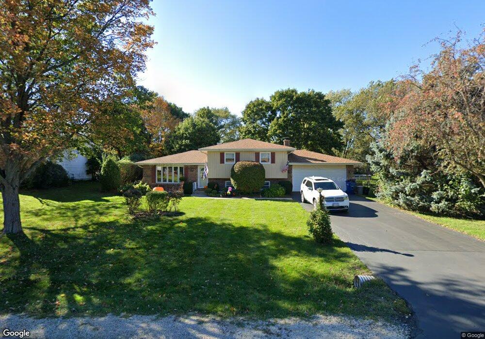
4N138 Locust Ave West Chicago, IL 60185
Estimated Value: $375,000 - $444,000
3
Beds
3
Baths
1,821
Sq Ft
$221/Sq Ft
Est. Value
About This Home
This home is located at 4N138 Locust Ave, West Chicago, IL 60185 and is currently estimated at $402,218, approximately $220 per square foot. 4N138 Locust Ave is a home located in DuPage County with nearby schools including Wayne Elementary School, Kenyon Woods Middle School, and South Elgin High School.
Ownership History
Date
Name
Owned For
Owner Type
Purchase Details
Closed on
Sep 18, 2007
Sold by
Franz Herbert A and Franz Edith E
Bought by
Huen Thomas J and Quarto Kelly M
Current Estimated Value
Home Financials for this Owner
Home Financials are based on the most recent Mortgage that was taken out on this home.
Original Mortgage
$225,000
Outstanding Balance
$141,869
Interest Rate
6.49%
Mortgage Type
Purchase Money Mortgage
Estimated Equity
$260,349
Create a Home Valuation Report for This Property
The Home Valuation Report is an in-depth analysis detailing your home's value as well as a comparison with similar homes in the area
Home Values in the Area
Average Home Value in this Area
Purchase History
| Date | Buyer | Sale Price | Title Company |
|---|---|---|---|
| Huen Thomas J | $251,000 | Atg |
Source: Public Records
Mortgage History
| Date | Status | Borrower | Loan Amount |
|---|---|---|---|
| Open | Huen Thomas J | $225,000 |
Source: Public Records
Tax History Compared to Growth
Tax History
| Year | Tax Paid | Tax Assessment Tax Assessment Total Assessment is a certain percentage of the fair market value that is determined by local assessors to be the total taxable value of land and additions on the property. | Land | Improvement |
|---|---|---|---|---|
| 2024 | $6,886 | $105,690 | $33,606 | $72,084 |
| 2023 | $6,298 | $95,890 | $30,490 | $65,400 |
| 2022 | $6,295 | $89,120 | $28,340 | $60,780 |
| 2021 | $6,095 | $84,600 | $26,900 | $57,700 |
| 2020 | $5,961 | $82,060 | $26,090 | $55,970 |
| 2019 | $5,885 | $79,130 | $25,160 | $53,970 |
| 2018 | $5,785 | $75,730 | $24,080 | $51,650 |
| 2017 | $5,684 | $72,710 | $23,120 | $49,590 |
| 2016 | $5,235 | $65,520 | $20,830 | $44,690 |
| 2015 | $5,290 | $62,020 | $19,720 | $42,300 |
| 2014 | $4,787 | $59,260 | $24,020 | $35,240 |
| 2013 | $5,748 | $60,670 | $24,590 | $36,080 |
Source: Public Records
Map
Nearby Homes
- 4N139 Norris Ave
- 30W170 Whitney Rd
- 4N336 Locust Ave
- 30W359 Wiant Rd
- 30W010 Smith Rd
- 30W520 Arbor Ln
- 4N707 White Oak Ln
- 582 Partridge Dr
- 29W725 Army Trail Rd
- 2625 Bobwhite Ln
- 3N234 Cuyahoga Terrace
- 31W780 North Ave
- 1548 Wood Creek Trail
- 1542 Wood Creek Trail
- 31W141 Army Trail Rd
- 3N050 Timberline Dr
- 1529 Longmeadow Ln
- 29W548 Cape Ave
- 356 Post Oak Cir Unit 3
- 30W030 Schick Rd
- 4N180 Locust Ave
- 4N200 Locust Ave
- 4N125 Locust Ave
- 4N110 Locust Ave
- 4N153 Locust Ave
- 4N141 Locust Ave
- 4 Locust Ave
- 4N139 Kenwood Ave
- 4N111 Locust Ave
- 4N125 Kenwood Ave
- 4N155 Kenwood Ave
- 4N090 Locust Ave
- 4N111 Kenwood Ave
- 4N091 Locust Ave Unit 1
- 30W280 Whitney Rd
- 4N091 Kenwood Ave
- 4N080 Locust Ave
- 30W225 Whitney Rd
- 4N126 Il Route 59
- 30W316 Whitney Rd