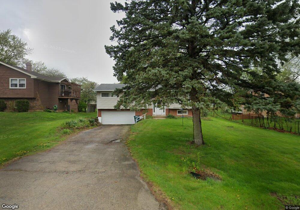
4N203 Locust Ave West Chicago, IL 60185
Estimated Value: $613,000 - $867,000
4
Beds
5
Baths
4,199
Sq Ft
$173/Sq Ft
Est. Value
About This Home
This home is located at 4N203 Locust Ave, West Chicago, IL 60185 and is currently estimated at $726,725, approximately $173 per square foot. 4N203 Locust Ave is a home located in DuPage County with nearby schools including Wayne Elementary School, Kenyon Woods Middle School, and South Elgin High School.
Ownership History
Date
Name
Owned For
Owner Type
Purchase Details
Closed on
Jan 27, 2020
Sold by
Ahed Abdul
Bought by
Majhass Revocable Living Trust
Current Estimated Value
Purchase Details
Closed on
May 10, 2019
Sold by
Trust No 12424
Bought by
Ahed Abdul and Ahed Qamar J
Purchase Details
Closed on
Dec 23, 2008
Sold by
Tufano Ignazio and Tufano Stacey L
Bought by
Itasca Bank & Trust Co and Trust #12424
Purchase Details
Closed on
Aug 13, 2004
Sold by
Itasca Bank & Trust Co
Bought by
Tufano Ignazio and Tufano Stacey L
Purchase Details
Closed on
Jun 30, 2003
Sold by
Mock Margaret A
Bought by
Itasca Bank & Trust Co and Trust #10897
Create a Home Valuation Report for This Property
The Home Valuation Report is an in-depth analysis detailing your home's value as well as a comparison with similar homes in the area
Home Values in the Area
Average Home Value in this Area
Purchase History
| Date | Buyer | Sale Price | Title Company |
|---|---|---|---|
| Majhass Revocable Living Trust | -- | -- | |
| Ahed Abdul | $370,000 | Fidelity National Title | |
| Itasca Bank & Trust Co | -- | None Available | |
| Tufano Ignazio | -- | -- | |
| Itasca Bank & Trust Co | $70,000 | Ctic |
Source: Public Records
Tax History Compared to Growth
Tax History
| Year | Tax Paid | Tax Assessment Tax Assessment Total Assessment is a certain percentage of the fair market value that is determined by local assessors to be the total taxable value of land and additions on the property. | Land | Improvement |
|---|---|---|---|---|
| 2024 | $14,647 | $215,799 | $35,303 | $180,496 |
| 2023 | $13,456 | $195,790 | $32,030 | $163,760 |
| 2022 | $9,688 | $133,920 | $29,770 | $104,150 |
| 2021 | $9,393 | $127,130 | $28,260 | $98,870 |
| 2020 | $9,195 | $123,320 | $27,410 | $95,910 |
| 2019 | $14,105 | $181,270 | $26,430 | $154,840 |
| 2018 | $13,893 | $173,460 | $25,290 | $148,170 |
| 2017 | $13,679 | $166,550 | $24,280 | $142,270 |
| 2016 | $12,673 | $150,090 | $21,880 | $128,210 |
| 2015 | $12,848 | $142,070 | $20,710 | $121,360 |
| 2014 | $10,813 | $126,310 | $25,220 | $101,090 |
| 2013 | $12,967 | $129,330 | $25,820 | $103,510 |
Source: Public Records
Map
Nearby Homes
- 30W170 Whitney Rd
- 4N139 Norris Ave
- 4N336 Locust Ave
- 30W010 Smith Rd
- 30W359 Wiant Rd
- 4N707 White Oak Ln
- 30W520 Arbor Ln
- 29W725 Army Trail Rd
- 582 Partridge Dr
- 2625 Bobwhite Ln
- 3N234 Cuyahoga Terrace
- 1548 Wood Creek Trail
- 1542 Wood Creek Trail
- 31W780 North Ave
- 1529 Longmeadow Ln
- 31W141 Army Trail Rd
- 30W030 Schick Rd
- 1433 Quincy Bridge Ct Unit 37
- 3N050 Timberline Dr
- 29W548 Cape Ave
- 4N203 Locust Ave
- 4N211 Locust Ave
- 30W280 Whitney Rd
- 4N223 Locust Ave
- 4N210 Locust Ave
- 4N186 Il Route 59
- 4N222 Locust Ave
- 4N210 Il Route 59
- 4N210 Il Route 59
- 30W220 Whitney Rd
- 4N153 Locust Ave
- 4N236 Locust Ave
- 4N200 Locust Ave
- 30W225 Whitney Rd
- 4N141 Locust Ave
- 4 Locust Ave
- 4N234 Il Route 59
- 30W316 Whitney Rd
- 4N249 Locust Ave
- 4N209 Kenwood Ave