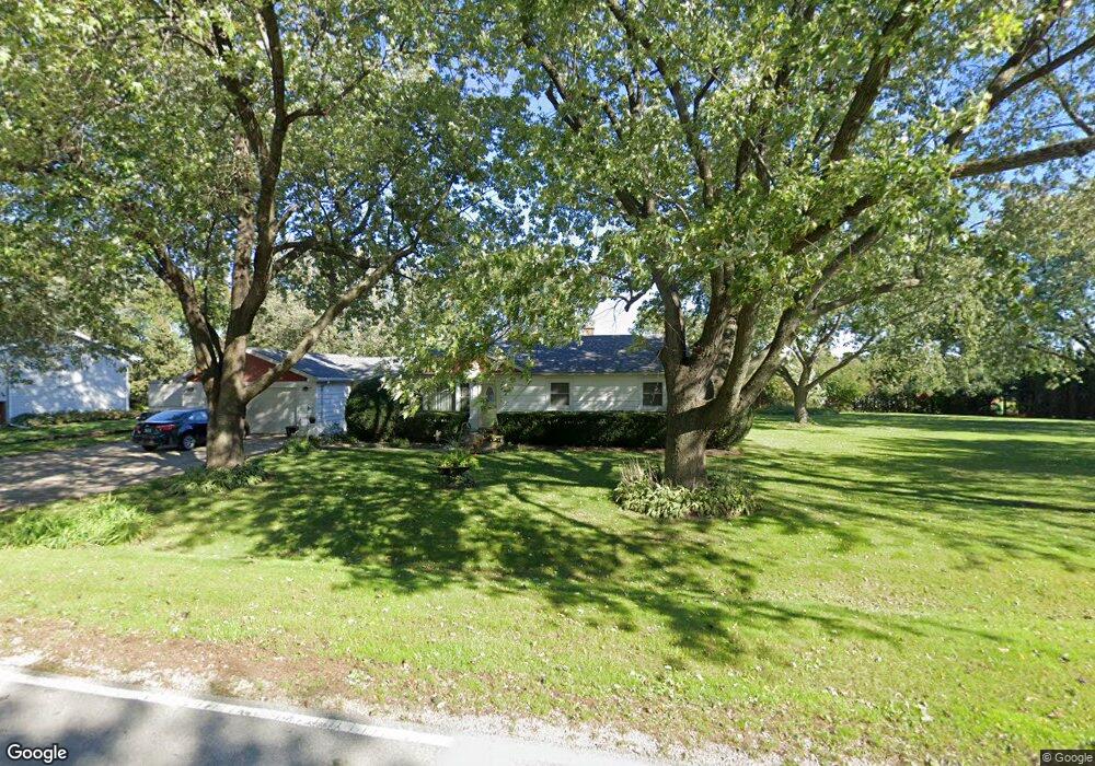
4N249 Locust Ave West Chicago, IL 60185
Estimated Value: $297,324 - $383,000
--
Bed
--
Bath
1,040
Sq Ft
$330/Sq Ft
Est. Value
About This Home
This home is located at 4N249 Locust Ave, West Chicago, IL 60185 and is currently estimated at $343,581, approximately $330 per square foot. 4N249 Locust Ave is a home located in DuPage County with nearby schools including Wayne Elementary School, Kenyon Woods Middle School, and South Elgin High School.
Ownership History
Date
Name
Owned For
Owner Type
Purchase Details
Closed on
Nov 17, 2014
Sold by
Dorsey Douglas D and Elmer G Dorsey Trust
Bought by
Dorsey Douglas D and Dorsey Kimberly
Current Estimated Value
Purchase Details
Closed on
Jun 8, 1999
Sold by
Dorsey Elmer G
Bought by
Dorsey Elmer G and Elmer G Dorsey Trust
Home Financials for this Owner
Home Financials are based on the most recent Mortgage that was taken out on this home.
Original Mortgage
$85,500
Interest Rate
6.94%
Purchase Details
Closed on
May 1, 1999
Sold by
Dorsey Elmer G and Elmer G Dorsey Trust
Bought by
Dorsey Elmer G
Home Financials for this Owner
Home Financials are based on the most recent Mortgage that was taken out on this home.
Original Mortgage
$85,500
Interest Rate
6.94%
Purchase Details
Closed on
Jan 4, 1995
Sold by
Dorsey Elmer G
Bought by
Dorsey Elmer G
Create a Home Valuation Report for This Property
The Home Valuation Report is an in-depth analysis detailing your home's value as well as a comparison with similar homes in the area
Home Values in the Area
Average Home Value in this Area
Purchase History
| Date | Buyer | Sale Price | Title Company |
|---|---|---|---|
| Dorsey Douglas D | -- | None Available | |
| Dorsey Elmer G | -- | -- | |
| Dorsey Elmer G | -- | -- | |
| Dorsey Elmer G | -- | -- |
Source: Public Records
Mortgage History
| Date | Status | Borrower | Loan Amount |
|---|---|---|---|
| Closed | Dorsey Elmer G | $85,500 |
Source: Public Records
Tax History Compared to Growth
Tax History
| Year | Tax Paid | Tax Assessment Tax Assessment Total Assessment is a certain percentage of the fair market value that is determined by local assessors to be the total taxable value of land and additions on the property. | Land | Improvement |
|---|---|---|---|---|
| 2024 | $5,588 | $87,272 | $33,606 | $53,666 |
| 2023 | $5,100 | $79,180 | $30,490 | $48,690 |
| 2022 | $5,119 | $73,590 | $28,340 | $45,250 |
| 2021 | $4,952 | $69,860 | $26,900 | $42,960 |
| 2020 | $4,840 | $67,760 | $26,090 | $41,670 |
| 2019 | $4,776 | $65,340 | $25,160 | $40,180 |
| 2018 | $4,690 | $62,530 | $24,080 | $38,450 |
| 2017 | $4,604 | $60,040 | $23,120 | $36,920 |
| 2016 | $4,231 | $54,100 | $20,830 | $33,270 |
| 2015 | $4,269 | $51,210 | $19,720 | $31,490 |
| 2014 | $3,977 | $50,250 | $24,020 | $26,230 |
| 2013 | $4,778 | $51,450 | $24,590 | $26,860 |
Source: Public Records
Map
Nearby Homes
- 4N336 Locust Ave
- 30W170 Whitney Rd
- 4N139 Norris Ave
- 30W010 Smith Rd
- 4N707 White Oak Ln
- 30W359 Wiant Rd
- 30W520 Arbor Ln
- 29W725 Army Trail Rd
- 582 Partridge Dr
- 2625 Bobwhite Ln
- 1548 Wood Creek Trail
- 1542 Wood Creek Trail
- 3N234 Cuyahoga Terrace
- 1529 Longmeadow Ln
- 30W030 Schick Rd
- 31W141 Army Trail Rd
- 1433 Quincy Bridge Ct Unit 37
- 31W780 North Ave
- 3N050 Timberline Dr
- 29W548 Cape Ave
- 4N261 Locust Ave
- 4N236 Locust Ave
- 4N262 Locust Ave
- 4N223 Locust Ave
- 4N271 Locust Ave
- 4N262 Il Route 59
- 4N234 Il Route 59
- 4N272 Locust Ave
- 4N222 Locust Ave
- 4N272 Il Route 59
- 4N272 Il Route 59
- 4N272 Il Route 59
- 4N272 State Route 59
- 4N211 Locust Ave
- 4N272 Rt 59
- 4N301 Locust Ave
- 4N210 Locust Ave
- 4N300 Locust Ave
- 4N210 Il Route 59
- 4N210 Il Route 59