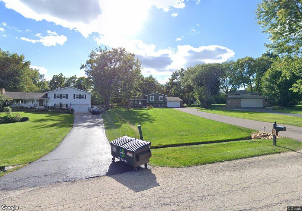
4N660 Brookside West Dr Saint Charles, IL 60175
Estimated Value: $421,000 - $522,000
--
Bed
1
Bath
1,227
Sq Ft
$375/Sq Ft
Est. Value
About This Home
This home is located at 4N660 Brookside West Dr, Saint Charles, IL 60175 and is currently estimated at $460,712, approximately $375 per square foot. 4N660 Brookside West Dr is a home located in Kane County with nearby schools including Wasco Elementary School, Thompson Middle School, and St Charles North High School.
Ownership History
Date
Name
Owned For
Owner Type
Purchase Details
Closed on
Dec 13, 2024
Sold by
Adamson Jeffrey and Adamson Leann
Bought by
Jeffrey L Adamson Revocable Trust and Adamson
Current Estimated Value
Purchase Details
Closed on
Apr 19, 2017
Sold by
Hotopp Hotopp Michael W Michael W and Hotopp Michael W
Bought by
Adamson Jeffrey and Adamson Leann
Home Financials for this Owner
Home Financials are based on the most recent Mortgage that was taken out on this home.
Original Mortgage
$200,000
Interest Rate
4.25%
Mortgage Type
New Conventional
Purchase Details
Closed on
Mar 25, 2008
Sold by
Hotopp Michael W and Hotopp Jean S
Bought by
Hotopp Michael W and Hotopp Jean S
Purchase Details
Closed on
Mar 27, 2007
Sold by
Hotopp Michael W and Hotopp Jean S
Bought by
Hotopp Michael W and Hotopp Jean S
Purchase Details
Closed on
Apr 30, 2005
Sold by
Hotopp Michael W and Hotopp Jean S
Bought by
Hotopp Michael W and Hotopp Jean S
Create a Home Valuation Report for This Property
The Home Valuation Report is an in-depth analysis detailing your home's value as well as a comparison with similar homes in the area
Home Values in the Area
Average Home Value in this Area
Purchase History
| Date | Buyer | Sale Price | Title Company |
|---|---|---|---|
| Jeffrey L Adamson Revocable Trust | -- | None Listed On Document | |
| Adamson Jeffrey | $284,000 | Fidelity National Title | |
| Hotopp Michael W | -- | None Available | |
| Hotopp Michael W | -- | None Available | |
| Hotopp Michael W | -- | -- |
Source: Public Records
Mortgage History
| Date | Status | Borrower | Loan Amount |
|---|---|---|---|
| Previous Owner | Adamson Jeffrey | $200,000 |
Source: Public Records
Tax History Compared to Growth
Tax History
| Year | Tax Paid | Tax Assessment Tax Assessment Total Assessment is a certain percentage of the fair market value that is determined by local assessors to be the total taxable value of land and additions on the property. | Land | Improvement |
|---|---|---|---|---|
| 2024 | $7,987 | $125,332 | $20,652 | $104,680 |
| 2023 | $7,797 | $110,620 | $18,464 | $92,156 |
| 2022 | $7,436 | $100,793 | $16,824 | $83,969 |
| 2021 | $7,097 | $95,168 | $15,885 | $79,283 |
| 2020 | $5,102 | $93,798 | $15,656 | $78,142 |
| 2019 | $5,031 | $92,421 | $15,426 | $76,995 |
| 2018 | $5,022 | $92,421 | $15,426 | $76,995 |
| 2017 | $4,565 | $91,065 | $15,200 | $75,865 |
| 2016 | $4,810 | $65,554 | $14,816 | $50,738 |
| 2015 | -- | $63,744 | $14,407 | $49,337 |
| 2014 | -- | $64,721 | $14,628 | $50,093 |
| 2013 | -- | $65,806 | $14,873 | $50,933 |
Source: Public Records
Map
Nearby Homes
- 42W474 Red Bud Ct Unit 2
- 42W697 Bridle Ct
- 5N683 Ravine Dr
- 5N634 Lostview Ln
- 42W641 Jens Jensen Ln Unit 2
- 42W534 Empire Rd
- 40W778 Ellis Johnson Ln
- 40W758 Ellis Johnson Ln
- 40W897 Brown Rd
- 40W930 Trotter Ln
- 41W329 Prairie View Ln
- 4N466 Mark Twain St
- 41W234 Prairie View Ln Unit 3
- Lot 15 Campton Meadow Dr
- 40W665 Carriage Ct
- 4N621 Pathfinder Dr
- 41W066 Campton Wood Dr
- 24 Autumn Ct
- 40W139 Jack London St
- 41W590 Bowgren Dr
- 4N660 Brookside Dr W
- 4N670 Brookside West Dr
- 4N670 Brookside Dr W
- 4N650 Brookside West Dr
- 4N680 Brookside West Dr
- 4N630 Brookside West Dr
- 4N681 Brookside West Dr
- 4N681 Brookside Dr W
- 4N641 Brookside West Dr
- 4N641 Brookside Dr W
- 4N602 Brookside West Dr
- 4N602 Brookside Dr W
- 4N697 Chaffield Dr
- 4N730 Brookside West Dr
- 4N675 Chaffield Dr
- 4N727 N Circle Dr
- 4N725 Chaffield Dr
- 4N644 S Circle Dr
- Lot 1 Brookside Dr W
