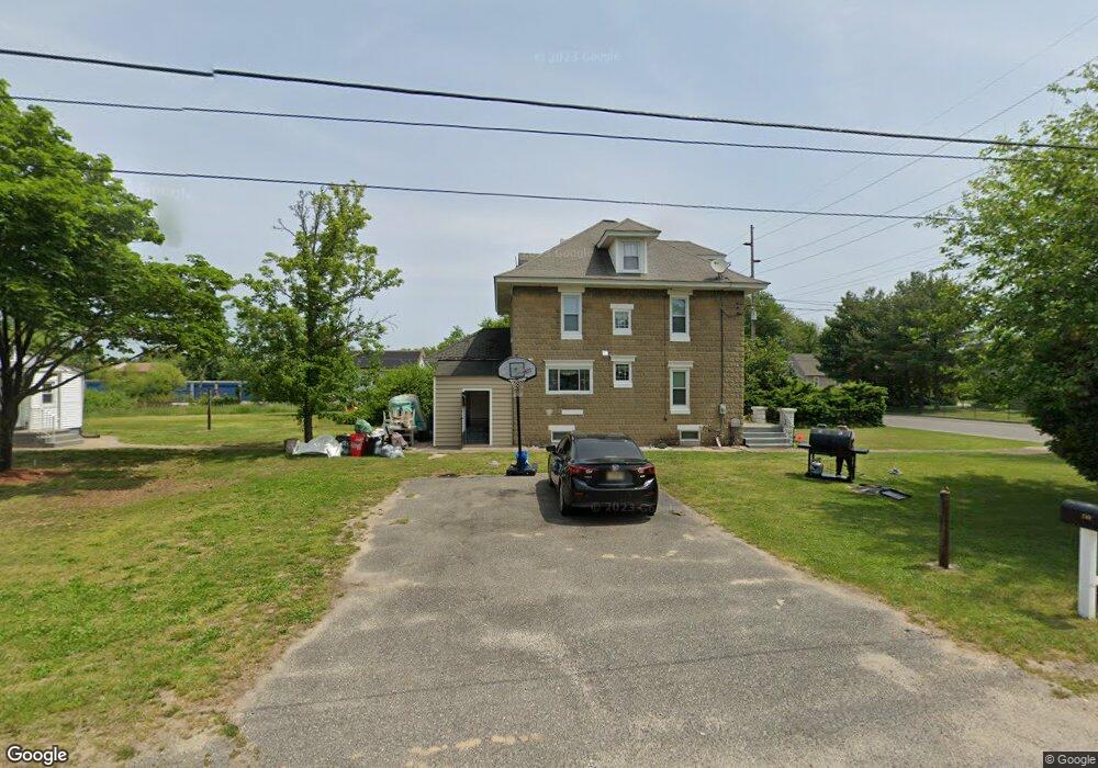
5 7th Ave Penns Grove, NJ 08069
Estimated Value: $216,427 - $372,000
--
Bed
--
Bath
3,112
Sq Ft
$89/Sq Ft
Est. Value
About This Home
This home is located at 5 7th Ave, Penns Grove, NJ 08069 and is currently estimated at $276,607, approximately $88 per square foot. 5 7th Ave is a home located in Salem County with nearby schools including Lafayette-Pershing Elementary School, Paul W. Carleton Elementary School, and Field Street Elementary School.
Ownership History
Date
Name
Owned For
Owner Type
Purchase Details
Closed on
Oct 19, 2007
Current Estimated Value
Purchase Details
Closed on
Jun 19, 2006
Sold by
Devaney Joseph E and Devaney Paula M
Bought by
Driver Christopher
Home Financials for this Owner
Home Financials are based on the most recent Mortgage that was taken out on this home.
Original Mortgage
$153,000
Interest Rate
9.74%
Mortgage Type
Balloon
Purchase Details
Closed on
Apr 23, 1996
Sold by
Blum Diane L and Montagna Diane L
Bought by
Devaney Joseph E and Devaney Paula M
Home Financials for this Owner
Home Financials are based on the most recent Mortgage that was taken out on this home.
Original Mortgage
$74,250
Interest Rate
7.28%
Purchase Details
Closed on
Feb 16, 1996
Sold by
Montagna James R and Hebib Diane L
Bought by
Hebib Diane L and Montagna Diane L
Create a Home Valuation Report for This Property
The Home Valuation Report is an in-depth analysis detailing your home's value as well as a comparison with similar homes in the area
Home Values in the Area
Average Home Value in this Area
Purchase History
| Date | Buyer | Sale Price | Title Company |
|---|---|---|---|
| -- | -- | -- | |
| Driver Christopher | $170,000 | Commonwealth Land Title Insu | |
| Devaney Joseph E | $82,500 | Intercoastal Title Agency In | |
| Hebib Diane L | $20,000 | Intercoastal Title Agency In |
Source: Public Records
Mortgage History
| Date | Status | Borrower | Loan Amount |
|---|---|---|---|
| Previous Owner | Driver Christopher | $153,000 | |
| Previous Owner | Devaney Joseph E | $74,250 |
Source: Public Records
Tax History Compared to Growth
Tax History
| Year | Tax Paid | Tax Assessment Tax Assessment Total Assessment is a certain percentage of the fair market value that is determined by local assessors to be the total taxable value of land and additions on the property. | Land | Improvement |
|---|---|---|---|---|
| 2025 | $4,892 | $88,200 | $13,900 | $74,300 |
| 2024 | $4,728 | $88,200 | $13,900 | $74,300 |
| 2023 | $4,728 | $88,200 | $13,900 | $74,300 |
| 2022 | $4,557 | $88,200 | $13,900 | $74,300 |
| 2021 | $4,361 | $88,200 | $13,900 | $74,300 |
| 2020 | $4,418 | $88,200 | $13,900 | $74,300 |
| 2019 | $4,436 | $88,200 | $13,900 | $74,300 |
| 2018 | $6,329 | $90,000 | $20,000 | $70,000 |
| 2017 | $6,351 | $156,900 | $21,900 | $135,000 |
| 2016 | $6,111 | $156,900 | $21,900 | $135,000 |
| 2015 | $5,854 | $156,900 | $21,900 | $135,000 |
| 2014 | $5,790 | $156,900 | $21,900 | $135,000 |
Source: Public Records
Map
Nearby Homes
- 106 S Broad St
- 85 State St
- 80 S Broad St
- 15 Walnut St
- 106 Sack Ave
- 65 S Broad St
- 32 Westminster Ave
- 34 38 Cumberland Ave
- 59-61 Walnut St
- 32 Walnut St
- 55 57 Walnut St
- 39 41 Cumberland Ave
- 0 Lincoln Avenue & Cumberland
- 88 Railroad Ave
- 3 Naylor Ave
- 0 Cumberland Ave
- 204 206 S Broad St
- 114 Deming Ave
- 91 Mill St
- 0 Delaware Dr