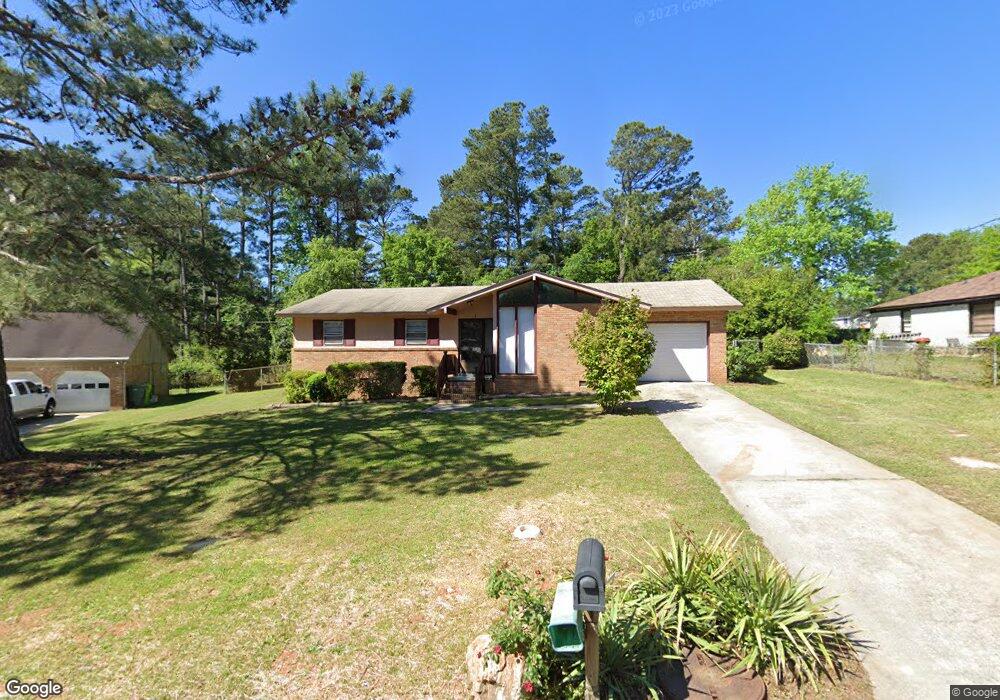
5 Ambrose Cir Columbia, SC 29210
Saint Andrews NeighborhoodEstimated Value: $156,000 - $197,000
3
Beds
2
Baths
1,280
Sq Ft
$138/Sq Ft
Est. Value
About This Home
This home is located at 5 Ambrose Cir, Columbia, SC 29210 and is currently estimated at $177,252, approximately $138 per square foot. 5 Ambrose Cir is a home located in Richland County with nearby schools including Sandel Elementary School, St. Andrews Middle School, and Columbia High School.
Ownership History
Date
Name
Owned For
Owner Type
Purchase Details
Closed on
Sep 10, 2018
Sold by
Conrex Residential Property Group 2012 2
Bought by
Ser Mt Llc
Current Estimated Value
Purchase Details
Closed on
Nov 21, 2008
Sold by
Baylor William L
Bought by
Baylor Pierre
Home Financials for this Owner
Home Financials are based on the most recent Mortgage that was taken out on this home.
Original Mortgage
$86,200
Interest Rate
6.1%
Mortgage Type
Purchase Money Mortgage
Create a Home Valuation Report for This Property
The Home Valuation Report is an in-depth analysis detailing your home's value as well as a comparison with similar homes in the area
Home Values in the Area
Average Home Value in this Area
Purchase History
| Date | Buyer | Sale Price | Title Company |
|---|---|---|---|
| Ser Mt Llc | $13,579,286 | Os National Llc | |
| Baylor Pierre | $86,200 | -- |
Source: Public Records
Mortgage History
| Date | Status | Borrower | Loan Amount |
|---|---|---|---|
| Previous Owner | Baylor Pierre | $86,200 |
Source: Public Records
Tax History Compared to Growth
Tax History
| Year | Tax Paid | Tax Assessment Tax Assessment Total Assessment is a certain percentage of the fair market value that is determined by local assessors to be the total taxable value of land and additions on the property. | Land | Improvement |
|---|---|---|---|---|
| 2024 | $2,812 | $93,000 | $0 | $0 |
| 2023 | $2,742 | $3,236 | $0 | $0 |
| 2022 | $2,512 | $80,900 | $12,800 | $68,100 |
| 2021 | $2,501 | $4,850 | $0 | $0 |
| 2020 | $2,513 | $4,850 | $0 | $0 |
| 2019 | $2,483 | $4,840 | $0 | $0 |
| 2018 | $2,262 | $4,390 | $0 | $0 |
| 2017 | $2,201 | $4,390 | $0 | $0 |
| 2016 | $2,164 | $4,390 | $0 | $0 |
| 2015 | $2,135 | $4,390 | $0 | $0 |
| 2014 | $2,095 | $73,100 | $0 | $0 |
| 2013 | -- | $4,390 | $0 | $0 |
Source: Public Records
Map
Nearby Homes
- 1533 Westchester Dr
- 1509 Nunamaker Dr
- 1605 Kathleen Dr
- 1618 van Lingle Ave
- 1825 Woodsboro Dr
- 1810 Saint Michaels Rd
- 1917 Chandler Ave
- 1900 Rolling Hills Rd
- 1917 Kathleen Dr
- 1204 Old Manor Rd
- 2006 Mary Hill Dr
- 1101 Menlo Dr
- 2225 Hertford Dr
- 2135 Rolling Hills Rd
- 2229 Hertford Dr
- 2114 Apple Valley Rd
- 104 Menlo Dr
- 101 Menlo Dr
- 506 Menlo Dr
- 2116 Chandler Ave
- 1700 Westchester Dr
- 9 Ambrose Cir
- 6 Ambrose Cir
- 14 Ambrose Cir
- 1704 Westchester Dr
- 10 Ambrose Cir
- 2709 Brinkley Ln
- 133 St Andrews Place Dr
- 1708 Westchester Dr
- 129 St Andrews Place Dr
- 2701 Brinkley Ln
- 1621 Westchester Dr Unit 1627
- 1621 Westchester Dr
- 125 St Andrews Place Dr
- 125 St Andrews Pl Dr
- 133 Saint Andrews Place Dr
- 129 Saint Andrews Place Dr
- 1509 Kathleen Dr
- 1611 Westchester Dr Unit 3
- 121 St Andrews Place Dr