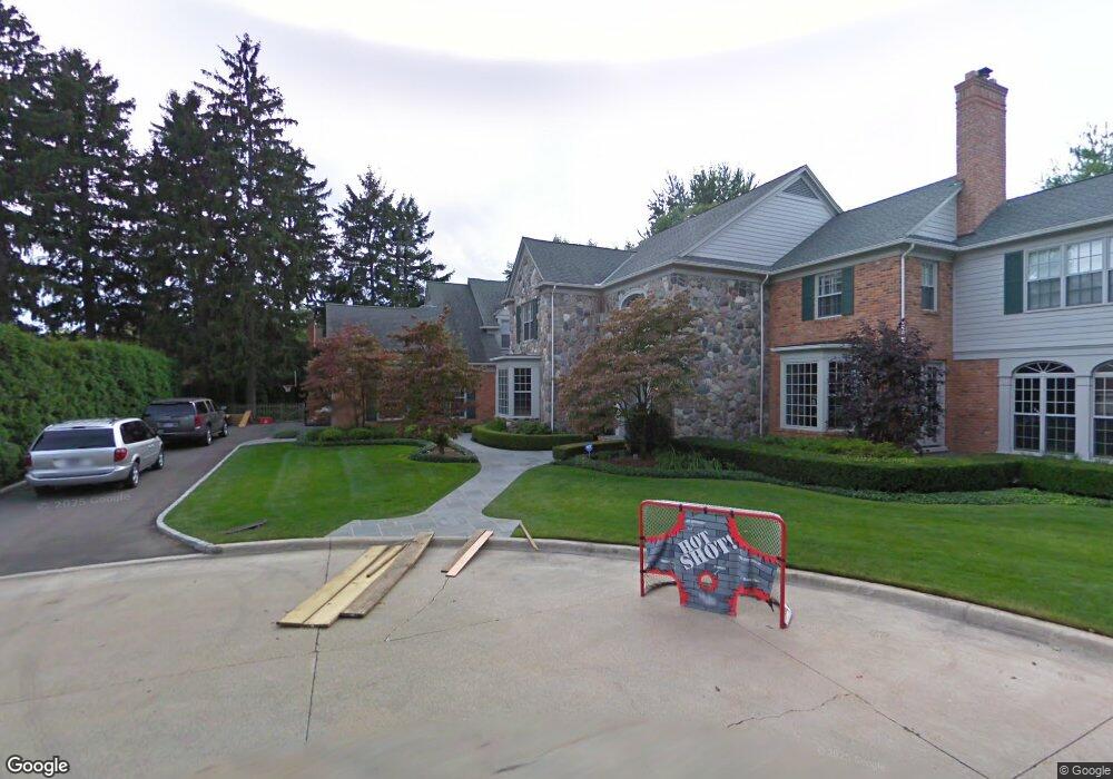
5 Baker Ln Grosse Pointe Farms, MI 48236
Estimated Value: $2,053,892 - $3,257,000
5
Beds
6
Baths
6,700
Sq Ft
$372/Sq Ft
Est. Value
About This Home
This home is located at 5 Baker Ln, Grosse Pointe Farms, MI 48236 and is currently estimated at $2,492,964, approximately $372 per square foot. 5 Baker Ln is a home located in Wayne County with nearby schools including Kerby Elementary School, Brownell Middle School, and Grosse Pointe South High School.
Ownership History
Date
Name
Owned For
Owner Type
Purchase Details
Closed on
Feb 17, 2025
Sold by
Maccagnone Jeffery T and Maccagnone Jennifer
Bought by
Maccagnone Jeffery and Jennifer Maccagnone Trust
Current Estimated Value
Purchase Details
Closed on
Jul 13, 2009
Sold by
Hollerbach Michael D and Hollerbach Nancy D
Bought by
Maccagnone Jeffery T
Purchase Details
Closed on
Sep 14, 1994
Sold by
Walter B Bridgforth
Bought by
Hollerbach Michael D and Hollerbach Nancy D
Create a Home Valuation Report for This Property
The Home Valuation Report is an in-depth analysis detailing your home's value as well as a comparison with similar homes in the area
Home Values in the Area
Average Home Value in this Area
Purchase History
| Date | Buyer | Sale Price | Title Company |
|---|---|---|---|
| Maccagnone Jeffery | -- | None Listed On Document | |
| Maccagnone Jeffery | -- | None Listed On Document | |
| Maccagnone Jeffery T | $1,400,000 | Greco | |
| Hollerbach Michael D | -- | -- |
Source: Public Records
Tax History Compared to Growth
Tax History
| Year | Tax Paid | Tax Assessment Tax Assessment Total Assessment is a certain percentage of the fair market value that is determined by local assessors to be the total taxable value of land and additions on the property. | Land | Improvement |
|---|---|---|---|---|
| 2025 | $17,119 | $1,117,900 | $0 | $0 |
| 2024 | $17,119 | $1,043,800 | $0 | $0 |
| 2023 | $15,683 | $996,200 | $0 | $0 |
| 2022 | $15,683 | $895,200 | $0 | $0 |
| 2021 | $28,778 | $868,600 | $0 | $0 |
| 2019 | $28,297 | $865,400 | $0 | $0 |
| 2018 | $14,481 | $738,000 | $0 | $0 |
| 2017 | $25,126 | $631,300 | $0 | $0 |
| 2016 | $26,339 | $588,500 | $0 | $0 |
| 2015 | $52,170 | $567,200 | $0 | $0 |
| 2013 | $50,540 | $505,400 | $0 | $0 |
| 2012 | $13,178 | $495,500 | $67,000 | $428,500 |
Source: Public Records
Map
Nearby Homes
- 93 Merriweather Rd
- 159 Grosse Pointe Blvd
- 65 Mapleton Rd
- 130 Merriweather Rd
- 105 Lake Shore Rd
- 286 Grosse Pointe Blvd
- 166 Lewiston Rd
- 216 Ridge Rd
- 189 Cloverly Rd
- 76 Grosse Pointe Blvd
- 218 Merriweather Rd
- 257 Ridge Rd
- 194 Charlevoix Ave
- 213 Muir Rd
- 273 Ridge Rd
- 201 Mcmillan Rd
- 259 Mount Vernon Ave
- 340 Kercheval Ave
- 81 Moross Rd
- 233 Mcmillan Rd
- 3 Baker Ln
- 8 Windward Place
- 21 Westwind Ln
- 31 Harbor Hill Rd
- 10 Windward Place
- 27 Harbor Hill Rd
- 35 Harbor Hill Rd
- 6 Windward Place
- 13 Baker Ln
- 12 Baker Ln
- 1 Baker Ln
- 25 Harbor Hill Rd
- 12 Windward Place
- 25 Westwind Ln
- 7 Windward Place
- 34 Harbor Hill Rd
- 28 Harbor Hill Rd
- 9 Windward Place
- 4 Windward Place
- 5 Windward Place