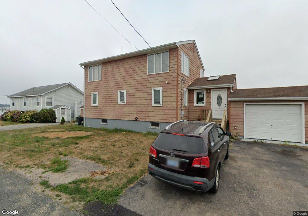
5 Benjamin Rd Narragansett, RI 02882
Estimated Value: $1,130,000 - $1,377,000
3
Beds
3
Baths
1,536
Sq Ft
$807/Sq Ft
Est. Value
About This Home
This home is located at 5 Benjamin Rd, Narragansett, RI 02882 and is currently estimated at $1,239,697, approximately $807 per square foot. 5 Benjamin Rd is a home located in Washington County with nearby schools including Narragansett Elementary School, Narragansett Pier Middle School, and Narragansett High School.
Ownership History
Date
Name
Owned For
Owner Type
Purchase Details
Closed on
Nov 9, 2022
Sold by
Deluca David A
Bought by
David and David Catherine Deluc
Current Estimated Value
Purchase Details
Closed on
Mar 15, 2014
Sold by
Kronson Geraldine M
Bought by
Daniel L & G M Kronson Re
Purchase Details
Closed on
Mar 25, 2013
Sold by
Deluca Francis J Est and Deluca
Bought by
Deluca Beverly A
Create a Home Valuation Report for This Property
The Home Valuation Report is an in-depth analysis detailing your home's value as well as a comparison with similar homes in the area
Home Values in the Area
Average Home Value in this Area
Purchase History
| Date | Buyer | Sale Price | Title Company |
|---|---|---|---|
| David | -- | None Available | |
| Daniel L & G M Kronson Re | -- | None Available | |
| Deluca Beverly A | -- | -- |
Source: Public Records
Tax History
| Year | Tax Paid | Tax Assessment Tax Assessment Total Assessment is a certain percentage of the fair market value that is determined by local assessors to be the total taxable value of land and additions on the property. | Land | Improvement |
|---|---|---|---|---|
| 2025 | $8,402 | $1,237,400 | $953,100 | $284,300 |
| 2024 | $8,105 | $1,237,400 | $953,100 | $284,300 |
| 2023 | $7,491 | $804,600 | $615,000 | $189,600 |
| 2022 | $7,241 | $804,600 | $615,000 | $189,600 |
| 2021 | $7,129 | $804,600 | $615,000 | $189,600 |
| 2020 | $7,610 | $726,100 | $555,500 | $170,600 |
| 2019 | $7,428 | $726,100 | $555,500 | $170,600 |
| 2018 | $7,225 | $726,100 | $555,500 | $170,600 |
| 2017 | $7,437 | $704,300 | $555,600 | $148,700 |
| 2016 | $7,099 | $704,300 | $555,600 | $148,700 |
| 2015 | $7,001 | $704,300 | $555,600 | $148,700 |
| 2014 | $6,850 | $682,300 | $538,200 | $144,100 |
Source: Public Records
Map
Nearby Homes
- 7 Conch Rd
- 17 Goose Island Rd
- 1185 Succotash Rd
- 6 MacAlder St
- 1140 Succotash Rd
- 1138 Succotash Rd
- 14 E Pointe Ct Unit 14
- 0 Hemlock Ave
- 0 Point Judith Rd
- 120 Chestnut Ave
- 47 Saint James Rd
- 62 Flintstone Rd
- 64 Burnside Ave
- 210 Washington St
- 660 Point Judith Rd Unit C4
- 609 Point Judith Rd
- 200 Clarke Rd Unit A208
- 22 Shore Rd
- 28 Palm Beach Ave
- 1499 Ocean Rd Unit 9
Your Personal Tour Guide
Ask me questions while you tour the home.