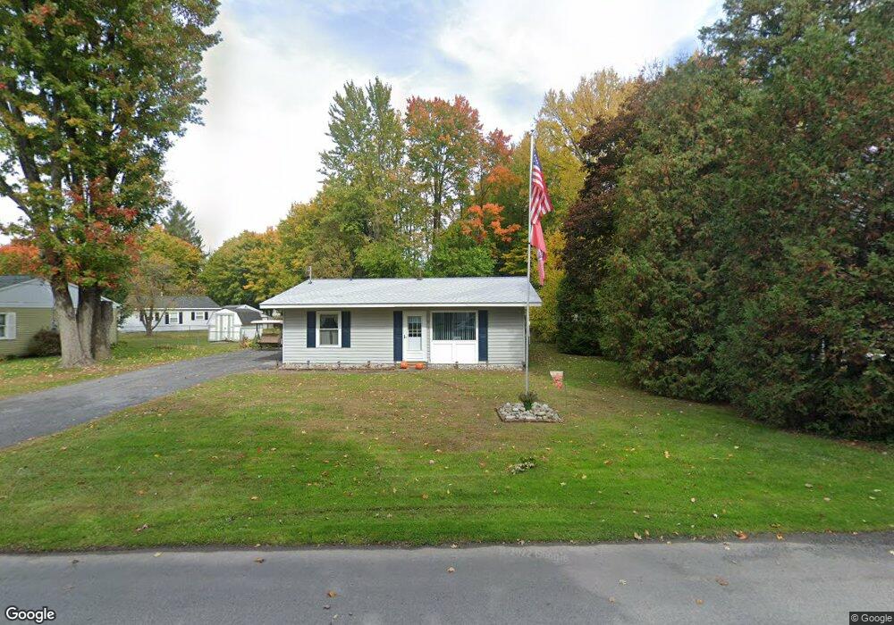
5 Birchdale Rd Utica, NY 13502
North Utica NeighborhoodEstimated Value: $167,885 - $202,000
3
Beds
1
Bath
957
Sq Ft
$201/Sq Ft
Est. Value
About This Home
This home is located at 5 Birchdale Rd, Utica, NY 13502 and is currently estimated at $192,471, approximately $201 per square foot. 5 Birchdale Rd is a home located in Oneida County with nearby schools including Thomas R. Proctor High School, Utica Academy of Science Charter School, and Christian Heritage School.
Ownership History
Date
Name
Owned For
Owner Type
Purchase Details
Closed on
Jun 19, 2019
Sold by
Roy Suzanne M and Roy David P
Bought by
David & Suzanne Roy Irt
Current Estimated Value
Purchase Details
Closed on
Jun 15, 2009
Sold by
Smith Herbert Leon
Bought by
Roy Suzanne M
Home Financials for this Owner
Home Financials are based on the most recent Mortgage that was taken out on this home.
Original Mortgage
$74,575
Interest Rate
4.91%
Mortgage Type
Unknown
Create a Home Valuation Report for This Property
The Home Valuation Report is an in-depth analysis detailing your home's value as well as a comparison with similar homes in the area
Home Values in the Area
Average Home Value in this Area
Purchase History
| Date | Buyer | Sale Price | Title Company |
|---|---|---|---|
| David & Suzanne Roy Irt | -- | -- | |
| Roy Suzanne M | $78,500 | John Livingston |
Source: Public Records
Mortgage History
| Date | Status | Borrower | Loan Amount |
|---|---|---|---|
| Previous Owner | Roy Suzanne M | $74,575 |
Source: Public Records
Tax History Compared to Growth
Tax History
| Year | Tax Paid | Tax Assessment Tax Assessment Total Assessment is a certain percentage of the fair market value that is determined by local assessors to be the total taxable value of land and additions on the property. | Land | Improvement |
|---|---|---|---|---|
| 2024 | $2,080 | $42,500 | $12,900 | $29,600 |
| 2023 | $577 | $42,500 | $12,900 | $29,600 |
| 2022 | $603 | $42,500 | $12,900 | $29,600 |
| 2021 | $590 | $42,500 | $12,900 | $29,600 |
| 2020 | $1,143 | $42,500 | $12,900 | $29,600 |
| 2019 | $511 | $42,500 | $12,900 | $29,600 |
| 2018 | $1,687 | $42,500 | $12,900 | $29,600 |
| 2017 | $1,649 | $42,500 | $12,900 | $29,600 |
| 2016 | $2,258 | $42,500 | $12,900 | $29,600 |
| 2015 | -- | $42,500 | $12,900 | $29,600 |
| 2014 | -- | $42,500 | $12,900 | $29,600 |
Source: Public Records
Map
Nearby Homes
- 239 Colonial Cir
- 128 Concord Dr
- 405 Briarcliff Ave
- 5635 Mapleton Dr
- 170 Concord Dr
- 125 Windsor Cir
- 5720 Mapleton Dr
- 1427 Fairwood Dr
- 422 Donegal Dr
- 153 Rodeo Dr
- 423 Brody Dr
- 516 Woodburne Dr
- 435 Brody Dr
- 1506 Bette Rd
- 617 Kilkenny Dr
- 164 Rodeo Dr
- 606 Sycamore Ln
- 403 Brody Dr
- 616 Sycamore Ln
- 1355 Herkimer Rd
- 3 Birchdale Rd
- 416 Briarcliff Ave
- 135 Concord Dr
- 15 Birchdale Rd
- 137 Concord Dr
- 418 Briarcliff Ave
- 8 Birchdale Rd
- 414 Briarcliff Ave
- 18 Birchdale Rd
- 6 Birchdale Rd
- 420 Briarcliff Ave
- 136 Concord Dr
- 4 Birchdale Rd
- 125 Concord Dr
- 417 Briarcliff Ave
- 415 Briarcliff Ave
- 412 Briarcliff Ave
- 422 Briarcliff Ave
- 421 Briarcliff Ave
- 121 Concord Dr