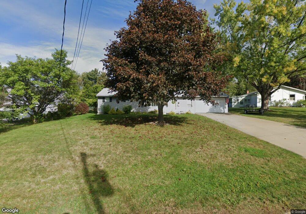
5 Brant Rd Johnstown, NY 12095
Estimated Value: $282,665 - $363,000
3
Beds
2
Baths
1,680
Sq Ft
$189/Sq Ft
Est. Value
About This Home
This home is located at 5 Brant Rd, Johnstown, NY 12095 and is currently estimated at $317,416, approximately $188 per square foot. 5 Brant Rd is a home located in Fulton County with nearby schools including Pleasant Avenue School, Warren Street School, and Johnstown Senior High School.
Ownership History
Date
Name
Owned For
Owner Type
Purchase Details
Closed on
Jun 7, 2013
Sold by
Pettit Mary Davida
Bought by
Petersen Nathan C
Current Estimated Value
Home Financials for this Owner
Home Financials are based on the most recent Mortgage that was taken out on this home.
Original Mortgage
$132,000
Outstanding Balance
$25,012
Interest Rate
3.43%
Mortgage Type
Purchase Money Mortgage
Estimated Equity
$292,404
Purchase Details
Closed on
Jun 6, 2007
Sold by
Frenzke Richard Ellen
Bought by
Pettit Mary Davida
Purchase Details
Closed on
Nov 27, 2002
Sold by
William Charles Walter
Bought by
Frenzke Richard
Purchase Details
Closed on
May 15, 2000
Sold by
Cowper Tod
Bought by
Charles Walter William
Create a Home Valuation Report for This Property
The Home Valuation Report is an in-depth analysis detailing your home's value as well as a comparison with similar homes in the area
Home Values in the Area
Average Home Value in this Area
Purchase History
| Date | Buyer | Sale Price | Title Company |
|---|---|---|---|
| Petersen Nathan C | $165,000 | Del B. Salmon | |
| Petersen Nathan C | $165,000 | Del B. Salmon | |
| Pettit Mary Davida | -- | Thomas C Walsh | |
| Frenzke Richard | $92,000 | Thomas Walsh | |
| Frenzke Richard A | -- | Thomas C Walsh | |
| Charles Walter William | $87,500 | Michael Albanese |
Source: Public Records
Mortgage History
| Date | Status | Borrower | Loan Amount |
|---|---|---|---|
| Open | Petersen Nathan C | $132,000 |
Source: Public Records
Tax History Compared to Growth
Tax History
| Year | Tax Paid | Tax Assessment Tax Assessment Total Assessment is a certain percentage of the fair market value that is determined by local assessors to be the total taxable value of land and additions on the property. | Land | Improvement |
|---|---|---|---|---|
| 2024 | $4,470 | $165,000 | $23,000 | $142,000 |
| 2023 | $4,645 | $165,000 | $23,000 | $142,000 |
| 2022 | $4,601 | $165,000 | $23,000 | $142,000 |
| 2021 | $4,427 | $165,000 | $23,000 | $142,000 |
| 2020 | $4,040 | $165,000 | $23,000 | $142,000 |
| 2019 | $5,221 | $165,000 | $23,000 | $142,000 |
| 2018 | $5,671 | $165,000 | $23,000 | $142,000 |
| 2017 | $3,404 | $165,000 | $23,000 | $142,000 |
| 2016 | $3,325 | $165,000 | $23,000 | $142,000 |
| 2015 | -- | $165,000 | $23,000 | $142,000 |
| 2014 | -- | $66,000 | $20,400 | $45,600 |
Source: Public Records
Map
Nearby Homes
- 400 S Melcher St
- 8 Woodland Dr
- 302 S William St
- L21 S Comrie South Ave
- 312 S Perry St
- 307 W Madison Ave Extension
- 113 S William St
- 807 Fon Clair St
- 112 S Market St
- 107 E Montgomery St
- 12 Cady St
- 12 1/2 E Clinton St
- 44 S Perry St
- 5 S William St
- 107 Glebe St
- 122 Hoosac St
- 26 N Market St
- 0 New York 29 Unit 11333158
- 2 W Green St
- 80 E Main St