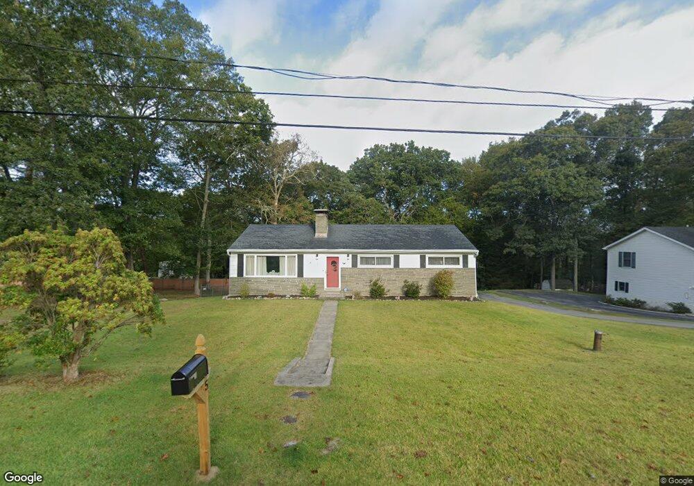
5 Brewster Dr Gales Ferry, CT 06335
Estimated Value: $353,000 - $390,000
3
Beds
2
Baths
1,372
Sq Ft
$267/Sq Ft
Est. Value
About This Home
This home is located at 5 Brewster Dr, Gales Ferry, CT 06335 and is currently estimated at $367,001, approximately $267 per square foot. 5 Brewster Dr is a home located in New London County with nearby schools including Ledyard Middle School, Ledyard High School, and Integrated Day Charter School.
Ownership History
Date
Name
Owned For
Owner Type
Purchase Details
Closed on
Jul 31, 2001
Sold by
Soraci Lois A
Bought by
Iliff Robert S
Current Estimated Value
Purchase Details
Closed on
Jun 21, 1999
Sold by
Martin Raymond F and Laman Sandra M
Bought by
Sorace Lois A
Purchase Details
Closed on
Aug 23, 1994
Sold by
Lundberg Albert W and Lundberg Elin G
Bought by
Martin Raymond F and Martin Sandra
Purchase Details
Closed on
Jun 9, 1988
Sold by
Reiner Otis
Bought by
Dusenberry David
Create a Home Valuation Report for This Property
The Home Valuation Report is an in-depth analysis detailing your home's value as well as a comparison with similar homes in the area
Home Values in the Area
Average Home Value in this Area
Purchase History
| Date | Buyer | Sale Price | Title Company |
|---|---|---|---|
| Iliff Robert S | $150,000 | -- | |
| Sorace Lois A | $129,900 | -- | |
| Martin Raymond F | $133,000 | -- | |
| Dusenberry David | $147,000 | -- |
Source: Public Records
Mortgage History
| Date | Status | Borrower | Loan Amount |
|---|---|---|---|
| Open | Dusenberry David | $128,000 | |
| Closed | Dusenberry David | $30,000 |
Source: Public Records
Tax History Compared to Growth
Tax History
| Year | Tax Paid | Tax Assessment Tax Assessment Total Assessment is a certain percentage of the fair market value that is determined by local assessors to be the total taxable value of land and additions on the property. | Land | Improvement |
|---|---|---|---|---|
| 2025 | $5,202 | $140,070 | $45,640 | $94,430 |
| 2024 | $4,920 | $139,720 | $45,640 | $94,080 |
| 2023 | $4,829 | $139,720 | $45,640 | $94,080 |
| 2022 | $4,725 | $139,720 | $45,640 | $94,080 |
| 2021 | $4,695 | $139,720 | $45,640 | $94,080 |
| 2020 | $4,463 | $127,610 | $47,810 | $79,800 |
| 2019 | $4,474 | $127,610 | $47,810 | $79,800 |
| 2018 | $4,352 | $126,910 | $47,810 | $79,100 |
| 2017 | $4,130 | $126,910 | $47,810 | $79,100 |
| 2016 | $4,048 | $126,910 | $47,810 | $79,100 |
| 2015 | $3,858 | $126,910 | $47,810 | $79,100 |
| 2014 | $4,019 | $134,400 | $47,810 | $86,590 |
Source: Public Records
Map
Nearby Homes
- 5 Bittersweet Dr
- 15 Drawbridge Rd
- 3 Holdsworth Rd
- 16 Marlene Dr
- 0 Clarks Falls Unit 24089817
- 123A Whalehead Rd
- 11 Willow Ln
- 7 Briarwood Ct
- 421 Kitemaug Rd
- 65 Dydo Dr
- 7 Barn Rd
- 5 Arrowhead Dr
- 178 Route 2a
- 2 Garden Ct
- 6 Arrowhead Dr
- 165 Massapeag Rd
- 104 Route 2a
- 6 Route 117
- 127 Massapeag Rd
- 16 Marty's Way
- 7 N Glenwoods Rd
- 11 N Glenwoods Rd
- 5 N Glenwoods Rd
- 6 Brewster Dr
- 7 Brewster Dr
- 8 N Glenwoods Rd
- 15 N Glenwoods Rd
- 50 Stonybrook Rd
- 9 Brewster Dr
- 12 N Glenwoods Rd
- 48 Stonybrook Rd
- 2 Forest Ln
- 8 Brewster Dr
- 1 N Glenwoods Rd
- 6 N Glenwoods Rd
- 52 Stonybrook Rd
- 4 N Glenwoods Rd
- 18 Brewster Dr
- 54 Stonybrook Rd
- 18 N Glenwoods Rd