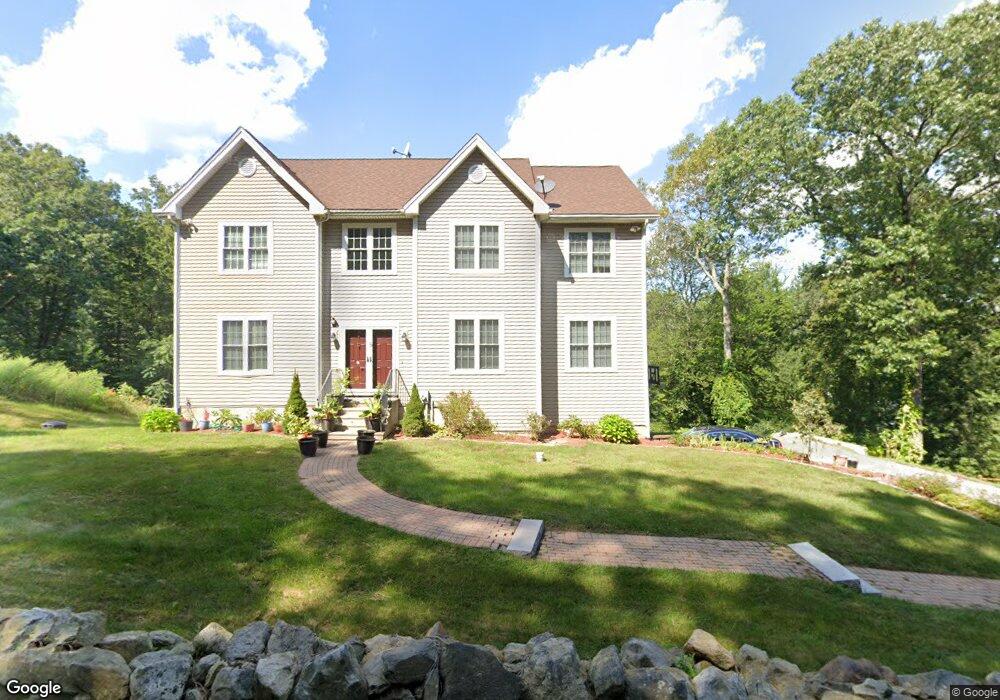
5 Burnett Rd Southborough, MA 01772
Estimated Value: $1,211,000 - $1,316,369
4
Beds
5
Baths
2,924
Sq Ft
$429/Sq Ft
Est. Value
About This Home
This home is located at 5 Burnett Rd, Southborough, MA 01772 and is currently estimated at $1,253,342, approximately $428 per square foot. 5 Burnett Rd is a home located in Worcester County with nearby schools including Mary E Finn School, Albert S. Woodward Memorial School, and Margaret A. Neary School.
Ownership History
Date
Name
Owned For
Owner Type
Purchase Details
Closed on
Feb 25, 2013
Sold by
Madhireddy Venkateswar
Bought by
Madhireddy Venkateswar and Madhireddy Geetha
Current Estimated Value
Home Financials for this Owner
Home Financials are based on the most recent Mortgage that was taken out on this home.
Original Mortgage
$417,000
Outstanding Balance
$292,929
Interest Rate
3.44%
Mortgage Type
Purchase Money Mortgage
Estimated Equity
$960,413
Purchase Details
Closed on
Mar 2, 2010
Sold by
Timberwolf Dev Rt and Castelli Laurie L
Bought by
Madhireddy Venkateswar
Home Financials for this Owner
Home Financials are based on the most recent Mortgage that was taken out on this home.
Original Mortgage
$391,680
Interest Rate
5.11%
Mortgage Type
Purchase Money Mortgage
Create a Home Valuation Report for This Property
The Home Valuation Report is an in-depth analysis detailing your home's value as well as a comparison with similar homes in the area
Home Values in the Area
Average Home Value in this Area
Purchase History
| Date | Buyer | Sale Price | Title Company |
|---|---|---|---|
| Madhireddy Venkateswar | -- | -- | |
| Madhireddy Venkateswar | $148,600 | -- |
Source: Public Records
Mortgage History
| Date | Status | Borrower | Loan Amount |
|---|---|---|---|
| Open | Madhireddy Venkateswar | $417,000 | |
| Previous Owner | Madhireddy Venkateswar | $391,680 |
Source: Public Records
Tax History Compared to Growth
Tax History
| Year | Tax Paid | Tax Assessment Tax Assessment Total Assessment is a certain percentage of the fair market value that is determined by local assessors to be the total taxable value of land and additions on the property. | Land | Improvement |
|---|---|---|---|---|
| 2025 | $15,295 | $1,107,500 | $351,300 | $756,200 |
| 2024 | $14,110 | $1,014,400 | $337,500 | $676,900 |
| 2023 | $12,868 | $871,800 | $321,100 | $550,700 |
| 2022 | $11,932 | $732,900 | $279,100 | $453,800 |
| 2021 | $4,431 | $711,400 | $270,100 | $441,300 |
| 2020 | $11,494 | $689,900 | $265,400 | $424,500 |
| 2019 | $11,330 | $676,800 | $265,400 | $411,400 |
| 2018 | $10,683 | $661,900 | $265,400 | $396,500 |
| 2017 | $10,652 | $650,300 | $265,400 | $384,900 |
| 2016 | $10,283 | $650,000 | $270,100 | $379,900 |
| 2015 | $10,179 | $635,400 | $256,400 | $379,000 |
Source: Public Records
Map
Nearby Homes
- 14 High St
- 15 Lovers Ln
- 14 Lovers Ln
- 6 Walker St
- 6 Eastbrook Farm Ln
- 8 Samuel Harrington Rd
- 379 Stearns Rd
- 43 Stearns Rd
- 181 Morrissey Rd
- 20 Clifford Rd
- 56 Sears Rd
- 19 Washington St
- Lot 2 Quinn Rd
- 38 Haskell St
- lot 1 Sears Rd
- 105 Fisher Rd
- 11 Skylar Dr
- 9 John Matthews Rd
- 237 Brigham St
- 120 Airport Blvd
- 3 Burnett Rd
- 10 Burnett Rd
- 13 Granuaile Rd
- 15 Granuaile Rd
- 17 Granuaile Rd
- 11 Granuaile Rd
- 2 Old Harry Rd
- 9 Granuaile Rd
- lot1 16 Oregon Rd
- lot2 18 Oregon Rd
- LOT 4 Fisher Rd
- Lot 7 Vine St
- Lot7A Lover's Ln
- LOT 3 Middle Rd
- LOT 5 Middle Rd
- LOT 1 Middle Rd
- LOT 26 Stockwell Ln
- - Lot 4 Buffalo Run
- LOT 21 Stockwell Ln
- LOT 30 Stockwell Ln