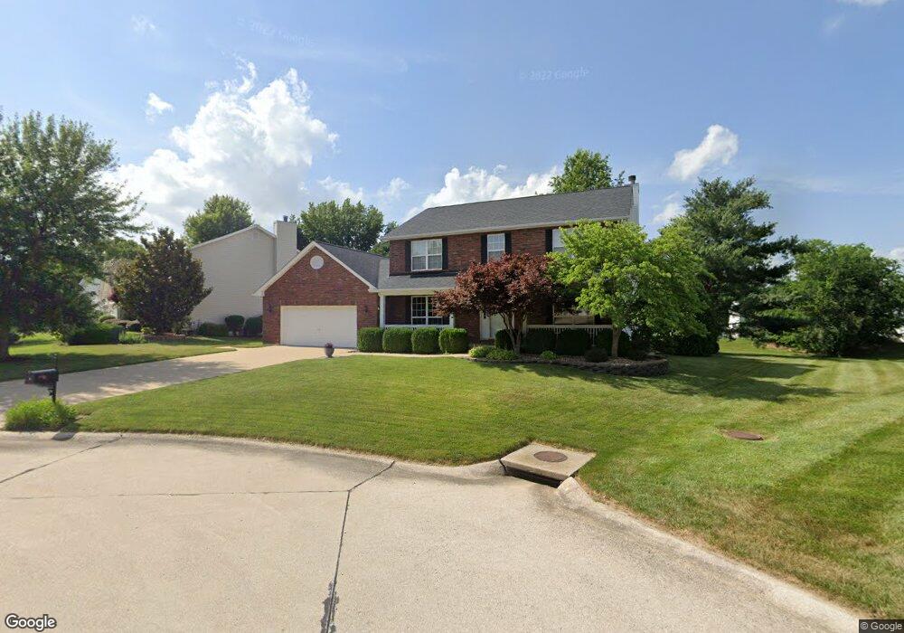
5 Canter Ct Saint Peters, MO 63376
Estimated Value: $445,000 - $503,000
4
Beds
3
Baths
2,467
Sq Ft
$191/Sq Ft
Est. Value
About This Home
This home is located at 5 Canter Ct, Saint Peters, MO 63376 and is currently estimated at $472,306, approximately $191 per square foot. 5 Canter Ct is a home located in St. Charles County with nearby schools including Progress South Elementary School, Fort Zumwalt South Middle School, and Fort Zumwalt South High School.
Ownership History
Date
Name
Owned For
Owner Type
Purchase Details
Closed on
Dec 23, 1998
Sold by
Tr Hughes Inc
Bought by
Miller David W and Miller Amy B
Current Estimated Value
Home Financials for this Owner
Home Financials are based on the most recent Mortgage that was taken out on this home.
Original Mortgage
$170,000
Outstanding Balance
$38,482
Interest Rate
6.74%
Estimated Equity
$433,824
Purchase Details
Closed on
Oct 20, 1998
Sold by
Kaplan Development & Investment Co
Bought by
Tr Hughes Inc
Create a Home Valuation Report for This Property
The Home Valuation Report is an in-depth analysis detailing your home's value as well as a comparison with similar homes in the area
Home Values in the Area
Average Home Value in this Area
Purchase History
| Date | Buyer | Sale Price | Title Company |
|---|---|---|---|
| Miller David W | $179,500 | -- | |
| Tr Hughes Inc | -- | -- |
Source: Public Records
Mortgage History
| Date | Status | Borrower | Loan Amount |
|---|---|---|---|
| Open | Miller David W | $170,000 |
Source: Public Records
Tax History Compared to Growth
Tax History
| Year | Tax Paid | Tax Assessment Tax Assessment Total Assessment is a certain percentage of the fair market value that is determined by local assessors to be the total taxable value of land and additions on the property. | Land | Improvement |
|---|---|---|---|---|
| 2025 | $5,166 | $84,716 | -- | -- |
| 2023 | $5,168 | $78,294 | $0 | $0 |
| 2022 | $4,694 | $66,160 | $0 | $0 |
| 2021 | $4,698 | $66,160 | $0 | $0 |
| 2020 | $4,270 | $58,176 | $0 | $0 |
| 2019 | $4,279 | $58,176 | $0 | $0 |
| 2018 | $3,767 | $48,861 | $0 | $0 |
| 2017 | $3,724 | $48,861 | $0 | $0 |
| 2016 | $3,601 | $47,068 | $0 | $0 |
| 2015 | $3,348 | $47,068 | $0 | $0 |
| 2014 | $3,008 | $41,573 | $0 | $0 |
Source: Public Records
Map
Nearby Homes
- 146 Huntington Crossing Dr
- 307 Santa Fe Trail Dr
- 113 Stage Coach Landing Dr
- 114 Knaust Rd
- 211 Butternut Stage Dr
- 7 Park City Ct
- 2068 Williamstown Dr
- 42 Kingspointe Dr
- 5 Arborgate Dr Unit 69A
- 67 Oakridge West Dr
- 212 Jacobs Way
- 225 Jacobs Way
- 1 Pauley Cir
- 34 Aspen Pointe Dr
- 8201 Bristol Valley Dr
- 31 Lace Bark Ct
- 2 Oak Point Ct
- 421 Jacobs Place Dr
- Franklin Plan at Strawberry Farms - Liberty Series
- Hamilton II Plan at Strawberry Farms - Liberty Series
- 3 Canter Ct
- 7 Canter Ct
- 214 Equestrian Downs Dr
- 9 Canter Ct
- 4 Canter Ct
- 210 Equestrian Downs Dr
- 11 Canter Ct
- 12 Canter Ct
- 220 Equestrian Downs Dr
- 206 Equestrian Downs Dr
- 110 Huntington Crossing Dr
- 106 Huntington Crossing Dr
- 114 Huntington Crossing Dr
- 13 Canter Ct
- 14 Canter Ct
- 215 Equestrian Downs Dr
- 118 Huntington Crossing Dr
- 219 Equestrian Downs Dr
- 211 Equestrian Downs Dr
- 174 Huntington Crossing Dr