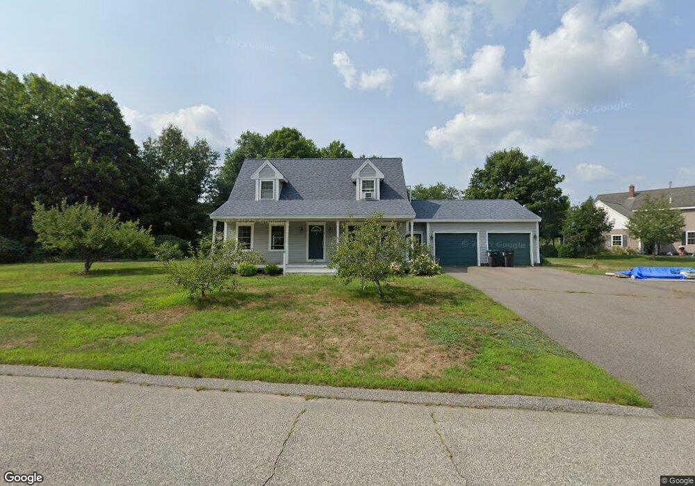
5 Channel Cove Kennebunk, ME 04043
Estimated Value: $662,759 - $695,000
3
Beds
3
Baths
1,638
Sq Ft
$415/Sq Ft
Est. Value
About This Home
This home is located at 5 Channel Cove, Kennebunk, ME 04043 and is currently estimated at $680,440, approximately $415 per square foot. 5 Channel Cove is a home located in York County with nearby schools including Kennebunk High School and The New School.
Ownership History
Date
Name
Owned For
Owner Type
Purchase Details
Closed on
Oct 6, 2020
Sold by
Coughlan Carter T and Coughlan Beth A
Bought by
Brady Patrick C and Traub Carly J
Current Estimated Value
Home Financials for this Owner
Home Financials are based on the most recent Mortgage that was taken out on this home.
Original Mortgage
$399,950
Outstanding Balance
$355,086
Interest Rate
2.8%
Mortgage Type
New Conventional
Estimated Equity
$325,354
Create a Home Valuation Report for This Property
The Home Valuation Report is an in-depth analysis detailing your home's value as well as a comparison with similar homes in the area
Home Values in the Area
Average Home Value in this Area
Purchase History
| Date | Buyer | Sale Price | Title Company |
|---|---|---|---|
| Brady Patrick C | -- | Misc Company |
Source: Public Records
Mortgage History
| Date | Status | Borrower | Loan Amount |
|---|---|---|---|
| Open | Brady Patrick C | $399,950 |
Source: Public Records
Tax History Compared to Growth
Tax History
| Year | Tax Paid | Tax Assessment Tax Assessment Total Assessment is a certain percentage of the fair market value that is determined by local assessors to be the total taxable value of land and additions on the property. | Land | Improvement |
|---|---|---|---|---|
| 2024 | $5,402 | $318,700 | $77,100 | $241,600 |
| 2023 | $5,115 | $318,700 | $77,100 | $241,600 |
| 2022 | $4,653 | $318,700 | $77,100 | $241,600 |
| 2021 | $4,541 | $318,700 | $77,100 | $241,600 |
| 2020 | $4,510 | $318,700 | $77,100 | $241,600 |
| 2019 | $4,382 | $318,700 | $77,100 | $241,600 |
| 2018 | $4,183 | $239,000 | $57,800 | $181,200 |
| 2017 | $3,674 | $239,000 | $57,800 | $181,200 |
| 2016 | $3,800 | $239,000 | $57,800 | $181,200 |
| 2015 | $3,511 | $239,000 | $57,800 | $181,200 |
| 2014 | $3,420 | $239,000 | $57,800 | $181,200 |
Source: Public Records
Map
Nearby Homes
- 9 Patterson Dr
- 30 Twine Mill Rd
- 24-4,25-10 Chapman Ln
- 274 Alfred Rd
- 276 Alfred Rd
- 284 Alfred Rd Unit Lot F13
- 5 Meander Ln Unit 2
- 20 Cascade Cir Unit 11
- 9 Hammond Rd
- 23 Cascade Cir Unit 22
- 18 Cascade Cir Unit 12
- 141 Thompson Rd
- 0 Potvin Rd
- 7 Meander Ln Unit 3
- 13 Tranquility Dr Unit 20
- 12 Tranquility Dr Unit 17
- 23 Lilac Ln
- 3 Nichols Ln
- 056 Cat Mousam Rd
- lot #3 Salvato Ln