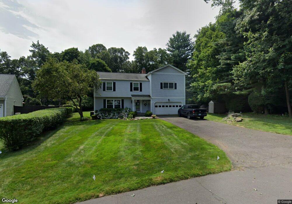
5 Charcoal Rd Norwalk, CT 06854
Brookside NeighborhoodEstimated Value: $886,000 - $1,138,000
4
Beds
3
Baths
2,577
Sq Ft
$406/Sq Ft
Est. Value
About This Home
This home is located at 5 Charcoal Rd, Norwalk, CT 06854 and is currently estimated at $1,045,458, approximately $405 per square foot. 5 Charcoal Rd is a home located in Fairfield County with nearby schools including Brookside Elementary School, Roton Middle School, and Brien Mcmahon High School.
Ownership History
Date
Name
Owned For
Owner Type
Purchase Details
Closed on
Jul 2, 1992
Sold by
Gutmann John and Gutmann Jennifer
Bought by
Berger Howard and Mcphilmy Jean
Current Estimated Value
Purchase Details
Closed on
Sep 13, 1989
Sold by
Murphy William O
Bought by
Zimmerman Marvin
Create a Home Valuation Report for This Property
The Home Valuation Report is an in-depth analysis detailing your home's value as well as a comparison with similar homes in the area
Home Values in the Area
Average Home Value in this Area
Purchase History
| Date | Buyer | Sale Price | Title Company |
|---|---|---|---|
| Berger Howard | $282,000 | -- | |
| Berger Howard | $282,000 | -- | |
| Zimmerman Marvin | $284,000 | -- |
Source: Public Records
Mortgage History
| Date | Status | Borrower | Loan Amount |
|---|---|---|---|
| Closed | Zimmerman Marvin | $185,063 | |
| Closed | Zimmerman Marvin | $227,000 | |
| Closed | Zimmerman Marvin | $214,000 |
Source: Public Records
Tax History
| Year | Tax Paid | Tax Assessment Tax Assessment Total Assessment is a certain percentage of the fair market value that is determined by local assessors to be the total taxable value of land and additions on the property. | Land | Improvement |
|---|---|---|---|---|
| 2025 | $11,914 | $501,850 | $196,780 | $305,070 |
| 2024 | $11,731 | $501,850 | $196,780 | $305,070 |
| 2023 | $9,241 | $370,134 | $141,291 | $228,843 |
| 2022 | $9,096 | $370,134 | $141,291 | $228,843 |
| 2021 | $7,740 | $370,134 | $141,291 | $228,843 |
| 2020 | $8,737 | $370,134 | $141,291 | $228,843 |
| 2019 | $8,438 | $370,134 | $141,291 | $228,843 |
| 2018 | $9,061 | $349,450 | $155,990 | $193,460 |
| 2017 | $8,744 | $349,440 | $155,990 | $193,450 |
| 2016 | $8,890 | $349,450 | $155,990 | $193,460 |
| 2015 | $7,985 | $349,450 | $155,990 | $193,460 |
| 2014 | $8,750 | $349,450 | $155,990 | $193,460 |
Source: Public Records
Map
Nearby Homes
- 133 Rowayton Woods Dr
- 176 Bouton St
- 6 Acorn Ln
- 40 Arnold Ln
- 9 Hollow Spring Rd
- 18 Auburn St
- 40 Tory Hill Ln
- 9 Arnold Ln
- 3 Edgewood St
- 5 Little Brook Rd
- 3 Hilltop Rd
- 8 Michael St
- 12 Arbor Ct
- 5 Outer Rd
- 2 Rochelle Rd
- 17 Paradiso St
- 72 Chestnut St Unit 6
- 166 Rowayton Ave Unit 2
- 10 Frances Ave
- 14 5 Mile River Rd
- 7 Charcoal Rd
- 236 Highland Ave
- 234 Highland Ave
- 9 Charcoal Rd
- 248 Highland Ave
- 6 Charcoal Rd
- 2 Rowayton Woods Dr
- 2 Rowayton Woods Dr Unit 2
- 1 Rowayton Woods Dr
- 8 Charcoal Rd
- 3 Rowayton Woods Dr
- 3 Rowayton Woods Dr Unit 3
- 245 Highland Ave
- 5 Rowayton Woods Dr
- 5 Rowayton Woods Dr Unit 5
- 4 Rowayton Woods Dr
- 4 Rowayton Woods Dr Unit 4
- 241 Highland Ave
- 243 Highland Ave
- 250 Highland Ave