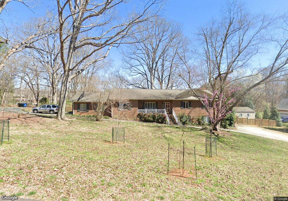
5 Chippers Way Durham, NC 27705
Croasdaile NeighborhoodEstimated Value: $541,000 - $685,000
3
Beds
3
Baths
2,211
Sq Ft
$282/Sq Ft
Est. Value
About This Home
This home is located at 5 Chippers Way, Durham, NC 27705 and is currently estimated at $623,264, approximately $281 per square foot. 5 Chippers Way is a home located in Durham County with nearby schools including Hillandale Elementary School, George L Carrington Middle, and Riverside High School.
Ownership History
Date
Name
Owned For
Owner Type
Purchase Details
Closed on
Dec 17, 2018
Sold by
Stancil Philip Earl and Stancil Patty
Bought by
Rodrigues Roberto Jaime and Rodrigues Monika
Current Estimated Value
Home Financials for this Owner
Home Financials are based on the most recent Mortgage that was taken out on this home.
Original Mortgage
$336,000
Outstanding Balance
$296,614
Interest Rate
4.9%
Mortgage Type
New Conventional
Estimated Equity
$326,650
Create a Home Valuation Report for This Property
The Home Valuation Report is an in-depth analysis detailing your home's value as well as a comparison with similar homes in the area
Home Values in the Area
Average Home Value in this Area
Purchase History
| Date | Buyer | Sale Price | Title Company |
|---|---|---|---|
| Rodrigues Roberto Jaime | $420,000 | None Available |
Source: Public Records
Mortgage History
| Date | Status | Borrower | Loan Amount |
|---|---|---|---|
| Open | Rodrigues Roberto Jaime | $336,000 |
Source: Public Records
Tax History Compared to Growth
Tax History
| Year | Tax Paid | Tax Assessment Tax Assessment Total Assessment is a certain percentage of the fair market value that is determined by local assessors to be the total taxable value of land and additions on the property. | Land | Improvement |
|---|---|---|---|---|
| 2025 | $7,377 | $744,148 | $171,000 | $573,148 |
| 2024 | $5,165 | $370,276 | $76,905 | $293,371 |
| 2023 | $4,850 | $370,276 | $76,905 | $293,371 |
| 2022 | $4,739 | $370,276 | $76,905 | $293,371 |
| 2021 | $4,717 | $370,276 | $76,905 | $293,371 |
| 2020 | $4,574 | $367,702 | $76,905 | $290,797 |
| 2019 | $4,574 | $367,702 | $76,905 | $290,797 |
| 2018 | $4,348 | $320,528 | $64,087 | $256,441 |
| 2017 | $4,316 | $320,528 | $64,087 | $256,441 |
| 2016 | $4,170 | $320,528 | $64,087 | $256,441 |
| 2015 | $3,951 | $285,394 | $54,774 | $230,620 |
| 2014 | -- | $285,394 | $54,774 | $230,620 |
Source: Public Records
Map
Nearby Homes
- 105 Hay Sedge Ct
- Collins Plan at Stonewood Estates - Legacy
- Fisher Plan at Stonewood Estates - Landmark
- Winston Plan at Stonewood Estates - Landmark
- Mitchell Plan at Stonewood Estates - Landmark
- Hatteras Plan at Stonewood Estates - Landmark
- Elizabeth Plan at Stonewood Estates - Legacy
- Alexander Plan at Stonewood Estates - Legacy
- Dillon Plan at Stonewood Estates - Legacy
- 1100 Balsawood Dr
- 2100 Skipping Stone Dr
- 2020 Skipping Stone Dr
- 1709 Faison Rd
- 3 Greenway Cir
- 30 Appleton Place
- 4219 Berini Dr
- 3726 Foxwood Place
- 104 Cedar Ridge Way
- 3 White Ash Dr
- 2005 Cole Mill Rd
- 3819 Berini Dr
- 4 Chippers Way
- 15 Chippers Way
- 10 Chippers Way
- 3813 Berini Dr
- 25 Chippers Way
- 1 Bentgrass Ln
- 16 Chippers Way
- 9 Bentgrass Ln
- 3807 Berini Dr
- 15 Bentgrass Ln
- 33 Chippers Way
- 2 Duffers Place
- 1615 Cole Mill Rd
- 1402 Colewood Dr
- 21 Bentgrass Ln
- 1406 Colewood Dr
- 3801 Berini Dr
- 26 Chippers Way
- 1410 Colewood Dr